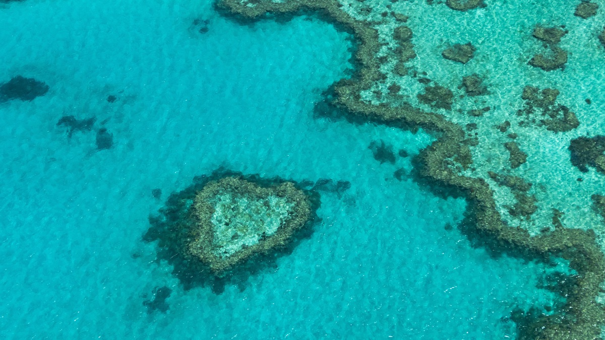
The Great Barrier Reef is a vast connected seascape of coral reefs, islands, seagrass beds and deep channels along northeastern Australia. It is often called the largest living structure on Earth, although no single organism built it. Many generations of reef-building corals created thousands of separate reefs across a continental-shelf system.
A NOAA summary identifies it as Earth’s largest living structure. From end to end, the wider reef region extends for more than 2,000 kilometers along Queensland. Its scale allows tropical habitats to change with latitude, distance from shore and depth.
The name can therefore be misleading if it suggests one continuous wall. Channels and open water separate individual reefs. Continental islands, coral cays and submerged features sit among them, creating an ecological network large enough to be seen clearly from orbit.
Thousands of reefs make one system
The Great Barrier Reef World Heritage Area covers about 348,000 square kilometers. UNESCO describes around 2,500 individual reefs and more than 900 islands within the property. Australian authorities use updated mapping and management boundaries, so some official totals differ slightly by definition.
Fringing reefs grow close to islands or the mainland. Platform reefs rise from the continental shelf, while long barrier formations face the open Coral Sea. Sandy cays form when waves and currents deposit reef-derived sediment above sea level.
Water depth ranges from shallow coastal flats to oceanic water beyond the continental shelf. Inshore reefs receive more influence from river runoff and coastal development. Outer reefs face clearer ocean water and stronger wave exposure.
The whole region spans roughly 14 degrees of latitude. Tropical conditions in the north differ from the cooler seasonal regime in the south. That geographic range supports communities adapted to distinct combinations of temperature, light and water movement.
Coral animals create the framework
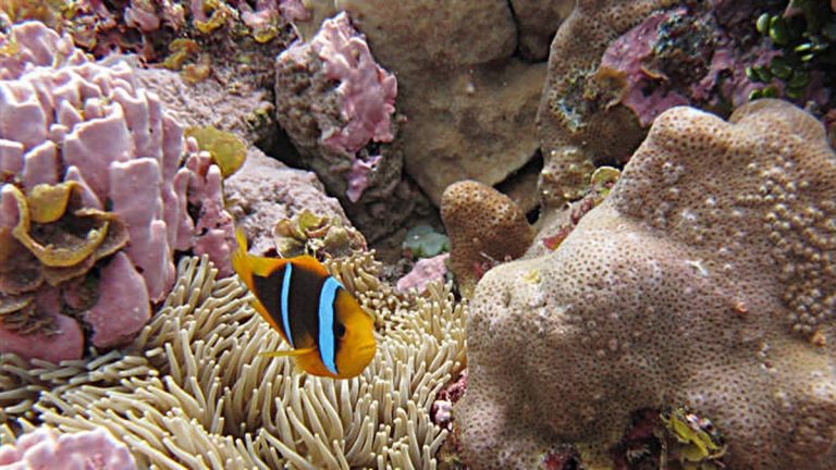
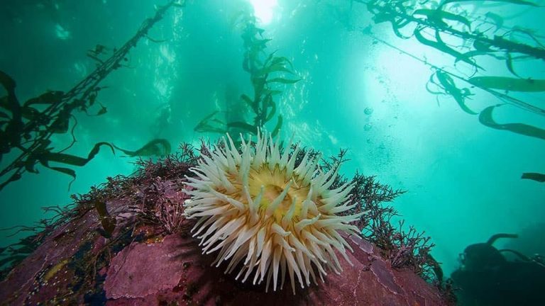
Reef-building coral polyps secrete calcium carbonate cups beneath their bodies. Colonies grow as polyps divide, while broken material and the skeletons of earlier generations add to the foundation. Coralline algae help cement loose surfaces.
Many shallow corals receive much of their energy from photosynthetic algae living inside their tissues. Clear, sunlit water favors rapid skeletal growth. Polyps also capture plankton and dissolved organic material, adding energy when light is limited or food is abundant.
Reef construction alternates with erosion. Waves break pieces away. Parrotfish and boring organisms wear down carbonate, producing sediment that may become beaches or cays. A healthy reef can retain complex structure while continuously losing and rebuilding material.
Biodiversity extends beyond the coral gardens
The Great Barrier Reef Marine Park Authority reports more than 450 hard-coral species and about 1,625 fish species. Six of the world’s seven marine turtle species occur in the World Heritage Area, along with important dugong populations.
Reef biodiversity includes much smaller organisms too. Sponges filter water through their bodies. Molluscs graze, burrow or hunt. Crustaceans occupy crevices and microscopic life cycles nutrients through water and sediment.
Seagrass meadows provide food for dugongs and green turtles. Mangroves shelter juvenile fish and stabilize some shorelines. Open-water predators move between reef passages, while seabirds carry marine nutrients onto islands.
These habitats exchange animals and material. A fish may begin life in a coastal nursery before moving to an offshore reef. Currents transport larvae between distant sites, although successful settlement depends on timing and suitable habitat.
The reef has a long geological history
Modern reef growth sits on a continental margin repeatedly exposed and flooded as sea level changed. UNESCO says reefs grew across the shelf during the past 15,000 years as the ocean rose after the last glacial period. Older geological structures beneath them record earlier cycles.
Coral colonies can build only where water depth, temperature and chemistry permit. As sea level rose, reef growth shifted landward or upward. Some former coastal hills became islands surrounded by coral habitat.
Aboriginal and Torres Strait Islander peoples have maintained cultural connections with the region for thousands of years. Sea country includes living relationships, knowledge and responsibilities that began long before the creation of modern park boundaries.
Heat is testing a managed reef
Marine heat waves can cause corals to expel their photosynthetic partners, producing bleaching. A colony may recover if stressful conditions end soon enough. Prolonged or intense heat raises the risk of starvation, disease and death.
Other pressures differ across the region. Poor water quality affects many inshore areas, crown-of-thorns starfish consume coral tissue and severe cyclones break colonies. Fishing, coastal development and marine debris also require management.
The marine park uses zoning, permits and compliance programs to regulate activity. Some zones allow fishing under rules, while no-take zones provide stronger protection. Management also depends on research partnerships and monitoring across a region too large for any one method.
Local action can improve resilience, but it cannot remove ocean warming. The IUCN coral review identifies climate change as the leading global pressure on reefs. The Great Barrier Reef’s future will reflect both local stewardship and the trajectory of greenhouse-gas emissions.
People use the reef under a zoning system
The Great Barrier Reef is a multiple-use area rather than a park closed to people. Tourism, fishing, shipping, research and Traditional Owner activities occur under different rules. Management tries to protect ecological values while recognizing that coastal communities depend on access.
Marine park zoning sets where particular activities may occur. Green zones prohibit extractive fishing, while other zones allow specified gear or harvest. Shipping lanes and port approaches receive separate controls because large vessels need predictable routes.
Zoning creates a network rather than one isolated reserve. No-take areas can protect spawning animals and intact habitat, although their effectiveness depends on placement, compliance and conditions outside the boundary. Monitoring compares trends among zones over time.
Tourism operators use moorings to reduce anchor damage and follow permit conditions at high-use sites. The Eye on the Reef program also gathers observations from people on the water. Citizen observations complement formal surveys when records include location and consistent descriptions.
Monitoring covers water, coral and wildlife
Aircraft and satellites measure broad changes such as flood plumes or surface temperature. Divers record coral cover, disease and reef-fish communities at selected sites. Autonomous instruments provide continuous data that a visiting survey vessel would miss.
Coral cover describes how much of a sampled bottom is occupied by living coral. It does not capture colony size, species identity or three-dimensional complexity on its own. Managers combine it with other indicators to interpret recovery.
Crown-of-thorns starfish surveys help direct control teams toward outbreaks where intervention is feasible. Water-quality programs track sediment and nutrients from catchments. Turtle and dugong monitoring follows animals whose ranges cross many management zones.
The system’s vast size means no sample represents every reef. A severe decline in one region can coincide with stability elsewhere. Long-term monitoring preserves those regional differences and prevents a single photograph or visit from standing in for the whole Great Barrier Reef.
Context gives monitoring numbers meaning
Traditional Owner knowledge contributes observations accumulated through continuing relationships with sea country. Partnerships can connect cultural priorities with scientific monitoring, especially where species, places and seasonal change carry significance beyond a conventional survey metric.
Public reports often compress the reef into one percentage. Managers need the underlying region, depth, habitat and survey date. Regional context shows whether a change followed heat, a cyclone, crown-of-thorns predation or several pressures acting together. The same coral-cover increase can represent young recovery after disturbance or expansion by one fast-growing species, outcomes with different implications for habitat complexity and its ability to shelter animals after future storms or marine heat waves.
Related reading: mesophotic coral ecosystems and artificial reefs.