
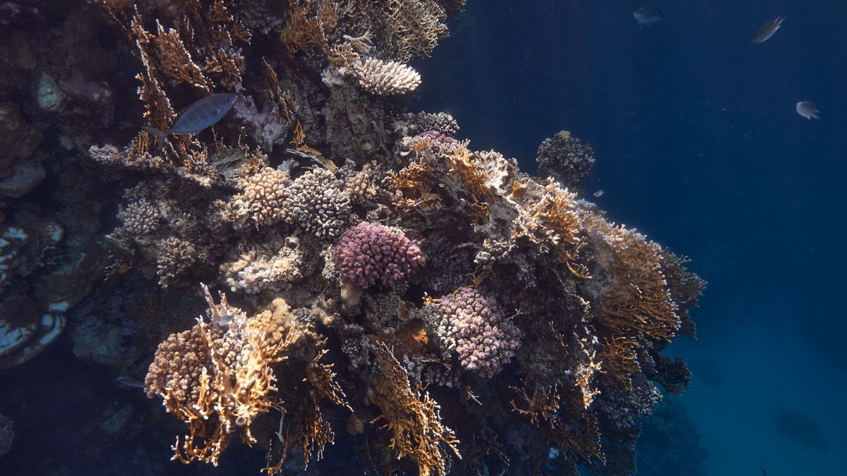
A mesophotic coral ecosystem is a tropical or subtropical reef community living in dim, middle-depth water where some sunlight still reaches the seafloor. It typically begins around 30 meters deep and can extend beyond 150 meters, depending on water clarity. Light-dependent corals, algae, sponges and fishes form the community.
NOAA’s mesophotic reef overview places these ecosystems from almost 100 feet to more than 490 feet below the surface. The zone sits below familiar shallow reefs and above the dark deep sea. Its boundaries follow usable light rather than one rigid depth worldwide.
Mesophotic means “middle light.” Scientists commonly use 30 to 150 meters as a working depth range for tropical and subtropical light-dependent coral communities, though local limits shift. Clear oceanic water carries light deeper than turbid coastal water. A depth number alone cannot confirm the habitat, so surveys also document the light-dependent community and local environmental setting.
Life in the middle-light zone
Water removes colors and weakens sunlight with depth. Red wavelengths disappear first, while blue light travels farther in clear ocean water. Reef-building corals that depend on photosynthetic partners must collect enough light to support that partnership. Many grow as thin plates or broad surfaces that intercept the limited rays.
Not every coral in a mesophotic ecosystem relies on light. Black corals, sea fans and other suspension feeders capture particles from currents. Sponges filter water and algae grow where illumination permits. The community changes gradually with depth as light, temperature, water movement and food supply change.
Some species occur from shallow reefs into the upper mesophotic zone, while others are depth specialists. Lower mesophotic communities can differ sharply from the reef overhead. NOAA’s coastal science program studies habitat connectivity and maps likely reef locations; it also assesses damage across those depth bands.
Coral form can change along the slope. Broad plates expose more surface to faint light, whereas the same or related corals may grow as thicker mounds in bright shallow water. Pigments and photosynthetic partners also differ with depth. Such patterns reflect acclimatization and adaptation, but growth form alone does not identify a species or prove that two populations exchange larvae.
Why scientists reached these reefs late
Conventional scuba diving usually ends near the upper boundary of the zone. Deeper work requires technical diving with specialized gas mixtures and careful decompression, or robotic and crewed vehicles. Large submersibles can be costly in relatively shallow, rugged terrain. The resulting access gap kept many reefs poorly mapped.
Multibeam sonar now reveals steep slopes, banks and ridges likely to hold coral. Remotely operated vehicles send live video and collect samples. Autonomous vehicles cover broad areas, while technical divers make precise observations and experiments. Each tool fills a different part of the depth, area and sampling problem.
Mapping begins with seafloor form, then cameras ground-truth what sonar suggests. Researchers measure temperature, currents, light and water chemistry alongside species. Genetic analysis tests whether shallow and deep populations exchange larvae. Long-term instruments capture heat or storm events that a short expedition could miss.
Access remains difficult, so absence in a survey may mean an animal escaped detection. Steep walls create blind spots and small colonies are hard to identify on video. Scientists report survey effort and uncertainty, then use predictive maps to target the next dive.
Can deep reefs replenish shallow reefs?
The deep reef refuge hypothesis proposes that some mesophotic populations may survive disturbances above and later supply larvae to damaged shallow reefs. Shared species and cooler water make the idea plausible in certain places. Effective rescue requires the same species at both depths, surviving adults below, upward larval transport and successful settlement in the damaged habitat.
Evidence shows important limits. A NOAA-hosted Caribbean study found mesophotic corals could bleach when temperatures exceeded their locally adapted threshold. Cooler average water did not guarantee protection. Other studies find weak genetic connectivity or communities dominated by depth specialists.
Mesophotic reefs should therefore be conserved for their own biodiversity and ecological roles, regardless of whether they replenish shallow reefs. They provide essential habitat for some fishes and contain species found nowhere else. Treating them solely as a backup could overlook damage from fishing gear, pollution, energy development and warming.
Connectivity differs among organisms. NOAA research in the Caribbean found that some fishes move between shallow nursery habitat and mesophotic adult habitat, while coral communities below about 40 meters can share fewer species with the shallows. Larval behavior, spawning time, currents and suitable settlement surfaces all affect exchange. A reef may be connected for one fish and largely isolated for a coral living beside it.
Genetic similarity can show past or ongoing exchange, but it does not say how many new recruits arrive after a disturbance. Parentage analysis, larval models, settlement observations and population surveys answer different parts of the question. Managers need evidence that larvae travel upward, settle, survive and reproduce before counting a deeper population as a practical source for shallow-reef recovery.
Threats and conservation below easy diving depth
Depth does not isolate a reef from human influence. Heat penetrates below the surface and hurricanes can disturb deep slopes. Sediment and pollutants travel downslope. Anchors, cables, traps and bottom-contact fishing gear can break slow-growing organisms. Oil spills may expose broad areas that people rarely see. Damage can be difficult to notice from the surface. Lost fishing gear may abrade sea fans for years and sediment can reduce light or bury attached organisms. Deepwater Horizon injured documented mesophotic habitat in the Gulf, according to NOAA. Baseline maps, repeated imagery and specimen records are crucial because investigators cannot measure recovery accurately when the earlier community was never surveyed. Comparable camera routes help separate new injury from old scars.
Protection starts with knowing where habitat exists. Predictive maps guide surveys and help agencies avoid sensitive areas during permitting. Cameras document broken colonies, lost gear, disease and bleaching. Repeated visits establish whether damage is recovering or spreading.
Restoration at depth is technically demanding. In July 2026, NOAA reported a Gulf mission that propagated 16 mesophotic coral fragments in the field and placed corals on the seafloor, including on designed concrete structures. Such projects remain carefully monitored experiments rather than a substitute for preventing habitat loss. The mission used specialized technical divers because ascent requires planned decompression stops. Closed-circuit rebreathers recycle breathing gas and remove carbon dioxide; they also add oxygen in controlled amounts, extending useful time at depth. Remotely operated vehicles can work longer and deeper, but divers retain fine control for some tasks. Safety and limited bottom time constrain the size and pace of mesophotic restoration.
Mesophotic ecosystems expand the familiar picture of a coral reef down a dim slope. Their corals and sponges support food webs while their species reveal adaptations to low light; connections with shallow water vary from place to place. Better technology is making the zone visible, while the science argues for cautious, depth-aware management.
Protection can include limits on bottom-contact gear, careful placement of cables or energy infrastructure, water-quality controls and moorings that keep anchors off sensitive habitat. Predictive maps help prioritize surveys but require camera confirmation. A suitable-looking ridge may lack coral because of sediment, currents, or past disturbance, so management decisions should preserve uncertainty rather than treating modeled habitat as a complete inventory. Repeated surveys can then test whether protections reduce new damage and allow slow-growing colonies to recover across the mapped depth bands over several years.
Related reading: pelagic and benthic zones and abiotic factors in the ocean.





