
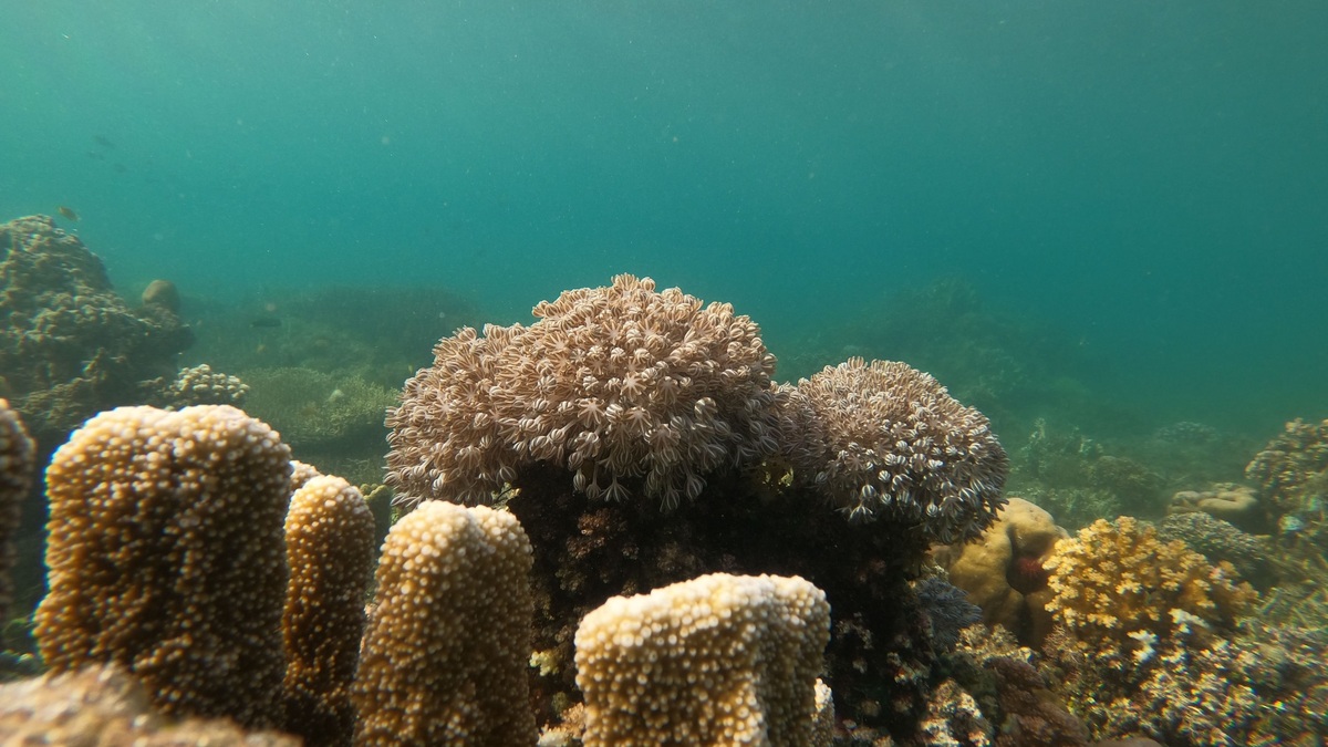
A national marine sanctuary is a federally protected area of U.S. ocean or Great Lakes waters recognized for exceptional natural, cultural, historical, scientific, or recreational value. NOAA manages each sanctuary under site-specific rules and a management plan. Protection does not usually mean closing the whole area to people; compatible fishing, boating, diving, research and tourism may continue.
NOAA’s sanctuary definition describes these places as a network of underwater parks. The comparison is useful but incomplete because every designation has its own boundaries and regulations. A sanctuary may protect coral reefs, whale habitat, kelp forests, archaeological sites, shipwrecks, or a culturally important seascape.
What makes an area a sanctuary
The National Marine Sanctuaries Act authorizes the U.S. Secretary of Commerce to designate marine areas of special national significance. Qualifying values can include conservation, ecology, history, archaeology, science, education, recreation, culture and scenery. NOAA’s Office of National Marine Sanctuaries handles day-to-day management after designation.
Sanctuaries vary greatly in size and setting. Some lie along populated coasts, while others protect remote Pacific waters. The system also includes Great Lakes sites known for shipwrecks and maritime heritage. A marine designation therefore refers to the management framework, not to saltwater alone or a single type of ecosystem.
The agency’s legislation summary explains that the Act’s primary objective is protecting sanctuary resources such as unique habitats, reefs and historic vessels. Other laws have also designated or expanded particular sites. The legal authority behind a sanctuary is stated in its designation documents and regulations.
A national marine sanctuary differs from a marine national monument, wildlife refuge, national park, or state marine protected area. Boundaries sometimes overlap and agencies may cooperate. The correct label identifies the manager and governing law while directing visitors to enforceable rules.
Designation can focus on living ecosystems, submerged heritage, or both. The protected resources named in the legal documents determine which activities require special attention. Boundaries may follow coordinates rather than visible features on the water. Mariners should therefore use official charts and site maps instead of assuming that distance from shore identifies the edge.
How a sanctuary is designated
A designation begins with identifying a place whose resources warrant national attention. Communities can nominate areas through NOAA’s sanctuary nomination process. Acceptance into the inventory does not itself create a sanctuary. It means the nomination may be considered if the agency decides to begin a formal designation process.
Formal designation review involves scientific assessment, environmental analysis, proposed boundaries and draft regulations. NOAA seeks input from Tribes and Indigenous communities, state agencies, local governments, businesses, resource users, conservation groups and the public. Alternatives allow decision-makers to compare protection strategies and likely effects.
Public comments can change boundaries, management priorities, or proposed prohibitions. Congress and state authorities have roles defined by law and a final designation package explains the decision. The process can take years because a sanctuary is intended as a lasting commitment with funding, staff, enforcement and monitoring needs.
Designation is followed by implementation rather than a finished conservation task. Managers establish research and education programs alongside partnerships, permitting and enforcement. Sanctuary advisory councils provide local recommendations. New information or changing uses may prompt later review of the management plan and regulations.
A management-plan review does not automatically rewrite every rule. It evaluates resource condition, threats, research needs and public priorities, then identifies actions for the next period. A separate rulemaking process supplies notice and public comment when regulatory changes are proposed. The distinction lets managers update programs while preserving legal transparency. Published responses explain how substantive public comments influenced the final decision in the record.
What activities are allowed
Sanctuary status does not create one nationwide list of bans. Site-specific regulations are tailored to the resources and threats at each site. A rule may prohibit disturbing a shipwreck, discharging material, taking a protected species, anchoring on coral, or altering the seabed. Another activity may remain allowed throughout much of the same sanctuary.
Fishing is a common source of confusion. Some sanctuaries allow commercial and recreational fishing under existing federal or state fishery rules, while specific zones or methods may face added restrictions. Visitors should check the regulations for the exact sanctuary and activity rather than assuming the word “sanctuary” settles the question.
Sanctuary permits can authorize research, education, restoration, or other activities that would otherwise be prohibited when the work meets required criteria. A permit may set methods, timing, reporting and mitigation conditions. The NOAA management portal connects site plans with regulations, permits and enforcement information.
Boating, wildlife viewing, snorkeling and diving are often encouraged when done responsibly. Operators still follow navigation, wildlife, fishing, discharge and safety rules. A sanctuary protects resources while supporting access compatible with that protection. Local restrictions may include no-entry zones or seasonal limits near sensitive animals.
The official federal sanctuary regulations place the program rules in 15 CFR Part 922 and separate general provisions from site-specific subparts. Reading the applicable subpart resolves questions that a network-wide summary cannot. State law and other federal rules may still apply within the same boundary.
How sanctuaries protect nature and history
Managers collect long-term monitoring data on water conditions, habitat, wildlife and human uses. Repeated surveys can reveal coral disease, kelp loss, changing fish communities, or damage to archaeological sites. Monitoring does not prevent harm by itself, but it shows where restoration or a policy response may be needed.
Research vessels, divers, satellites, acoustic instruments and autonomous vehicles provide different views. Partnerships with universities and community scientists extend capacity. Data also support emergency response when a vessel grounds, cargo spills, or marine debris threatens habitat. Baselines make it possible to compare conditions before and after an event.
Cultural protection includes more than preserving objects. Shipwrecks, traditional navigation routes, fishing grounds and living relationships with the sea can carry community meaning. Managers work with knowledge holders and historians to interpret such places. Respectful stewardship requires understanding both material remains and continuing cultural connections.
Education connects distant audiences with protected waters. Visitor centers and virtual dives join classroom resources and public programs in explaining why a site was designated. Recreation can build support and local income, provided use remains compatible with conservation. The sanctuary’s management plan defines how these goals fit together.
How to visit responsibly
Start with the official page for the sanctuary you plan to enter. Review boundaries, weather, wildlife guidance, fishing rules, mooring information and prohibited activities. Regulations can differ across adjacent waters and a phone’s map may not display every management zone. Download needed information before leaving reliable service.
On the water, avoid touching coral or disturbing resting wildlife. Use installed mooring buoys where required and secure loose gear while keeping trash aboard. Divers should maintain buoyancy around reefs and wrecks. Boaters can reduce collision risk by following speed guidance and posting a lookout in areas used by whales or turtles.
Historic artifacts should remain where they are found. Removing a small object erases archaeological context and may violate federal law. Photographs and accurate location notes can help managers document a discovery without damaging it. Report entanglements, groundings, pollution, or injured wildlife through the appropriate local channel.
A national marine sanctuary is a place managed for protection and compatible public use through a specific legal plan. Its name signals national significance, while its local rules tell visitors what stewardship requires. Checking the individual site turns a broad conservation promise into practical conduct on the water.
Related reading: marine protected areas and reserves and ocean and sea terminology.





