NOAA helps clean up oil and chemical spills by forecasting where pollution will move and identifying people or habitats at risk. It also advises the agencies that direct the response. Its specialists bring scientific models and chemical databases, supported by environmental maps, to a command structure that includes federal and state authorities.
The agency’s summary of spill cleanup methods describes tools used on water and shore. NOAA usually does not arrive as a single cleanup crew with one technique. It supplies the evidence that helps incident commanders choose among containment, recovery and other actions as conditions change.
Scientific support starts quickly
When a major spill threatens coastal waters, NOAA’s Office of Response and Restoration can send a Scientific Support Coordinator to work with the federal response. The coordinator connects the command team with oceanographers, chemists and biologists who can answer incident-specific questions.
Early information is often incomplete. Responders may know the location of a damaged vessel but have only an estimate of the release rate. Product identity may be uncertain after a fire. Scientists document assumptions and update them as evidence arrives. They also explain how uncertainty changes the recommended action.
The United States organizes large incidents through the National Oil and Hazardous Substances Pollution Contingency Plan. Operational leadership depends on where the spill occurs. NOAA’s role centers on coastal science and decision support rather than command of every vessel or shoreline crew.
Models predict where pollution may go
For oil on water, modelers use the GNOME Suite to calculate possible trajectories. Winds push the surface slick while currents carry it through channels or offshore. Forecasts show a best estimate together with a wider uncertainty area that responders can use for minimum-regret planning.
Aircraft and satellites report the observed location of oil, while field teams add close-range evidence. Those reports reveal when a forecast needs adjustment. Repeated updates allow containment equipment and wildlife teams to be moved ahead of the changing threat.
Chemical releases can create hazards in air as well as water. ALOHA, part of the CAMEO software suite, estimates how a toxic gas cloud could disperse and identifies areas where concentrations may threaten people. Its calculations require weather data and properties of the released substance.
No model removes uncertainty. Terrain can channel a vapor cloud and local currents may differ from a regional forecast. Specialists compare model output with measurements and use conservative safety zones when the evidence does not support a narrow boundary.
Databases explain what was spilled
The CAMEO software suite, developed by NOAA with EPA, gives planners information about thousands of hazardous chemicals. CAMEO Chemicals lists physical properties and response recommendations. It can also flag dangerous reactions when substances mix.
Oil products change after release. Lighter components evaporate as waves disperse droplets. Some oil also combines with water to form persistent emulsions. NOAA’s ADIOS tools estimate this oil weathering, helping responders judge how long a technique such as skimming may remain effective.
Maps identify sensitive places
Environmental Sensitivity Index maps combine shoreline type with biological resources and human uses. A marsh can retain oil and suffer long-lasting harm, while a public water intake may demand immediate protection for a different reason. The maps let teams see these priorities before pollution arrives.
During an incident, the Environmental Response Management Application, known as ERMA, brings observations and reference layers into one online map. Responders can compare the predicted slick with wildlife areas, sampling sites and operational boundaries. Shared mapping reduces the risk of separate teams acting from conflicting versions of events.
Field biologists add seasonal knowledge that a national dataset may not capture. A bird colony can be most vulnerable during nesting and fish movement changes through the year. Local and tribal experts may identify cultural resources or harvesting areas that require specific precautions.
Priorities are revisited as the release moves. A shoreline that appeared safe in the morning may enter the forecast envelope after a wind shift. Updated maps help leaders allocate limited equipment where it can prevent the greatest harm.
Cleanup methods depend on the setting
Floating booms can contain or divert oil when waves and currents are manageable. Skimmers then remove oil from the surface. In rough water, boom may fail to hold a slick and vessels can recover only a portion of widely dispersed material.
Responders may consider in situ burning for relatively fresh, thick oil under controlled conditions. Chemical dispersants break surface oil into smaller droplets, moving more of it into the water column. Both methods require evaluation of weather and safety, followed by a review of environmental tradeoffs before authorization.
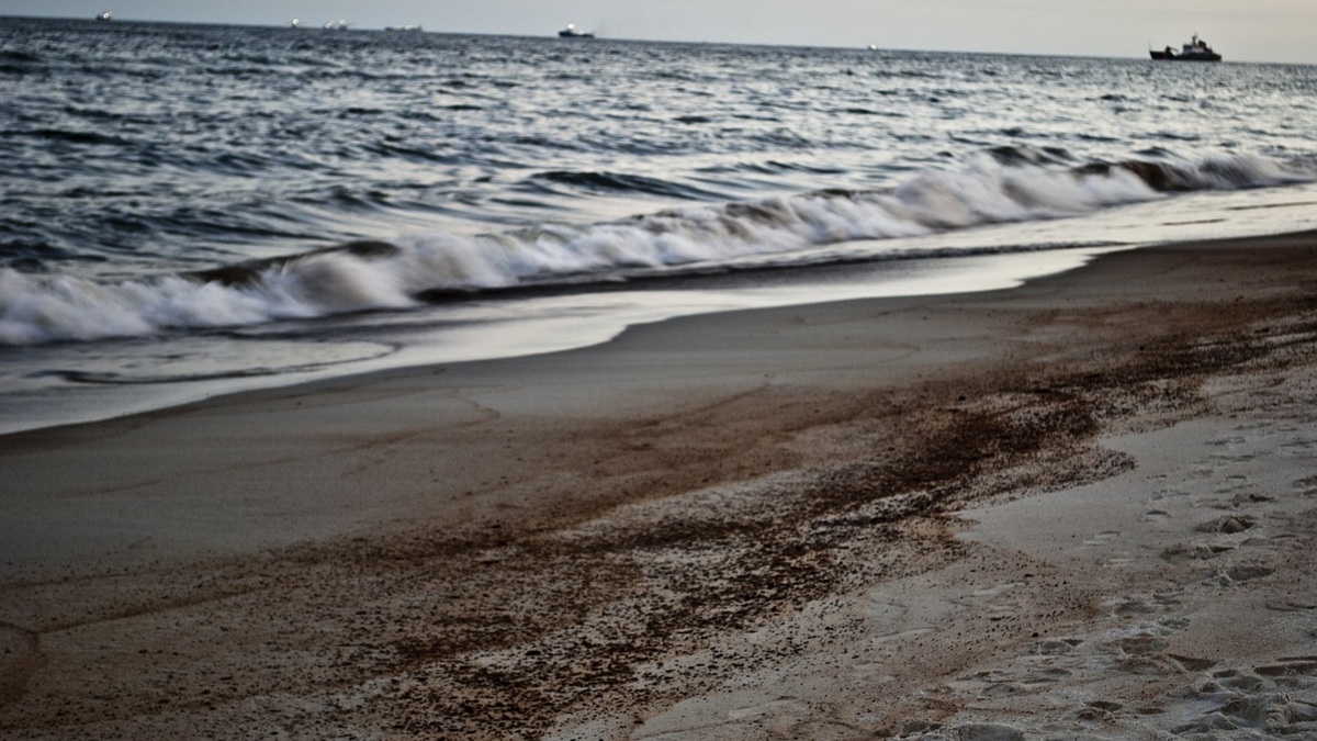
Along a shore, crews may use sorbents, vacuum equipment or careful manual removal. Flushing can move trapped oil toward a collection point. Aggressive washing may damage organisms or drive oil deeper into sediment, so cleanup goals include avoiding additional injury.
NOAA’s spill containment guidance notes that no single method works in every situation. Oil type and access constrain the choice. The presence of sensitive habitat can favor a slower, less intrusive technique.
Chemical incidents demand their own tactics. Some substances dissolve or sink, while others release dangerous vapor. Entry teams need protective equipment based on measured hazards. Containment or recovery may be impossible until immediate fire and reactivity hazards are controlled, including any inhalation risk.
Damage assessment continues after cleanup
Removing visible oil does not end the scientific work. Under federal law, trustees can conduct a Natural Resource Damage Assessment to determine how public resources were injured and what restoration is needed. NOAA may study habitat, fisheries and recreational losses.
Assessment teams compare affected areas with reference conditions and follow recovery over time. A beach can look clean while buried oil remains and a population-level effect may take longer to measure. Claims need documented methods that can withstand technical and legal review.
Restoration may rebuild marsh, improve fish habitat or replace lost public access. The responsible parties can be required to fund projects tied to the measured injury. Environmental restoration aims to compensate the public for losses from the spill, rather than simply declaring the response finished when equipment leaves.
Preparedness makes the tools useful
Many response resources are built before an accident. Agencies map sensitive shoreline and maintain weather stations. They also practice the incident-command structure. Facilities prepare response plans, while local officials use CAMEO information for chemical hazards in their communities.
Exercises expose missing data and communication problems under safe conditions. They also establish working relationships among scientists and responders. During a real release, those connections save time that would otherwise be spent finding the right expert or dataset.
Preparedness also includes keeping software and local datasets current. A trajectory model needs usable shoreline geometry and current information, while chemical planners need accurate facility inventories. Tools that sit untouched between incidents may fail at the moment their output becomes urgent.
NOAA’s contribution is strongest when forecasting, field evidence and local knowledge remain connected. Cleanup equipment handles the material, while science shows where it may go and which action is least likely to compound the damage.
Lessons strengthen the next response
Public communication is another part of the response. Maps and technical terms can be misread when released without context, so agencies explain forecast times and uncertainty. Clear updates help local officials make decisions while avoiding the claim that every place inside a model boundary will be contaminated.
After-action reviews carry lessons into the next plan. Teams compare forecasts with observations and document which tools were useful. The review also identifies data gaps. Improved models cannot prevent a release, but they can shorten the time between an accident and a well-supported protective decision.
Related reading: the effects of oil spills on marine life and how natural oil seeps differ from spills.