
The HydroSHEDS HydroLAKES database reveals the extraordinary scale of Earth’s inland waters. Its global inventory maps about 1.4 million lakes and reservoirs. It also provides a consistent scientific foundation for comparing their surface areas, shorelines, depths and estimated volumes.
Even the word “largest” carries several meanings. A lake can dominate by area, depth, or total water volume. This ranking uses freshwater surface area and follows the familiar geographic convention of counting Lakes Michigan and Huron separately.
How the lakes are ranked
Surface area measures how much of Earth’s surface a lake occupies. Researchers can calculate it from mapped shorelines and satellite observations. HydroSHEDS summarizes its goal clearly: “HydroLAKES aims to provide the shoreline polygons of all global lakes with a surface area of at least 10 ha.”
The ranking includes natural freshwater lakes and leaves out saline water bodies such as the Caspian Sea. Reservoirs are also treated separately. Published area estimates can vary because shorelines shift, measurements come from different years and mapping methods use different boundary definitions.
1. Lake Superior, 82,100 square kilometers
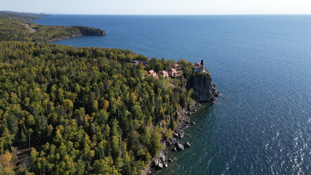
At roughly 82,100 square kilometers, Lake Superior has the greatest surface area of any conventionally recognized freshwater lake. It forms the northwestern end of the North American Great Lakes system. Ontario borders its northern and eastern shores, while Minnesota, Wisconsin and Michigan meet it to the south and west.
Superior stretches about 560 kilometers from end to end and reaches a maximum depth of around 406 meters. More than 200 rivers and streams feed the lake. Its water flows east through the St. Marys River toward Lake Huron, linking Superior to the rest of the Great Lakes and eventually the Atlantic Ocean.
2. Lake Victoria, Africa’s tropical giant
Lake Victoria is the largest lake in Africa and the world’s largest tropical lake. Depending on the shoreline dataset and measurement period, published estimates place its area between about 60,000 and 69,000 square kilometers. Tanzania, Uganda and Kenya share its broad waters.
Victoria covers a vast area while remaining relatively shallow. Its maximum depth is about 81 meters and its average depth is close to 41 meters. Numerous rivers and streams enter the lake. Water leaves through the Victoria Nile on its northern shore, making the lake a major reservoir within the Nile basin.
3. Lake Huron and the Michigan connection
Lake Huron covers approximately 59,600 square kilometers between Ontario and Michigan. Its geography includes long bays, intricate shorelines and thousands of islands. Manitoulin Island, located in its northern waters, is widely recognized as the world’s largest island within a freshwater lake.
Huron reaches a maximum depth of about 229 meters. The Straits of Mackinac connect it directly to Lake Michigan and both lakes sit at essentially the same surface elevation. Hydrologists therefore describe them as one continuous water body called Michigan-Huron, even though maps and rankings traditionally list them separately.
4. Lake Michigan, the largest within one country
Covering about 58,000 square kilometers, Lake Michigan is the largest freshwater lake located entirely within a single country by surface area. Illinois, Indiana, Michigan and Wisconsin surround it. Major cities along its shores include Chicago and Milwaukee.
The lake extends about 494 kilometers from north to south and reaches nearly 190 kilometers across at its widest point. Its deepest waters descend to around 281 meters. At the northern end, the Straits of Mackinac provide an open exchange of water with Lake Huron.
5. Lake Tanganyika, a deep African rift lake
Lake Tanganyika occupies about 32,900 square kilometers within the western branch of the East African Rift. Tanzania, the Democratic Republic of the Congo, Burundi and Zambia share its shoreline. Its long and narrow basin stretches for more than 670 kilometers.
The lake descends to about 1,470 meters, making it Africa’s deepest lake and one of the deepest on Earth. Its immense depth gives Tanganyika far more water than its surface ranking might suggest. The Ruzizi, Malagarasi and Kalambo rivers feed the basin, while the Lukuga River carries water toward the Congo River system.
6. Lake Baikal, the freshwater volume leader
Lake Baikal covers approximately 31,722 square kilometers in southern Siberia. Its surface area places it below Tanganyika in this ranking. A maximum depth of about 1,642 meters gives Baikal the greatest volume of any freshwater lake on Earth.
The lake contains roughly 23,600 cubic kilometers of water and holds a substantial share of the world’s unfrozen surface freshwater. Baikal formed in an active continental rift and is also among the planet’s oldest lakes. The Selenga River is its largest inflow, while the Angara River provides its only major surface outlet.
7. Great Bear Lake, Canada’s largest lake
Great Bear Lake covers about 31,153 square kilometers in Canada’s Northwest Territories. It is the largest lake located entirely within Canada. Its irregular arms extend across the Arctic Circle, creating a sprawling shoreline in a region shaped by long winters and extensive seasonal ice.
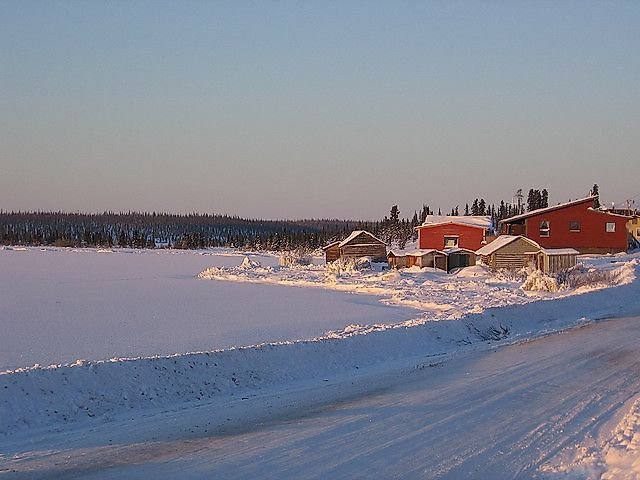
The lake reaches a maximum depth of approximately 446 meters. Rivers including the Haldane, Whitefish and Big Spruce flow into it. Water exits through the Great Bear River, which joins the Mackenzie River and continues toward the Arctic Ocean. The community of Deline sits on the lake’s western shore.
8. Lake Malawi, a biodiversity stronghold
Lake Malawi has a surface area of roughly 29,600 square kilometers. Malawi, Mozambique and Tanzania share the lake, which is also known as Lake Nyasa and Lago Niassa. Like Tanganyika, it occupies part of the East African Rift system.
Its basin reaches a maximum depth of about 706 meters and an average depth near 292 meters. The lake is especially famous for its rich fish life, including an exceptional variety of cichlids adapted to different habitats and food sources. Water leaves through the Shire River before joining the Zambezi River system.
9. Great Slave Lake, North America’s deepest
With an area of about 27,200 square kilometers, Great Slave Lake is the second-largest lake located entirely within Canada. It lies south of Great Bear Lake in the Northwest Territories. Its long northern shoreline includes Yellowknife, the territorial capital.
A maximum depth of about 614 meters makes Great Slave the deepest lake in North America. The Slave River provides much of its inflow, carrying water from Lake Athabasca and surrounding drainage basins. The lake empties through the Mackenzie River, which flows north for more than 1,700 kilometers before reaching the Arctic Ocean.
10. Lake Erie, the shallow Great Lake
Lake Erie covers roughly 25,700 square kilometers and ranks fourth among the Great Lakes by surface area. Ontario borders its northern shore. Michigan, Ohio, Pennsylvania and New York surround its American side.
Erie has an average depth of only about 19 meters and a maximum depth near 64 meters. Its shallow basin responds quickly to changing air temperatures and storms. Water enters primarily through the Detroit River and leaves through the Niagara River, which carries it toward Niagara Falls and Lake Ontario.
How shorelines and definitions affect the ranking
Lake measurements rarely remain perfectly fixed. Rainfall, drought, evaporation, river flow, ice and human water use can alter seasonal water levels. Shallow lakes with broad shorelines may experience especially noticeable changes in mapped area. Satellite imagery can also capture different water boundaries depending on image resolution and the date of observation.
Boundary conventions create another important variable. Michigan and Huron behave as one hydrological lake because the Straits of Mackinac allow water to move freely between them. Treated as Michigan-Huron, their combined area surpasses Lake Superior. This ranking follows the widely used geographic convention that recognizes two named lakes.
Surface area also tells only one part of the physical story. Superior leads this list by conventional surface area, while Baikal leads freshwater lakes by volume and depth. Tanganyika has a much smaller surface than Superior, yet its deep rift basin stores an immense quantity of water.
Despite those measurement choices, the global pattern remains striking. North America contains six of the ten entries when Michigan and Huron are listed separately. Africa contributes three immense rift and tropical lakes, while Asia’s representative is the exceptionally deep Lake Baikal.
Lake Malawi appears in global comparisons, but its published dimensions deserve separate treatment. Argo’s Lake Malawi map, size and depth profile explains why official sources give different maximum-depth figures.





