A study in Scientific Reports has brought a hidden water puzzle beneath Utah’s Great Salt Lake into sharper view. Researchers led by University of Utah geophysicists used airborne instruments to detect signs of a potentially vast freshwater reservoir buried below one of North America’s saltiest landscapes.
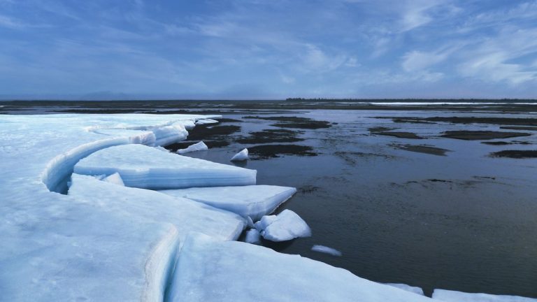
The finding matters because the Great Salt Lake is shrinking, exposing broad stretches of dry lakebed. That exposed playa can release dust that reaches nearby communities. A better map of groundwater beneath the lake could help scientists understand how water moves through the basin and where natural moisture might still rise toward the surface.
The study focused on Farmington Bay and the northern end of Antelope Island. In that area, researchers found evidence that freshwater-saturated sediments sit below the lake’s hypersaline surface. The system appears to extend from shallow depths down to several kilometers below the ground.
For a lake famous for salt, the result is striking. The team’s measurements suggest that the hidden freshwater is wider and deeper than researchers expected from surface clues alone.
Reed-covered mounds revealed a buried clue
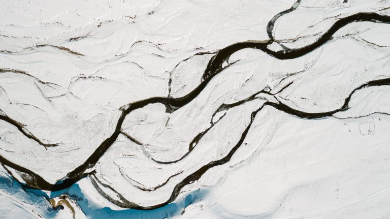
The story began with strange circular mounds on the dried lakebed of Farmington Bay. Each mound measured roughly 50 to 100 meters across. Tall stands of phragmites reeds grew from them, forming green islands on a pale playa.
Those reeds were the clue. Phragmites need fresh or brackish water to thrive. Their presence suggested that pressurized groundwater was pushing upward through gaps in a less permeable layer below the exposed lake floor.
Researchers had already suspected that fresh groundwater from nearby mountains could move toward the lake. Snowmelt and precipitation in the Wasatch Mountains recharge aquifers east of the basin. Over time, some of that water can travel westward through sediment and fractured rock.
The mounds gave the team a visible target. If water was rising there, the deeper source might be detectable with geophysical tools. That led scientists to look below the lakebed without drilling a dense network of wells.
Helicopter surveys mapped the lakebed
In February 2025, the research team arranged an airborne electromagnetic survey over the southeastern margin of the lake. A helicopter carried instruments suspended below it, tracing long flight lines across Farmington Bay and the northern part of Antelope Island.
The aircraft completed 10 east-west lines that covered 154 miles in total. The instruments measured how easily the ground conducted electrical currents. That property is useful because salty water conducts electricity far better than freshwater.
The paper describes the work as “the pilot airborne electromagnetic (AEM) and magnetic survey conducted over a sector of Great Salt Lake.” That pilot design gave researchers a focused test area where they could compare surface clues with subsurface signals.
In simple terms, the method let the team distinguish brine-rich zones from more resistive freshwater zones. The approach is often useful in coastal aquifer studies, where fresh and salty waters meet underground. Here, the scientists applied it to a terminal lake with an extremely salty surface environment.
The team also combined the electromagnetic data with magnetic measurements. Together, the methods helped produce a three-dimensional view of the subsurface structure. That added context for where groundwater might collect and move beneath the playa.
Freshwater reached miles below the salt
The survey results showed a strong contrast between the shallow salty layer and deeper resistive material. In parts of the study area, the transition appeared within about 10 meters of the surface. Below that, the data indicated widespread freshwater-saturated sediment.
According to the University of Utah research summary, the freshwater signal appears to continue down to 3 to 4 kilometers. That is about 10,000 to 13,000 feet below the surface. The number points to a much deeper system than the reed mounds alone could reveal.
The lake’s surface water is hypersaline because the basin has no natural outlet. Water flows in, then evaporation leaves salts behind. Over long periods, that process makes the lake salty enough to shape its entire ecosystem.
Below the lake, the story is more layered. Sediments can hold water in pore spaces like a buried sponge. If those sediments receive recharge from surrounding highlands, they may store freshwater for long periods beneath a saline surface.
The researchers treat the finding as a mapped freshwater reservoir along the eastern lake margin. Because the study area covered only part of the lake, the full size of the system remains an open question.
The reservoir stretched toward the lake’s interior
One of the most surprising results was the apparent direction and extent of the freshwater body. The data suggest that freshwater beneath the lake reaches well into the interior zone of the basin. That pattern is important for how scientists think about terminal lakes.
In many simple models, dense brine would dominate below a saline lake. Freshwater from the surrounding mountains would mostly enter near the edges. The Farmington Bay results point to a more complex underground arrangement.
The team’s three-dimensional imaging also found a dramatic change in the basement surface below the playa. Beneath part of Farmington Bay, the basement lies at less than 200 meters depth. Nearby, it drops abruptly to depths of 3 to 4 kilometers.
That structural boundary sits below one of the reed-covered mounds. It may help explain why pressurized water finds pathways toward the surface there. Faults, fractures and sediment changes can all influence groundwater movement in basin settings.
This part of the study shows why the lakebed cannot be treated as a flat container. The hidden geology below it shapes where freshwater accumulates, where brine remains and where water can rise.
A possible tool against toxic dust
The finding also connects to a growing public health concern. As the Great Salt Lake has declined, large areas of lakebed have been exposed to wind. Dust from those surfaces can carry metals and other contaminants into surrounding communities.
Researchers and state agencies have been looking for realistic ways to reduce dust from exposed playa. Reflooding broad areas can require large volumes of water. Targeted wetting of dust hotspots may offer another management option in some locations.
The newly mapped pressurized groundwater could be relevant because some of it already rises naturally through the lakebed. If scientists can identify where that happens, they can better understand which areas stay damp and which become dust sources.
Any use of groundwater would need careful study. Pumping or redirecting water could change underground pressures or water chemistry. The present work gives scientists a clearer starting point for asking those practical questions.
The broader project is tied to the Utah Department of Natural Resources and the Great Salt Lake Commissioners’ Office. That link between research and planning reflects the urgency around lake decline, dust exposure and water management in northern Utah.
What researchers need to map next
The study is a pilot survey, so the next step is scale. The Great Salt Lake covers a much larger footprint than the Farmington Bay and Antelope Island survey area. Researchers need broader coverage to see whether the same freshwater system extends across other parts of the basin.
Future surveys could reveal how the freshwater body connects to mountain recharge, buried sediments and structural features below the lake. They could also show where the reservoir thins, deepens, or mixes with brine.
The magnetic measurements are especially useful for mapping the shape of the deeper basin. When paired with electromagnetic data, they can help scientists identify geological boundaries that influence groundwater flow.
Better maps could support decisions about dust control, groundwater protection and lake restoration. They could also reshape scientific understanding of saline terminal lakes, which are among the world’s most stressed water bodies.
For now, the Great Salt Lake’s hidden freshwater system is coming into focus one flight line at a time. The salty surface remains the lake’s most obvious feature, while the buried reservoir below may become a crucial part of its future.