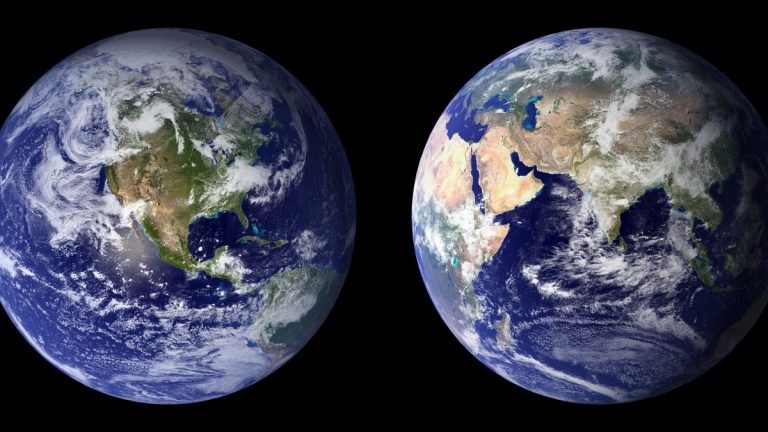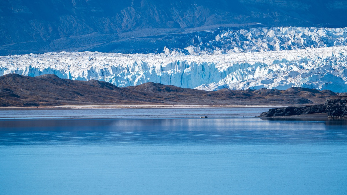
The cryosphere is all the frozen water on Earth. It includes vast ice sheets and mountain glaciers, but also seasonal snow, frozen lakes, sea ice and ground that remains frozen for years. Some parts last only through winter, while Antarctic ice can preserve snow deposited hundreds of thousands of years ago.
NOAA’s definition of the cryosphere joins these scattered forms into one Earth system. The name comes from the Greek word for cold and the frozen regions interact constantly with the atmosphere, ocean, land and living world.
Ice affects faraway places by reflecting sunlight while storing fresh water. Changes in land ice also alter ocean level. Snowmelt supplies rivers used by communities and farms. Frozen ground supports roads and buildings. Sea ice meanwhile provides habitat as it changes the exchange of heat between ocean and air.
Frozen water takes several forms
Snow becomes part of the cryosphere after it lands. A seasonal cover may disappear in spring, or it may accumulate where summers remain cold. Repeated burial compresses old snow into firn and eventually into glacier ice.
Glaciers flow under their own weight. Alpine glaciers move through mountain valleys. The ice sheets of Greenland and Antarctica spread across continental areas. Smaller ice caps cover high terrain without being confined to valleys.
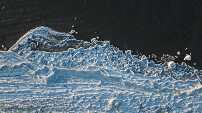
Sea ice forms when ocean water freezes. It grows or retreats with the seasons while drifting under the influence of wind and currents. Some sea ice survives for more than one year. Ice shelves extend from land-based ice over the ocean. Their origin and thickness differ from those of sea ice.
Frozen ground includes soil or rock at or below freezing. Permafrost is ground that stays frozen for at least two consecutive years. Its upper active layer commonly thaws in summer and freezes again in winter.
The National Snow and Ice Data Center overview also includes lake and river ice, icebergs and snow cover. Grouping them together helps scientists follow water and energy as they move among forms.
Bright surfaces cool the planet
Snow and ice reflect a large fraction of incoming sunlight. This property, called albedo, limits how much solar energy the surface absorbs. Dark open ocean and bare ground absorb more energy and warm more readily.
When reflective cover shrinks, exposed surfaces take in additional heat. The extra warming can encourage further melting, creating an ice-albedo feedback. Its strength depends on season, location, cloud cover and the kind of ice lost.
Fresh snow can be especially reflective. Soot and algae can darken snow already marked by dust, increasing absorption. Meltwater can also lower the reflectivity of an ice sheet by forming dark ponds or exposing older ice.
Sea ice insulates the relatively warm ocean from cold polar air. Thin or absent ice allows more heat and moisture to escape in winter, affecting clouds and regional weather. In summer, the contrast between bright ice and dark water becomes important for absorbed sunlight.
Land ice changes sea level
Melting land ice adds water to the ocean. Mountain glaciers and the Greenland and Antarctic ice sheets therefore contribute to global sea-level rise when their mass losses exceed snowfall gains.
Floating sea ice already displaces seawater, so its melting has little direct effect on sea level. The difference resembles an ice cube melting in a glass. Floating ice shelves also displace water, but their loss can remove resistance that slows glaciers flowing from land.
Ice-sheet mass balance combines snowfall, surface melt, evaporation and ice discharged into the sea. Satellites measure ice motion alongside elevation. Other satellite observations detect gravity changes. Aircraft and field teams provide detailed measurements that help interpret the remote observations.
NASA’s cryosphere research program examines interactions among polar ice, the ocean, atmosphere and solid Earth. No single measurement captures the whole balance, so researchers compare independent methods.
Sea-level effects are not distributed evenly. Regional differences reflect ocean circulation and land motion as well as gravity. Communities plan around the change measured at their own coasts rather than simply applying one global number.
Snow and glaciers store usable water
Seasonal snowpack acts as a natural reservoir. Water accumulates during cold months and runs into streams as temperatures rise. The timing supports drinking-water systems and irrigation. It also sustains hydropower in many mountain regions.
A warmer climate can shift precipitation from snow toward rain and bring earlier melt. The annual total may remain similar while less water is available during the dry season. Water managers monitor snow-water equivalent, which estimates how much liquid a snowpack contains.
Glaciers release meltwater during warm periods, buffering river flow for a time as the ice shrinks. Continued retreat eventually reduces that reserve. The result differs among basins because monsoons affect flow alongside groundwater. Local glacier coverage adds another control.
Permafrost links climate and infrastructure
Permafrost may contain ice that fills pores or forms large wedges. When that ice melts, the ground can settle unevenly. Roads buckle as building foundations shift. Coastlines rich in ground ice can also erode rapidly.
Frozen soils also store organic carbon accumulated over long periods. Thaw exposes some material to microbes, which can release carbon dioxide or methane. The rate depends on drainage, temperature, vegetation and whether soils become wet or dry.
Engineers working in permafrost regions design foundations to limit heat transfer into the ground. Some buildings stand on piles that allow cold air to circulate beneath them. Maintenance becomes harder where warming pushes ground conditions beyond the original design assumptions.
The U.S. Geological Survey’s permafrost research connects thaw with hydrology, ecosystems and infrastructure. Frozen ground can redirect water across a landscape, so thaw may drain one lake while creating wetlands elsewhere.
Ice records past environments
Snow buries particles and bubbles of ancient air as it becomes ice. Cores drilled from glaciers and ice sheets preserve layers that scientists can date and analyze. The trapped gases provide direct samples of past atmospheres.
Stable isotopes in the ice help reconstruct temperature. Dust and volcanic ash record changes in wind or eruptions. Annual layers can be counted in suitable locations, then tied to other dating methods deeper in the record.
Frozen sediments and permafrost preserve biological material as well. These records require careful interpretation because ice can deform, meltwater can move chemicals and local conditions may differ from broader climate.
Monitoring today’s cryosphere combines this long record with current measurements. The NASA sea-ice overview explains how satellites track seasonal extent and longer-term change across remote polar oceans.
The cryosphere reaches beyond the poles
Most frozen water lies at high latitudes, yet the cryosphere also appears on tropical mountains and across seasonally frozen midlatitude landscapes. A lake that freezes each winter belongs to the same system as the Antarctic Ice Sheet, though their scales and lifetimes differ enormously.
Changes must be described by component. A loss of Arctic sea-ice extent, a glacier’s retreat and a shorter snow season are related to temperature but carry different consequences. Lumping them into a single measure can hide the mechanisms that people need to understand.
Scientists observe area, thickness, mass, duration and motion. Together, those measurements reveal how frozen water stores energy and fresh water across the planet. The cryosphere is a shifting part of Earth rather than a distant white backdrop.
Different instruments see different changes
Optical satellites map snow and ice when clouds and darkness allow. Radar can observe through clouds and measure surface motion, while laser and radar altimeters track elevation. Gravity missions detect changes in the mass of large ice sheets across broad regions.
Field measurements remain necessary for calibration and physical detail. Stakes record glacier accumulation and melt. Drifting buoys track sea ice, while boreholes measure permafrost temperature. Combining these records prevents a change in surface appearance from being mistaken for an equal change in total ice mass.
Related reading: how melting icebergs affect the deep sea and today’s sea-ice conditions.