Sea ice affects global climate by controlling how much sunlight the polar regions reflect. It also insulates the ocean from the atmosphere and influences the formation of dense water that helps drive ocean circulation. Although the ice forms far from most population centers, its seasonal cycle alters energy exchanges across the planet.
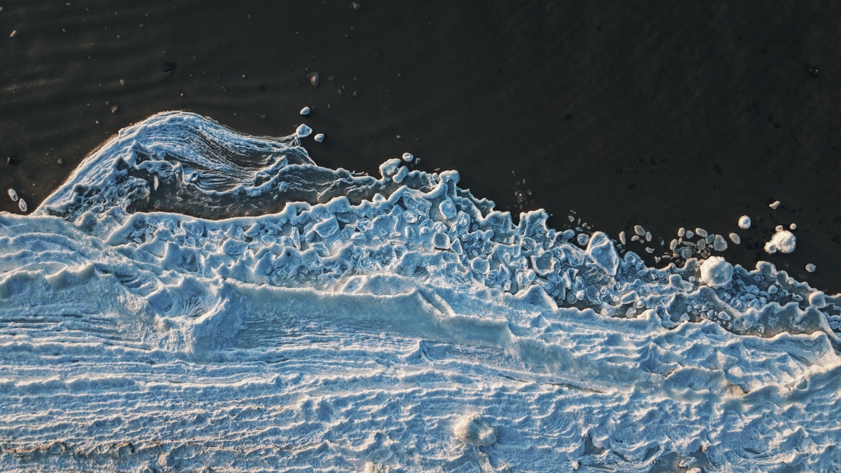
Unlike a glacier or ice sheet, sea ice is frozen ocean water. NOAA’s explanation of sea ice and climate notes that it covers about 15 percent of the world’s ocean during part of each year. Most expands during winter and shrinks during summer.
The Arctic Ocean is nearly enclosed by continents, while Antarctica is a continent surrounded by ocean. Geography makes their sea ice behave differently. Wind and current patterns reinforce the contrast. Both regions nevertheless play central roles in Earth’s energy balance and polar ecosystems.
Bright ice reflects incoming sunlight
Fresh snow and ice reflect much of the sunlight that reaches them. Dark open water absorbs a larger share and converts it to heat. The fraction reflected is called albedo and changing the surface from ice to water changes that fraction sharply.
When sea ice retreats, exposed water can warm under summer sun. Warmer water may delay autumn freeze-up, leaving more time for heat to move into the atmosphere. This reinforcing process is known as the ice-albedo feedback.
NASA describes declining Arctic sea ice as one observed consequence of a warming climate. The feedback does not act alone. Clouds and snowfall can modify its strength, while ocean heat transport changes the response from one season to another.
Floating sea ice loss does not raise global sea level directly in the way melting land ice does, because floating ice already displaces water. Its climate influence comes mainly through energy exchange, circulation and ecological effects.
Ice separates a relatively warm ocean from cold air
Sea ice acts as a lid between ocean and atmosphere. In winter, water beneath the ice is much warmer than the polar air above it. A continuous ice cover slows the upward transfer of heat and moisture.
Openings called leads and larger areas of persistent open water called polynyas release heat much faster. Moisture entering cold air can help form clouds and alter local weather. The location of openings therefore affects the atmospheric boundary layer even when total ice extent changes little.
Snow on top of sea ice adds insulation. Thick snow can slow ice growth by reducing heat loss from the ocean, yet it also reflects sunlight. The timing and depth of snow influence how ice responds during both freezing and melting seasons.
Freezing sea water changes salinity and density
When seawater freezes, most salt is excluded from the growing ice crystals. The rejected brine increases the salinity of nearby water. Cold salty water is dense, so it can sink when conditions permit.
This process contributes to the formation of water masses that ventilate deeper parts of the ocean. A NOAA current tutorial explains how temperature and salinity help establish density differences within the global circulation.
Sea-ice formation is only one part of that system. Winds and tides also move water, as do exchanges between ocean basins. Freshwater from precipitation or melting land ice can reduce surface salinity, which changes how readily water sinks.
New ice forms around Antarctica and can support production of dense shelf water in the Southern Ocean. In the Arctic, brine rejection occurs within a more enclosed basin whose connections to other oceans are restricted by narrow gateways.
Changes in ice production can alter water-mass formation, but the response is not a simple on-off switch for global currents. Researchers track heat and freshwater changes before attributing a circulation trend. Wind is assessed separately within the same physical system.
Sea ice guides polar ecosystems
Algae grow within and beneath sea ice, providing an early-season food source when light returns. Zooplankton feed on that production and larger animals depend on the food web it supports. The ice supplies habitat for animals to rest or hunt. Some seals, polar bears and penguins also use it during breeding.
Timing is crucial. Earlier retreat may separate a food pulse from the life stage that normally uses it. Less ice can open new feeding areas for some species while removing habitat for organisms adapted to the frozen surface.
The National Snow and Ice Data Center summarizes these ecological connections alongside sea ice’s climate functions. Ecological effects differ between the Arctic and Antarctic because the species and seasonal cycles are not interchangeable.
Human communities also use sea ice for travel and hunting. A map of extent does not fully describe whether local ice is stable, thick enough to cross or fractured by winds. Those qualities can change rapidly.
Ice movement connects the ocean and atmosphere
Sea ice is mobile. Winds and currents push floes. The movement opens water in one place while compressing ice elsewhere. Convergence can build pressure ridges much thicker than the surrounding sheet, while divergence exposes the ocean.
Drifting ice transports freshwater because melted sea ice is fresher than seawater. It also redistributes snow and material carried within the ice. The export of ice through narrow passages influences downstream seas.
Rough ice changes the drag between air and water. With less coverage, wind can transfer momentum directly to a larger ocean surface. The resulting changes in waves and upper-ocean mixing may affect coastal erosion and how heat is stored.
Scientists use several measures of sea ice change
Extent measures the area of ocean containing at least a specified concentration of ice, commonly 15 percent in widely used climate records. Concentration estimates how much of each grid cell is ice covered. Area answers a different question from thickness, while volume combines both dimensions.
Passive microwave satellites provide a consistent daily view through clouds and polar darkness. NASA’s Arctic sea ice record shows how September minimum extent has declined since satellite monitoring began in 1979.
Thickness is harder to measure than extent. Aircraft and upward-looking sonar contribute observations. Satellite altimeters estimate freeboard or surface elevation, which models convert into thickness. Snow depth remains an important source of uncertainty.
The NOAA Climate.gov record places annual minimum extent within a longer trend rather than treating one unusual year as the whole story. Weather can move or compact ice dramatically during an individual season.
Scientists therefore examine multiple indicators over decades. Sea ice is both a climate indicator and an active climate component: warming changes the ice, then the altered surface modifies reflection, insulation and exchanges between the ocean and atmosphere.
Arctic and Antarctic trends require separate interpretation
Arctic sea ice has shown a pronounced long-term decline in extent and age, especially near the September minimum. The loss of multiyear ice leaves a cover dominated by younger ice that is generally thinner and more responsive to summer weather. Extent does not capture this change in ice quality.
Antarctic sea ice varies around an open continent exposed to strong winds and the Southern Ocean. Its annual cycle is larger, expanding far beyond the coastline each winter before retreating. Recent low extents are scientifically important, but their causes cannot be inferred by copying an Arctic explanation onto the south. Ocean circulation and the geography of the Antarctic coastline affect regional responses.
The NSIDC Sea Ice Today analysis follows both hemispheres with current maps and historical comparisons. Researchers examine winds and ocean heat when explaining individual seasons, then consider atmospheric circulation in the same analysis. Satellite concentration products are interpreted alongside field observations and model results. Those comparisons help identify sensor limitations during surface melt or near the coast. Global climate links operate through regional physical processes, which is why careful comparisons preserve each pole’s distinct setting.
Related reading: the components of Earth’s cryosphere and why glacial ice appears in different colors.