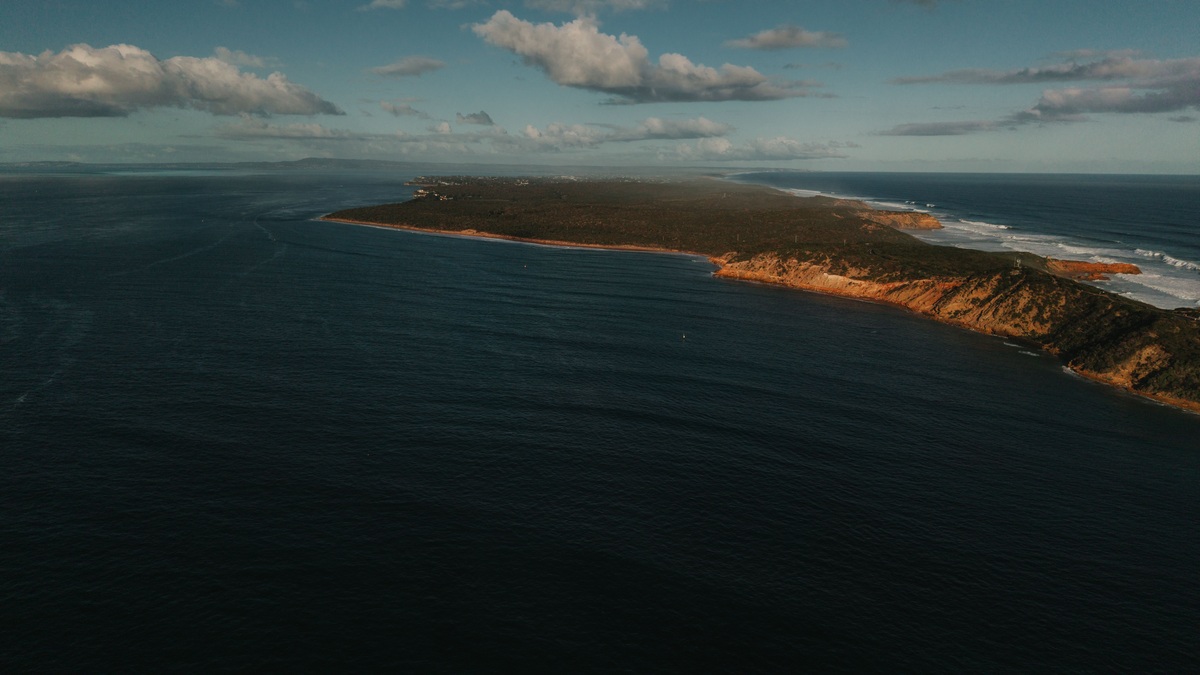
A coastal lidar survey maps land and water by timing laser pulses from an aircraft. Millions of measurements become a three-dimensional record of beaches, dunes and submerged terrain. The method gives scientists a consistent view across the shoreline, where ordinary land surveys and boat-based sonar each become difficult.
NOAA explains that lidar measures distance with reflected laser light. Survey systems combine those ranges with precise aircraft position and orientation. Processing gives every accepted return horizontal coordinates plus an elevation.
The result is not a photograph. It is a dense collection of measured points that can be classified and converted into elevation models. Coastal managers use those products to track erosion or update flood studies. The data also guide surveys in shallow water. Engineers can compare the mapped surface with proposed roads or protective structures. Scientists retain the point cloud because later questions may require detail that a simplified grid no longer contains.
A laser pulse becomes a mapped point
Lidar is short for light detection and ranging. A scanner sends a pulse toward the surface and records how long reflected energy takes to return. Since the speed of light is known, the elapsed time provides the distance between the sensor and the reflecting object.
Range alone cannot locate the point on Earth. The aircraft carries satellite positioning equipment and an inertial measurement unit that records its movement. Calibration data describe the scanner’s alignment. Software combines these inputs to calculate the position of each return.
A single emitted pulse may produce several returns. The first can come from vegetation while a later one reaches the ground. Analysts classify the returns so a bare-earth surface can be separated from tree canopy or buildings. Classification is partly automated, but unusual surfaces may require inspection. Wet sand and dark roofs do not always behave like nearby terrain and an incorrect class can affect the finished elevation model.
Coastal surveys often use two laser colors
Topographic lidar commonly uses near-infrared light, which reflects well from dry ground but is largely absorbed by water. A topobathymetric lidar adds green light that can penetrate clear water and return from the bottom. The two channels help trace one elevation surface from dry beach into the nearshore zone.
Water complicates the measurement. Light bends at the air-water boundary and waves make that boundary uneven. Processing has to correct refraction before a bottom return can be placed at the correct depth.
Turbidity also limits penetration. Suspended sediment and dissolved material scatter or absorb the beam, so a survey may map deeper water in a clear inlet than beside a muddy river mouth. Sun glare can further reduce usable returns. Foam or aquatic vegetation may hide the surface below. These limitations mean an empty patch in the data requires interpretation rather than an assumed depth.
The Joint Airborne Lidar Bathymetry Technical Center of Expertise supports coastal mapping with systems designed for this transition zone. Its work joins federal agencies that need compatible elevation data for navigation and coastal management.
The point cloud is only the beginning
Raw measurements form a point cloud. Each point stores coordinates and elevation, with optional attributes such as return number or intensity. Quality control removes noise before checking agreement between flight lines. Independently surveyed control points provide a separate elevation comparison.
Classified points can be interpolated into a digital elevation model. The grid is easier to use in mapping software, but its resolution cannot create detail that the survey did not measure. Point spacing and uncertainty remain important when interpreting a narrow dune or channel. Different products may represent bare ground or the highest surface. A bathymetric product instead represents the water bottom, so users have to select the surface that fits their question.
Why the shoreline is unusually hard to survey
A shoreline responds to tides while waves continually move its visible edge. Storms can alter the ground itself. Even the boundary between land and water can shift during a flight. Survey planners therefore use tide observations and water-level models to relate measurements to a common vertical reference.
Land elevations and water depths have traditionally been collected with different instruments. Ground crews can survey beaches accurately but cover limited areas. Sonar works well under a vessel, yet the boat may be unable to enter surf zones or very shallow flats.
Airborne lidar covers wide coastal corridors without placing a vessel in breaking waves. It also measures dunes and nearby structures during the same flight. The continuity is valuable when researchers need to model water flowing from the ocean across a beach and into developed land.
Coverage still depends on environmental conditions. Flight crews seek low turbidity and favorable water levels, preferably under limited cloud. A technically successful flight can contain gaps where the bottom was invisible and those gaps should not be mistaken for deep holes.
The federal 3D Elevation Program coordinates high-quality elevation data across the United States. Coastal topobathymetric projects complement its broad terrestrial coverage where a seamless land-to-water surface is needed.
Elevation models reveal coastal change
Repeated surveys allow scientists to subtract one surface from another. The difference shows where sand was removed or deposited. After a storm, this elevation differencing can measure dune loss and changes to barrier islands without relying only on scattered profiles.
The same data improve storm-surge and wave models. Small elevation changes can alter where water crosses a dune or follows a channel. The Federal Emergency Management Agency’s coastal flood mapping process draws on terrain and bathymetry as part of the evidence behind hazard studies. Modelers may reduce a dense survey to a coarser grid for computation, yet source elevations still identify ridges and openings that must be retained.
Lidar also supports habitat mapping. Elevation and slope help identify tidal flats, while surface form can reveal reef structure. The laser data alone do not identify every habitat. Field observations and other imagery provide the ecological context.
Accuracy depends on reference systems
Every elevation must be tied to a vertical datum, a defined reference surface. A depth relative to local low water is not interchangeable with a height relative to a geodetic datum. Metadata state the reference and document any conversion.
NOAA’s Continuously Operating Reference Stations support precise positioning for surveys. Their observations help establish the aircraft trajectory and connect measurements collected at different times to the national spatial reference system.
Uncertainty comes from several sources rather than one simple error. Aircraft position contributes alongside scanner calibration and surface conditions add further variation. Water-depth estimates include refraction and bottom-detection uncertainty. Responsible maps report accuracy instead of presenting every pixel as equally exact.
Specifications also set requirements for point density and quality checks. A high point count can improve representation of small features, but density cannot compensate for biased positioning or a bottom that the laser never reached. Cross sections through overlapping flight lines can reveal systematic offsets. Checkpoints on stable surfaces provide a separate test rather than allowing the lidar to validate itself.
What coastal lidar can and cannot show
A lidar map can show the form of a coast at the time of collection. It can locate a dune crest and measure the beach slope while tracing a shallow channel. It does not by itself explain why the coast changed or predict its next position. Survey date is therefore essential metadata. A beach measured before a hurricane cannot be presented as the post-storm surface, even if it is the newest complete regional dataset.
Interpretation improves when elevation is combined with waves, sediment records and field evidence. Used that way, seamless topobathymetry connects processes that do not stop at the waterline and gives coastal decisions a measured physical foundation. Its greatest strength is consistent geometry across a difficult boundary. Its clearest limit is that the laser records what returned light can reveal, not everything present in the water.
Related reading: how seafloor habitats are mapped and how nautical charts differ from maps.