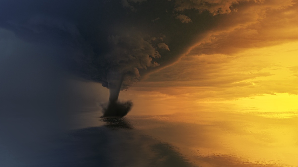
A waterspout is a rotating column of air connected to a cloud and extending over a body of water. The visible funnel consists of condensed water droplets, while spray may rise from the surface below. Despite the name, a waterspout does not pull a solid column of ocean water into the sky.
Meteorologists divide waterspouts into two main categories: fair-weather waterspouts and tornadic waterspouts. NOAA’s guide to waterspout formation emphasizes that the two types develop differently and can present different levels of danger.
Every waterspout should be treated as a marine hazard. Even a relatively weak circulation can produce damaging wind, steep local waves and airborne debris near a boat. A funnel associated with a severe thunderstorm may be as dangerous as a tornado over land.
Fair-weather waterspouts grow upward from the surface
Fair-weather waterspouts often form beneath developing cumulus clouds in an environment with light winds. Their rotation begins near the water and becomes stretched vertically by rising air. The circulation tightens as it is drawn toward the cloud base.
The National Weather Service in Miami notes that the visible funnel usually appears late in development, when a fair-weather waterspout is near maturity. A dark spot or ring on the water may be visible earlier.
These waterspouts commonly move slowly because the surrounding wind is weak. They often dissipate quickly after landfall. “Fair weather” does not mean harmless, nor does it guarantee blue sky throughout the area.
Warm water alone does not create a waterspout. The atmosphere needs instability and rising motion, while enough low-level rotation must also be present. Local boundaries where winds meet can supply the initial spin.
Tornadic waterspouts descend from thunderstorms
A tornadic waterspout is a tornado that forms over water or moves from land onto water. Its circulation develops within a thunderstorm, typically from a rotating updraft. The funnel extends downward toward the surface.
These storms may bring lightning and hail in addition to the rotating column. Damaging straight-line winds are another threat. Rough seas can extend beyond the narrow funnel, making the hazard larger than the visible tube.
The National Weather Service tornado guidance applies when a tornadic circulation approaches land. People should use a sturdy building and move to an interior room on the lowest floor, away from windows.
A visible funnel is only part of the circulation
Air cools as it rises and expands. If it reaches saturation, water vapor condenses into droplets that outline part of the rotating column. The visible funnel may not extend all the way to the surface even when damaging wind is present below it.
Near the water, rotation creates a spray ring. The National Weather Service in Key West describes this feature as a sign of a mature waterspout. A cascade, or tube of spray, can eventually surround the lower funnel.
Visibility changes with humidity and lighting. Rain can hide a circulation, while a thin condensation funnel may look less threatening than the winds beneath it. Mariners should rely on warnings and movement, not appearance alone.
Waterspouts vary greatly in diameter and strength. Most fair-weather examples are weaker than violent tornadoes, but a simple visual estimate cannot measure wind speed. Distance is the safest response to uncertainty.
Reports from trained observers remain valuable because radar beams may pass above shallow low-level circulations, especially far from shore. Photographs and precise locations can help forecasters confirm a threat, provided no one moves closer to collect them.
Warm coastal waters can favor development
Fair-weather waterspouts occur in many regions. They are especially familiar around the Florida Keys and other warm coastal waters. Seasonality follows local water temperature and atmospheric patterns rather than one global calendar.
Cold air moving over warmer water increases the temperature contrast near the surface. The resulting instability can support vigorous cumulus clouds. Converging sea breezes or other wind boundaries may add the low-level rotation needed for a spout.
The National Weather Service in Charleston links its local season with coastal water temperatures and weak-wind mornings. Conditions elsewhere differ, so a Florida pattern should not be applied automatically to the Great Lakes or Mediterranean.
Waterspouts can form over lakes as well as oceans. The physics depends on the water-atmosphere boundary, not salt. Lake forecasts may therefore include waterspout risk when cool air crosses relatively warm water.
Radar and observation help forecasters find them
Tornadic waterspouts associated with organized thunderstorms can produce radar signatures similar to land tornadoes. Doppler radar measures motion toward or away from the instrument, allowing meteorologists to identify rotation within a storm.
Fair-weather waterspouts are smaller and may develop below the level well sampled by radar. Forecasters examine instability and low-level convergence, including boundaries visible as cloud lines. Visual reports then help locate individual circulations.
Marine warnings are distributed through forecast products and NOAA Weather Radio. Boaters can also receive alerts through properly configured marine electronics or mobile services where coverage exists.
Boaters should move away at a right angle
If a waterspout is sighted, the National Weather Service advises moving at a 90-degree angle to its apparent motion. This course helps increase separation without trying to outrun the circulation along its track. Mariners should never approach for a closer look.
A safe maneuver still depends on surrounding hazards. A vessel must account for shoals and nearby traffic without approaching the coast dangerously. Reducing exposed canvas and ensuring everyone wears a life jacket may be appropriate before conditions deteriorate.
Lightning can strike well outside heavy rain. A tornadic storm may also produce sudden wind shifts that make the waterspout’s path difficult to judge. Seeking protected water early is safer than waiting for the funnel to become large.
The National Weather Service safe-boating guidance recommends checking the forecast before departure and maintaining access to warnings. A waterspout’s short lifetime does not make a close encounter safe.
If a circulation reaches land, authorities treat it as a tornado threat. People on shore should not stand outside to watch. The central lesson is straightforward: recognize that waterspouts have different origins, but give every rotating funnel ample room.
Common descriptions can create false confidence
People sometimes describe fair-weather waterspouts as weak tornadoes and stop there. The comparison misses the vulnerability of a small craft, which can be damaged by winds well below the intensity associated with the strongest land tornadoes. Hazard depends on exposure as well as wind speed.
The funnel also does not provide a precise boundary. Spray can occur outside the visible condensation, along with waves driven by the circulation. Gusts may reach beyond both. A waterspout hidden by rain may be especially difficult to judge from a moving vessel with a low horizon.
Another misconception is that all waterspouts “suck up” marine animals. Small objects or spray can become airborne in strong circulation, but the funnel is primarily made visible by condensation. Reports of material falling later do not change the meteorological definition.
Forecast language identifies the level of concern
A marine forecast may mention a chance of waterspouts when the environment supports development. A special marine warning signals an immediate hazard from a strong thunderstorm or observed circulation. When a tornadic waterspout threatens the coast, a tornado warning may follow.
The National Weather Service marine forecast system divides coastal waters into zones and issues watches or warnings appropriate to the threat. Boaters should know their zone before leaving shore, since place names used in alerts may differ from familiar landmarks.
Preparation is more reliable than visual diagnosis. A working receiver reduces the need for last-minute decisions. So does an alternate route planned with enough time to return to shelter. If a spout develops nearby, increasing distance remains the priority regardless of its label. Crews should agree on who will monitor warnings before departure so an alert is not missed during routine work.
Related reading: how rapidly intensifying storms form and how tropical cyclones are named.