
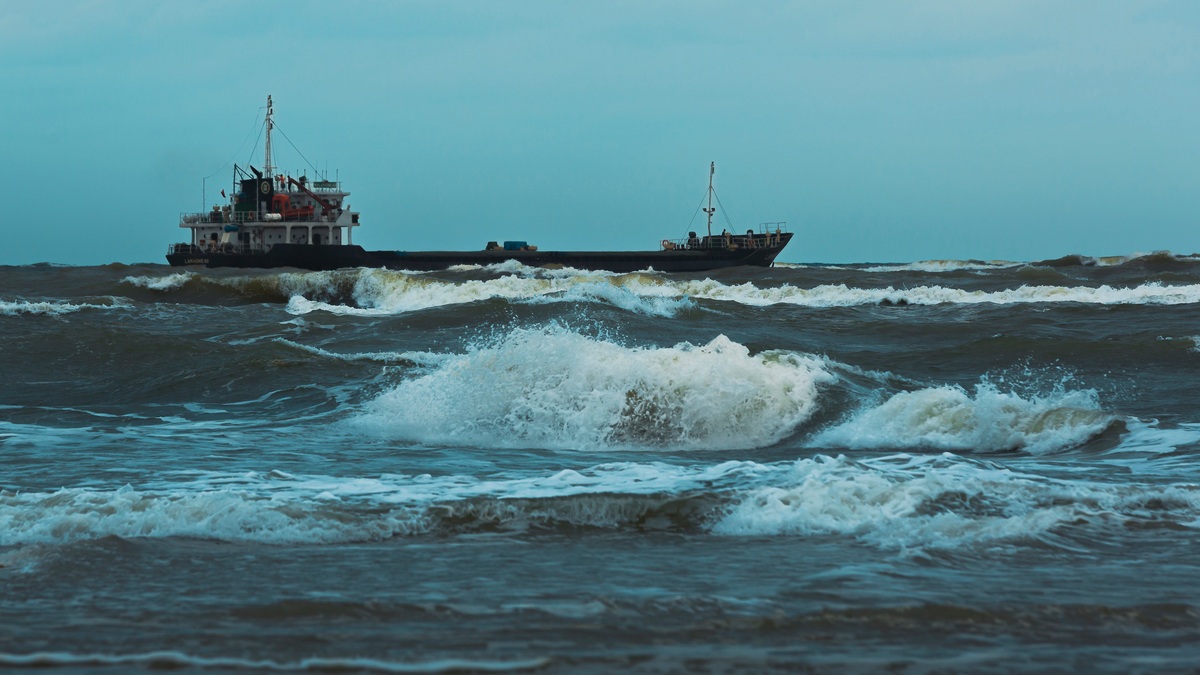
A high seas forecast describes weather and sea conditions across broad ocean areas beyond coastal forecast zones. It gives mariners wind and wave information needed to plan routes. Storm details are especially important where land-based observations are sparse.
NOAA defines high seas forecasts as products transmitted around the world in real or near-real time. National weather services divide responsibility for ocean regions so ships can receive standardized warnings across international routes.
The forecast is operational rather than a general outlook. A vessel’s master uses it to compare hazards with ship size, cargo and schedule, then revises the route as conditions develop.
High seas zones cover open ocean
Issue time and valid period are essential parts of the product. Crews compare both with their planned position because a ship may need many hours to reach the hazardous area. Successive bulletins reveal whether a storm is accelerating, strengthening or moving away from the earlier track. Offshore reception can be intermittent. Vessels therefore retain recent products and check for updates whenever communications permit. A forecast is most useful as a sequence of assessments rather than one isolated prediction.
The zones are broad because ships cross large distances between ports and may encounter several weather systems on one passage. Boundaries let forecasters organize bulletins consistently, but mariners must follow a hazard across adjacent zones rather than treating a line on the chart as a physical barrier. Forecast continuity across neighboring zones is especially important when a fast-moving storm approaches a route from outside the original bulletin area.
Coastal forecasts focus on waters near shore. Local terrain plus dense observations support finer detail there. Offshore zones extend farther out. High seas products cover the broad areas beyond them.
The National Weather Service issues forecasts for assigned portions of the Atlantic and Pacific, along with parts of Arctic waters. Boundaries are published so mariners know which bulletin applies at a given position.
The National Weather Service marine portal links coastal, offshore and high seas products. Adjacent national services coordinate under World Meteorological Organization arrangements.
A forecast describes several hazards
Timing language deserves close attention. A warning may describe conditions already occurring, while a forecast gives expected movement and development. Reading the issue time and valid period prevents an old bulletin from being mistaken for the latest assessment. Later updates must also be checked.
Wind speed and direction appear with the positions of fronts and pressure systems. Stronger warnings identify storm-force or hurricane-force conditions. Timing tells a vessel whether a hazard is approaching its route.
Wave information includes significant wave height, a statistical measure related to the average of the highest third of waves. Individual waves can be higher. Period and direction affect how a ship responds even when two forecasts show the same height.
Forecasters also describe tropical cyclones where relevant. Freezing spray or sea ice may require separate attention. Visibility may fall in fog or heavy precipitation. Each hazard has different consequences for deck operations and vessel stability.
The Ocean Prediction Center publishes analysis and forecasts for the North Atlantic and North Pacific. Its products include surface maps, wind and wave guidance, along with text bulletins designed for communication at sea.
Observations begin across a sparse ocean
Buoys measure wind and pressure at fixed locations. Many also observe wave conditions plus water temperature. Ships contribute reports along their routes. Satellites provide wider coverage of clouds and surface temperature. They also estimate ocean wind.
Scatterometers infer near-surface wind from microwave signals reflected by the sea. Altimeters estimate wave height along a satellite track. Neither instrument continuously covers every point, so analysts combine passes with other observations.
Weather balloons launched from islands or ships sample the atmosphere vertically. Aircraft observations help near busy routes. Remote ocean regions still have longer gaps than populated land.
Numerical models fill space and time between measurements by solving equations for the atmosphere and ocean. Data assimilation adjusts the model state toward observations while maintaining physical consistency.
Human forecasters compare model solutions, inspect new observations and account for known biases. They can emphasize a rapidly deepening low before all automated products agree on its effects.
Waves need their own prediction
Wave period changes how a given height affects a vessel. Long-period swell carries energy differently from short, steep wind waves. Direction also determines whether seas strike a ship on the bow, beam or stern, which can alter handling even when the reported height stays the same. Crossing seas can produce confused motion when swell intersects waves generated by local wind.
Ocean waves respond to wind speed and duration. Fetch, the distance over which wind blows, is another control. Local wind sea can mix with swell generated by a distant storm. The combined surface may be more difficult than either component alone.
Wave models track energy across different periods and directions. Swell can travel beyond the weather system that created it, reaching a route under clear skies. Opposing current can shorten waves and make them steeper.
Mariners interpret significant wave height as a distribution rather than a ceiling. A forecast of six-meter seas means some individual waves will exceed six meters during the period.
NOAA’s National Data Buoy Center provides observations that help initialize models and verify forecasts. A buoy reading is local, so a vessel should not assume conditions remain identical between stations.
International systems carry the message
The 1912 Titanic disaster helped drive international safety agreements and more coordinated services. The International Convention for the Safety of Life at Sea now includes requirements for navigational and meteorological warnings.
The International Maritime Organization administers SOLAS. The Global Maritime Distress and Safety System supports delivery of maritime safety information through satellite and radio services.
Text forecasts remain valuable because they use little bandwidth. Radiofax charts and satellite messages offer complementary formats. Internet products provide another route to the same safety information. Ships choose equipment according to operating area and regulatory requirements.
The World Meteorological Organization coordinates marine meteorological services among member nations. Common terminology reduces confusion when a voyage crosses forecast boundaries.
Redundant communication protects against equipment failure or poor reception. Crews verify that the bulletin is current and applies to their coordinates before relying on it.
Mariners turn forecasts into route choices
A large ship cannot always avoid a weather system at the last minute. Its speed and turning limits require early decisions. Routing may sacrifice distance to reduce wave impact or keep dangerous wind on a safer part of the vessel.
Heading relative to waves controls roll and pitching. Cargo condition and freeboard influence acceptable exposure. Fishing vessels or small commercial craft may use thresholds different from those of a large container ship.
Forecast uncertainty grows with lead time. Ensemble models show a range of possible storm tracks, helping route planners see where confidence is low. Updates can narrow or shift that range.
A bulletin has limits
High seas forecasts summarize enormous regions. Local squalls can produce stronger wind than the broad wording suggests. Observational gaps also mean a developing low may be sampled only after it strengthens.
Mariners combine the official forecast with onboard radar and barometer trends. Visual observations of clouds and sea state remain useful. A falling pressure can confirm that a forecast system is approaching faster than expected.
Low-bandwidth access is available through the Ocean Prediction Center’s mobile products, including text forecasts and sea-state charts. The time stamp is as important as the forecast values.
A high seas forecast cannot make the ocean safe. It gives a crew enough organized evidence to act before conditions reach the vessel. Forecast updates, ship limitations and conservative judgment complete the decision.
Related reading: how bombogenesis intensifies storms and the difference between hurricanes, cyclones and typhoons.





