VDatum is NOAA software that converts elevation data from one reference surface, or datum, to another. The transformation allows soundings, land surveys and tidal heights to line up within a common vertical framework, which is essential where a small height difference can move a mapped shoreline by many feet.
NOAA’s introduction to VDatum and coastal elevation describes the tool as a bridge among different sources of height data. It does not measure a coast by itself. Instead, it translates existing measurements so users can compare and combine them without treating unlike zeros as though they were identical.
Every elevation needs a reference
An elevation such as two meters is incomplete until its zero point is known. A surveyor might report height above a land-based vertical datum, while a nautical chart uses a tidal datum chosen for safe navigation. A satellite receiver can produce height relative to a mathematical ellipsoid.
Each reference answers a useful question. Orthometric heights relate closely to the direction gravity pulls and support land surveying. Tidal datums describe observed water levels at a location. Ellipsoid heights fit the geometric Earth model used by satellite positioning.
Problems appear when datasets based on different references are placed together. A lidar map of a beach may use one vertical datum while offshore depths use another. Their edges can show an artificial step even though the real seabed rises smoothly toward land.
How VDatum makes a conversion
The user supplies a location and an input reference, then chooses a target reference. VDatum follows a defined transformation path between them. Some steps use geoid models, while tidal conversions rely on regional grids built from water-level observations and hydrodynamic modeling.
The official VDatum 4.8 site lists support for many horizontal reference frames as well as vertical datums. Users can convert a single point or process compatible files. Coverage and available transformations vary by region.
Grids store the offset between surfaces at regularly spaced locations. VDatum interpolates between grid points to estimate a value for the requested coordinate. NOAA’s transformation-grid documentation explains that different paths use specific interpolation methods.
A conversion changes the reported numerical height, not the physical point. If a beach survey is transformed from one datum to another, the sand does not move. Its coordinate is being expressed relative to a different zero surface.
Tidal datums follow local water levels
Mean high water and mean lower low water are examples of tidal datums. They are calculated from observations over a standard period and tied to benchmarks near a station. Because tides respond to local geography, the relationship between tidal surfaces varies along the coast.
A single constant offset cannot accurately convert tidal height across an entire region. VDatum’s regional models represent spatial changes between tidal and geodetic surfaces. The conversion is most useful where sufficient observations and modeling support a validated grid.
NOAA’s tides and currents program provides datum information for individual stations. Those station values are direct local references. VDatum extends transformations between locations, with an uncertainty that users should retain in their analysis.
Why gentle coasts magnify small errors
On a steep cliff, a modest vertical difference may barely change the horizontal shoreline position. Across a broad, gently sloping marsh or beach, the same difference can move the intersection between land and water much farther. Mismatched datums can therefore distort inundation maps.
Storm-surge and sea-level scenarios combine terrain with water heights. Both need a consistent reference before a model can identify which ground lies below a projected water surface. A hidden datum mismatch may make flooding appear deeper or shallower than the inputs support.
The NOAA Sea Level Rise Viewer illustrates coastal inundation with mapped elevation information. Such public products involve more processing than a single VDatum conversion, but the underlying principle remains: land and water elevations must share a coherent frame.
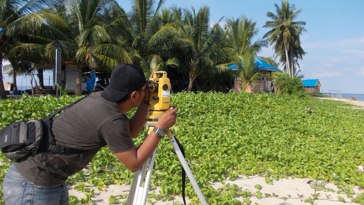
Hydrographic surveyors face the same issue at the land-water boundary. Sonar soundings need to connect with shoreline lidar. A common vertical framework helps create a continuous topobathymetric surface extending from dry land into submerged terrain.
Where VDatum is used
Coastal engineers can use transformed elevations when designing structures or comparing surveys from different agencies. Habitat managers may merge marsh elevation with tidal levels to study how often vegetation is flooded. Chart makers need dependable relationships between positioning systems and chart datums.
Emergency planners use consistent elevation for storm-surge and tsunami mapping. Researchers also compare observations collected years apart, although datum conversion is only one part of that task. Land subsidence and tectonic movement may need separate treatment.
VDatum includes desktop and online interfaces, plus an application programming interface. The API allows software to request conversions systematically, which can help projects process many points with repeatable settings.
Large projects often test a small sample before converting an entire dataset. Known benchmarks can reveal a reversed sign or wrong unit. They can also expose an incorrect source datum. A few independent checks are cheaper than discovering after mapping that millions of converted points share the same setup error.
Consistent datums also help future updates. A new shoreline survey can be compared with an older one after both are placed in the same reference system. Analysts can then investigate actual change instead of mistaking a difference between vertical zeros for erosion or land movement.
Uncertainty still follows the data
Every component has error. A source survey has measurement uncertainty and a transformation grid has uncertainty because observations are limited between stations. Interpolation introduces another estimate. VDatum can report transformation uncertainty where the supporting information is available.
Users should preserve the original data and record all chosen reference frames. They should also confirm that coordinates fall inside valid model coverage. A successful software response does not establish that the input datum was labeled correctly in the first place.
The VDatum user guide walks through selection of horizontal and vertical references. For consequential work, users need metadata from the survey provider and should follow the standards of the agency responsible for the map or design.
Datum transformation removes one major source of inconsistency, but it cannot improve a poor measurement or predict future shoreline change. Its value comes from making the reference explicit and applying a documented conversion. The remaining uncertainty must continue into the final product.
A shared zero connects land and sea
Coastal mapping brings together communities that historically used different height systems. Mariners focus on clearance beneath a vessel, while land surveyors use stable benchmarks. Satellite systems depend on global geometry. VDatum provides calculated links among those perspectives.
The result is less visible than a new satellite image, yet it supports clearer flood maps and more consistent surveys. When elevation sources agree on what zero means, users can focus on the real shape of the coast rather than artifacts created by incompatible references.
A shared reference also improves reproducibility. Another analyst can apply the recorded transformation to the same source coordinates and investigate any difference. Metadata should name the VDatum version and regional model because updated grids may change a converted value slightly.
Future national reference systems will require many organizations to update workflows. Transformation tools help connect older archives with newer coordinates, but users must still understand the epoch and datum attached to each dataset. Careful documentation keeps a numerical conversion from erasing the measurement’s history.
For a homeowner looking at a flood map, these technical choices are mostly invisible. For the scientists and engineers producing the map, they determine whether separate layers meet at the shoreline. VDatum makes those choices explicit and supplies a consistent route between them.
Related reading: how geodetic datums define elevation and why local sea level differs.