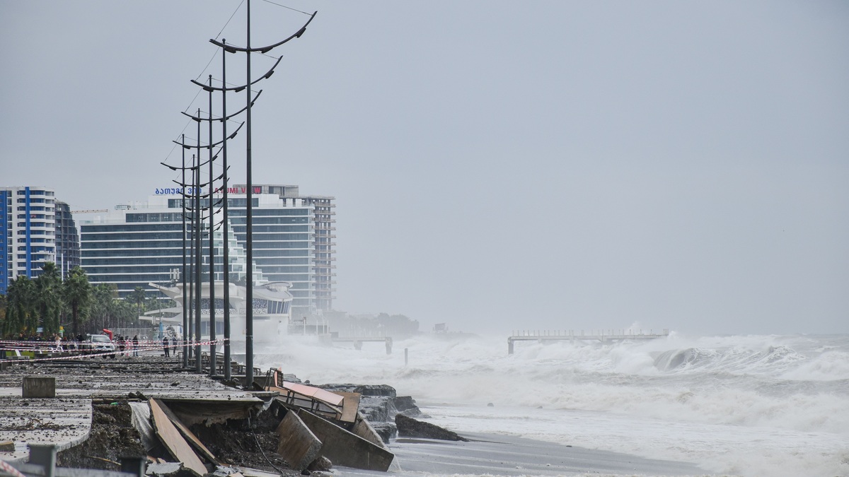
Coastal communities face danger from sudden disasters and slow changes that accumulate for decades. Hurricanes can destroy buildings in hours, while erosion removes the land beneath roads one storm at a time. Rising seas increasingly amplify routine high tides and storm surges.
NOAA’s overview of coastal threats includes storms, tsunamis and landslides alongside longer-term erosion and sea-level rise. The balance differs from one coast to another because geology, exposure and development determine which hazard becomes most damaging.
Risk also depends on who and what occupies the shoreline. The same flood can be a temporary nuisance in a protected open space and a life-threatening emergency in a dense neighborhood with limited evacuation routes.
Coastal risk grows when several hazards affect the same systems. Erosion can weaken a dune before a storm and flooding can close the road needed for evacuation. Planning works best when communities examine these interactions instead of preparing for each threat in isolation.
Storm surge raises water above the tide
A tropical cyclone pushes seawater toward land through persistent onshore wind. Low atmospheric pressure adds a smaller rise near the center. The resulting storm surge arrives on top of the astronomical tide.
Shallow shelves and funnel-shaped bays can concentrate the water. Waves then ride above the elevated surface, reaching structures that would remain dry during an ordinary tide. The storm’s track controls which coastline receives the strongest push.
The National Hurricane Center explains storm surge hazards separately from wind because the peak water may occur away from the eye. Evacuation zones reflect local flooding potential rather than a hurricane’s category alone.
Forecast maps often show several plausible water levels because small track changes can redirect the strongest onshore flow. Residents should use the official local evacuation instruction, which incorporates roads and response time in addition to modeled depth.
Coastal flooding has several causes
Heavy rain can overwhelm drainage while tide gates prevent runoff from reaching the sea. Rivers may deliver floodwater from far inland at the same time that surge blocks their outlets. Compound flooding becomes especially difficult to forecast when each source peaks on a different schedule.
High-tide flooding occurs without a storm when normal tidal cycles reach roads or drains. As mean sea level rises, the same tidal height begins from a higher baseline. Events that were once rare can recur more often.
NOAA’s high-tide flooding outlook tracks observed thresholds at coastal gauges. Local elevation remains crucial because water can enter low neighborhoods before it reaches higher parts of the same city.
Flood preparedness includes evacuation planning and protected utilities. It also requires clear routes for people without cars. Plans must address residents with disabilities as well as institutions that cannot move quickly.
Erosion removes beaches and bluffs
Waves move sand alongshore and between the beach and offshore bars. A stable-looking beach may narrow seasonally, then rebuild under calmer conditions. Long-term erosion occurs when sediment losses exceed the supply.
Seawalls can protect property directly behind them while reflecting wave energy and narrowing the beach in front. Beach nourishment adds sediment but requires suitable material and repeated projects. Managed retreat moves structures away from persistent exposure.
Rocky coasts erode differently. Waves exploit fractures at a cliff base, while rainfall weakens material above. A landslide can occur after the storm that started the damage has passed.
The U.S. Geological Survey monitors coastal change hazards with lidar, imagery and models. Forecasts identify places where dunes may erode or water may overtop the beach during storms.
Lost dunes remove a natural barrier. Their vegetation traps windblown sand, so repeated foot traffic or development can weaken the system before extreme weather arrives.
Sea-level rise changes every baseline
Global sea level rises as warming seawater expands and land ice melts. Local water levels may rise faster or slower because land itself moves. Subsidence can worsen exposure, whereas uplift offsets part of the ocean increase.
The NASA sea-level portal brings together satellite measurements and research on the causes of change. Tide gauges provide long coastal records, while satellites measure much of the open ocean.
Higher water allows storm surge to travel farther inland. Saltwater can reach groundwater and soils that formerly stayed fresh. Drainage systems designed around a lower tidal boundary may lose capacity.
Adaptation planning uses scenarios because future local rise depends on emissions, ice-sheet behavior and vertical land motion. Decisions about a short-lived structure can use a different planning horizon from a hospital or wastewater plant.
Groundwater can rise with the sea before waves cross the shoreline. Higher groundwater reduces empty space in the soil and increases basement seepage. It can also push salt toward wells. Surface defenses alone may leave this pathway open.
Tsunamis can cross entire oceans
Most destructive tsunamis begin when an undersea earthquake abruptly displaces the seafloor. Landslides and volcanic activity can also move water. In deep ocean, the waves travel fast with a height that may be difficult to notice from a ship.
As a tsunami enters shallow water, it slows and grows. The first arrival is not always the largest and dangerous currents may continue for hours. Natural warnings include strong shaking or an unusual withdrawal of the sea.
The U.S. Tsunami Warning System combines seismic data with sea-level observations. Communities still need signed evacuation routes because a nearby source may leave little time for an official alert.
Wetland loss weakens natural protection
Marshes and mangroves can reduce wave energy across broad shallow areas. Their soils store carbon and provide habitat for juvenile fish. Development behind a wetland may prevent it from migrating inland as the water rises.
A narrow strip cannot absorb every storm, so natural infrastructure complements evacuation and stronger buildings. Restoration projects need adequate room at a suitable elevation. They also require a continuing sediment supply.
The Environmental Protection Agency describes the benefits of wetlands for flood storage and shoreline stability. Protection can also preserve fisheries and water quality, spreading value beyond hazard reduction.
Coastal squeeze occurs where rising water pushes habitat against a fixed seawall or dense development. The wetland loses area because it cannot shift landward.
Barrier islands provide another moving defense. Storms can carry sand across them, helping the islands migrate toward land. Fixed roads and buildings often conflict with that motion, creating recurring demands for nourishment or repair.
Infrastructure can multiply disruption
Ports often sit near water because their work depends on access. Power plants and treatment systems may occupy the same exposed setting. A flood at one facility can interrupt supply chains or release pollution beyond the damaged site.
Roads and bridges may form the only evacuation route across wetlands or islands. Repeated nuisance flooding weakens pavement and raises maintenance costs even without a declared disaster.
Resilience starts with accurate elevation and hazard maps, then adds building standards suited to the local threat. FEMA’s flood maps support insurance and land-use decisions, although communities may also plan for conditions beyond the mapped regulatory flood.
Redundancy helps essential services recover. A backup generator placed in the same flood zone as the main electrical equipment offers little protection. Communications and mutual-aid agreements need testing before a storm.
Recovery policy changes future exposure. Rebuilding to the previous design can restore service quickly but preserve the same weakness. Elevation or relocation costs more at first, so communities need funding rules that recognize losses avoided over the structure’s remaining life. The strongest plan treats hazards as connected. Sea-level rise raises surge exposure while erosion removes buffers. Damaged infrastructure then slows recovery. Communities reduce losses by matching long-term development choices with the water and land conditions they are likely to face.
Related reading: how ghost forests form along coasts and where the world’s highest tides occur.