
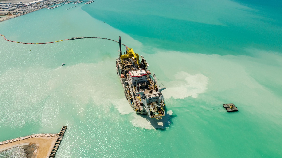
Dredging removes sediment or debris from the bottom of a waterway. A machine excavates the material and lifts it through the water. The load then moves to a placement site. The method changes with the sediment and the reason for removal.
NOAA’s explanation of dredging emphasizes the steady accumulation of sand and silt in channels. Rivers carry particles downstream, while currents redistribute them inside harbors. Without maintenance, the navigable depth gradually shrinks.
Dredging can also create a deeper port or remove contaminated deposits. Some projects supply sediment for restoration. Each purpose requires testing and a plan for where the excavated material will go.
Surveyors define what must be removed
Survey crews compare measured depths with the channel’s authorized dimensions and calculate the volume above the target surface. Sediment samples reveal grain size and possible contaminants. Those findings influence equipment choice and disposal options. They also determine the controls needed to protect surrounding water. Engineers also allow for uncertainty and material that may remain between survey lines. A realistic estimate prevents an apparently complete job from leaving isolated shoals above the required depth.
A hydrographic survey measures the existing bottom and compares it with the authorized channel dimensions. Engineers calculate the volume above the target grade, then look for isolated high spots that could threaten vessel clearance. Sediment samples reveal grain size and chemistry. Clean sand may suit beach nourishment, whereas contaminated mud can require controlled handling. Hard clay or rock demands equipment different from loose silt.
Designers also study currents and waves because suspended sediment can drift beyond the work area. Environmental windows may limit dredging during fish migration or spawning. Utility crossings and wrecks must be located before excavation begins.
Mechanical dredges lift the bottom
Production depends on more than bucket capacity. Operators account for swing time, vessel traffic, currents and the distance to an approved placement site. A powerful machine can still advance slowly when precision is required beside docks, cables or buried infrastructure. Operational limits may also restrict work to certain tides or seasons, extending the calendar even when excavation itself is efficient. Weather delays and safe vessel clearances can further reduce productive hours during a tightly scheduled harbor dredging project with active vessel traffic.
A mechanical dredge may use a bucket or clamshell to dig material. Backhoe-like tools serve some projects. The bucket rises through the water and empties into a barge. The method handles compact sediment and debris while allowing precise work near structures.
Every bucket cycle can release some fine particles into the water. Operators control the drop speed and avoid overfilling. Special environmental buckets close more tightly when contaminated sediment must be contained.
Barges carry the excavated material to a placement facility or approved aquatic site. Their load has to remain within safe stability limits. A separate unloading system may move the sediment ashore.
The U.S. Army Corps of Engineers groups equipment into mechanical and hydraulic methods. Selection depends on bottom material and water depth. The intended placement route also affects the choice.
Hydraulic dredges pump a slurry
A hydraulic dredge mixes sediment with water and draws the slurry through a pipe. A cutterhead may loosen compacted material at the intake. Centrifugal pumps provide the energy needed to move the mixture.
Pipeline dredges send slurry directly toward a nearby placement area. Booster pumps extend the distance when friction would otherwise slow the flow. The discharge can build a beach or enter a containment basin where solids settle.
Trailing suction hopper dredges are self-propelled ships. Drag arms collect sediment as the vessel moves, storing the slurry in an onboard hopper. Once full, the ship sails to an approved location.
The Corps’ dredging manual describes hopper and pipeline systems in detail. Hydraulic methods can move large volumes efficiently, although the added process water affects transport and placement.
Production instruments track position and depth so the operator can follow the design surface. Repeated surveys verify that the channel meets its target without unnecessary over-dredging.
Navigation channels need repeated work
Managers use follow-up surveys to decide when another maintenance cycle is justified. Shoaling is rarely uniform across an entire channel, so targeted removal may restore safe depth without excavating every reach. This approach limits cost and reduces disturbance where sufficient depth remains.
Maintenance dredging restores an existing channel after sedimentation. The frequency varies with river flow, storms and local geology. Some reaches shoal regularly, while others remain stable for years.
Capital dredging creates a new channel or deepens an old one. It often removes denser material that maintenance equipment has never disturbed. The larger change may need extensive environmental review and new placement capacity.
Vessel draft sets the minimum water depth needed beneath the keel, with a safety allowance for motion and uncertainty. Larger ships have increased pressure on ports to deepen certain approaches.
Contaminated sediment needs controls
Pollutants can bind to fine sediment near industrial areas. Environmental dredging removes deposits to reduce exposure, yet disturbing them may release contaminants temporarily. The operation therefore uses monitoring and containment suited to the site.
Testing defines which layers are contaminated and where clean material begins. Contractors may dredge in thin controlled cuts. Barges can be covered and water from dewatering facilities may require treatment.
The Environmental Protection Agency outlines shared federal responsibility for dredged sediment management under the Clean Water Act and the Ocean Dumping Act. Permit requirements depend on the placement environment.
Cleanup goals are site-specific. Removing every particle can cause more disruption than leaving deeply buried material in place. Risk assessments compare excavation with capping or monitored natural recovery.
Dredged sediment can become a resource
Suitable sand can rebuild eroding beaches. Fine sediment can raise a subsiding marsh when placement is carefully controlled. Other uses include habitat construction and engineered fill.
The Corps’ beneficial use program reports that more than 200 million cubic yards are removed annually from federally maintained navigation channels. Material still has to meet physical and chemical requirements for its intended use.
Beneficial placement can reduce demand for disposal capacity while keeping sediment within the coastal system. A marsh project needs the right elevation because placing too much material can bury vegetation, while too little may fail to offset subsidence.
Clean material may still be unsuitable for a particular beach if grain size or color differs sharply. Engineers compare source sediment with the receiving site and monitor how waves redistribute it.
Some material goes to confined disposal facilities or approved open-water sites. Choosing among options considers transport distance, environmental effects and long-term capacity.
Monitoring continues during and after work
Completion surveys verify that the required depth was reached without leaving high spots. Environmental monitoring may also track turbidity or conditions at the placement area. Post-dredging measurements provide the evidence needed to close the project and plan later maintenance.
Turbidity sensors can detect suspended sediment near the dredge. Biological observers may watch for protected animals, while water samples track contaminants when the project requires them.
Equipment noise and vessel traffic create additional effects. Work plans set operating boundaries and shutdown procedures. The limits must reflect the species and habitat present rather than a generic rule.
Final bathymetric surveys confirm depth and document any remaining high spots. Placement sites are inspected for stability, drainage or habitat response. Long-term monitoring can show whether restored sediment stays where designers expected.
Dredging works as a chain: characterize the bottom, select equipment, excavate carefully and place the material responsibly. Sediment management determines whether the operation simply moves a problem or supports a safer waterway with a useful environmental outcome.
Related reading: how canals differ from natural waterways and the waterways of the Great Loop.





