
A canal is a human-made waterway built to move vessels or water across a route that nature did not provide in a usable form. Some cut through land between seas. Others run beside rivers, while water-supply canals carry freshwater to farms and cities.
NOAA’s canal definition separates navigable waterways from aqueducts intended mainly to transport water. Both types reshape how water moves and both depend on engineering that matches the surrounding terrain.
Canals have linked markets for thousands of years. Modern examples still carry enormous ships and essential water supplies, but their operation can affect ecosystems, concentrate pollution and depend on increasingly variable rainfall.
Canals create a controlled route
A navigation canal may bypass rapids or shorten a coastal journey. It can also connect two separate basins. Engineers excavate a channel wide and deep enough for its expected traffic. Banks need protection from erosion caused by currents and vessel wakes.
Some canals remain at nearly one water level from end to end. Sea-level canals such as Suez cross relatively flat terrain without lifting ships through locks. Other routes climb over a divide and need a series of controlled pools.
Aqueduct canals move water by gravity where the slope permits, with pumps added when terrain requires a lift. Irrigation systems distribute flow among branches. Urban supply canals often end at reservoirs or treatment plants.
Locks lift and lower vessels
A lock is a watertight chamber with gates at each end. A vessel enters when the chamber matches the water level on one side. Once the gates close, valves admit or release water. The vessel rises or falls with the chamber surface.
The process usually relies on gravity. The U.S. Army Corps of Engineers illustrates how water seeks its own level as valves fill or empty a navigation lock. Reversing the sequence moves a ship in the other direction.
Locks divide a route into reaches at different elevations. Dams or embankments retain water in each reach. Gates must withstand unequal pressure, yet open reliably when levels on both sides of the gate are the same.
Water use can limit traffic. Every conventional lockage transfers a chamber volume downhill. Water-saving basins capture part of that volume for reuse and operators may place several vessels in one chamber when schedules and safety allow.
The Panama Canal crosses a divide
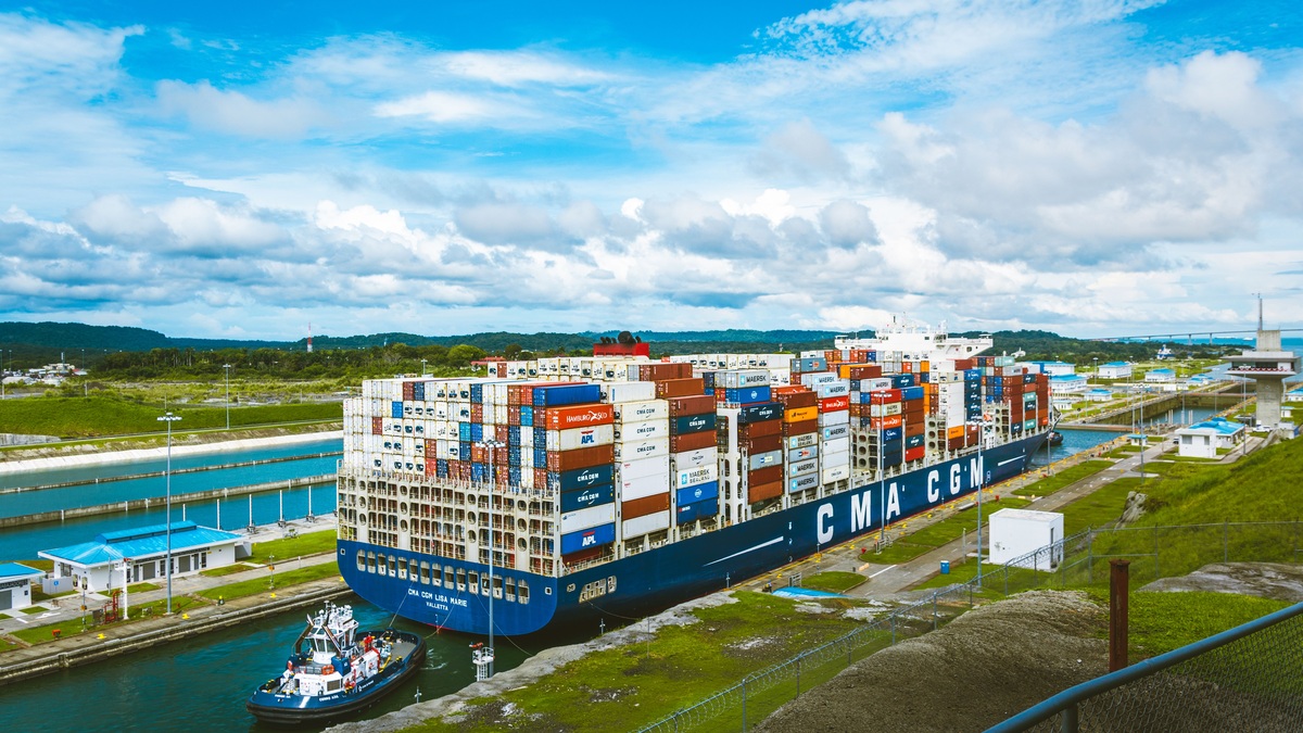
The Panama Canal connects the Atlantic and Pacific across the Isthmus of Panama. Ships rise from sea level to Gatun Lake before crossing the interior. They descend on the opposite side. Rainfall in the watershed supplies much of the freshwater used for navigation.
The original lock chambers opened to traffic in 1914. A third, larger set began commercial operation in 2016, allowing many ships too large for the earlier locks to transit. The expansion also introduced water-saving basins.
The Panama Canal Authority explains the route’s locks and operating system. Pilots work with tugboats to keep large vessels correctly positioned through narrow chambers. Locomotives or line handlers provide further control where the operating system calls for them.
Drought exposes the link between shipping and freshwater. Low lake levels can reduce allowable draft or daily transits. Canal managers balance navigation with municipal supply and the watershed’s ecological needs.
A canal shortens distance without eliminating constraints. Queue time, tolls, vessel dimensions and water conditions influence whether an operator uses the route or sails around a continent.
Suez follows a different design
The Suez Canal links the Mediterranean Sea with the Red Sea. Its route is close enough to sea level that ships do not pass through navigation locks. Channels and lakes provide the controlled corridor across Egypt.
Two-way movement depends on channel width and the location of passing areas, while traffic scheduling organizes each direction. Groundings can obstruct the route because vessels have limited room to turn. Dredging maintains depth as sediment moves and ships grow larger.
By avoiding the long voyage around southern Africa, the canal provides a major route between Europe and Asia. Its value comes from geography, though concentration also means a closure can disrupt schedules across global shipping networks.
The Suez Canal Authority publishes the waterway’s dimensions and navigational characteristics. Ongoing widening and deepening projects aim to improve capacity and recovery options.
Inland canals built regional networks
Before railways and highways, canals moved bulk cargo more efficiently than wagons. Towpaths allowed animals to pull barges along calm water. Locks carried traffic across changes in elevation that would stop an ordinary boat.
The Erie Canal connected the Hudson River with the Great Lakes, reducing transport costs between the interior and Atlantic ports. It influenced the growth of New York and cities along its route. Later enlargements replaced much of the original channel.
Across Europe, interconnected rivers support freight and recreation through linked canals. Lock size and bridge clearance determine which vessels can pass through each section, with channel depth imposing another limit.
The Corps of Engineers maintains navigation locks on major U.S. inland waterways. Lockmasters control entry because currents near gates can endanger smaller craft. Commercial tows and changing water levels add further hazards.
Older canals also serve as parks or heritage sites, often doubling as water corridors. Their modern purpose may differ from the trade system that justified construction, yet dams and embankments still require inspection and maintenance.
Canals alter ecosystems
Connecting basins can give aquatic species a route across a natural divide. Organisms may travel in the water. Others attach to hulls or arrive in ballast. Once established, an invasive species can spread through rivers linked to lakes.
Locks and salinity differences can slow movement without forming a complete biological barrier. Managers use monitoring and physical controls to reduce transfer, supported by rules for vessel operations. The most effective approach depends on the species and waterway.
Excavation changes wetlands and drainage. Canal banks may fragment habitat. Altered flow can affect sediment as well as water quality. Irrigation canals can lose water through seepage or evaporation, especially in hot, dry regions.
Pollution can accumulate where circulation is weak. The Gowanus Canal in New York, built as a commercial route, received industrial contamination and sewage. The Environmental Protection Agency oversees cleanup work at Gowanus and other contaminated sites in the state.
Canal operation is a water problem
Navigation requires a dependable depth. Reservoirs and feeder channels store water for dry periods, while spillways release excess during floods. Operators forecast inflow and demand so they can set draft limits before levels become unsafe.
Climate change can alter rainfall patterns and evaporation, including the duration of droughts. A canal designed around past conditions may need new storage, more efficient locks or different traffic rules. Adaptation competes with drinking-water needs and environmental flows.
Maintenance never ends. Sediment reduces depth as banks erode, while mechanical parts wear through use. Surveys locate shoaling so dredges can restore the channel. Scheduled closures give crews access to gates and valves.
Technology improves scheduling and measurement, yet every canal remains tied to its landscape. A sea-level cut differs from a lock staircase and an irrigation channel solves another problem entirely. Their shared feature is deliberate control of water along a route. Operators coordinate traffic with maintenance windows. Emergency response must also be ready because a disruption at one structure can delay vessels across the entire system. Each transit depends on the system around it.
Canals appear as simple blue lines on maps. On the ground, they are coordinated systems of channels, structures and operating decisions. Emergency plans cover collisions, floods, mechanical failures and pollution releases. Water accounting tracks lockages, evaporation, leakage and withdrawals from connected reservoirs. Local weather can alter those calculations within days. Their success depends on moving ships or water while managing the physical and ecological consequences of the connection they create.
Related reading: North America’s river and lake systems and how people altered Lake Erie.





