
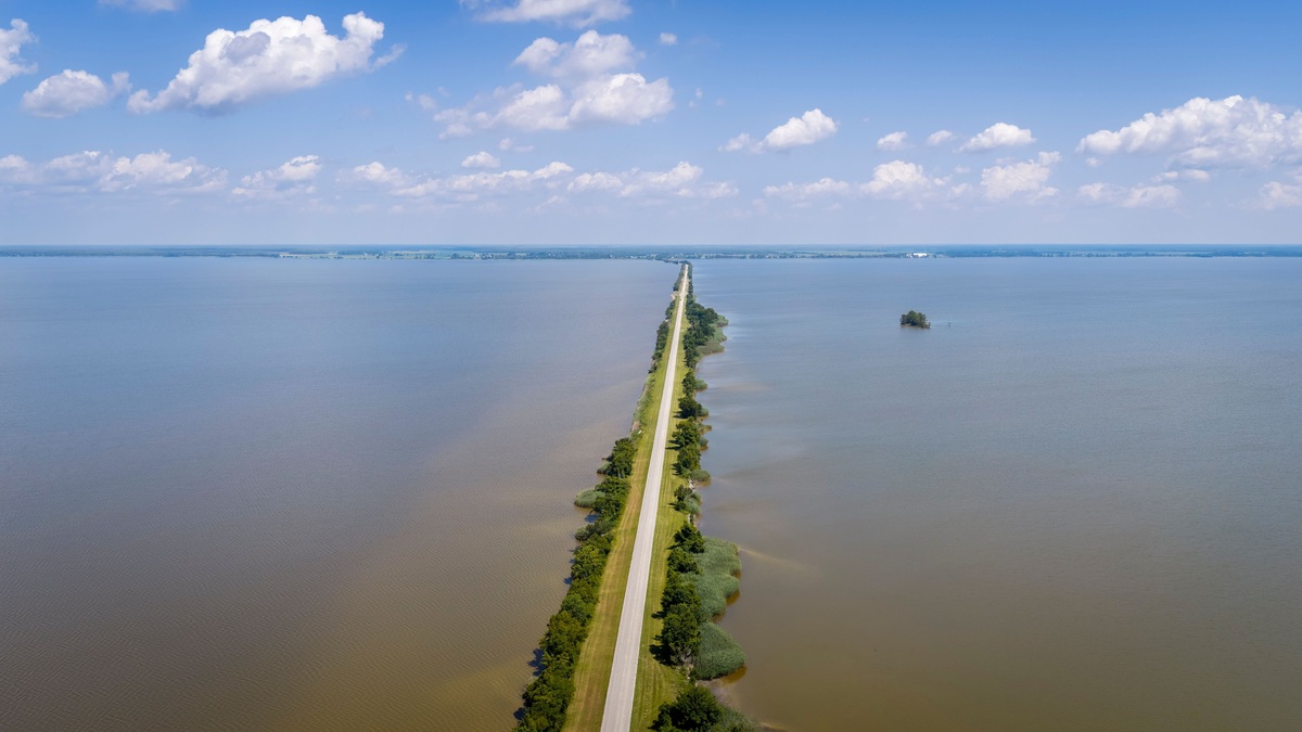
Lake Erie is a natural lake. Continental glaciers excavated and reshaped its basin during the ice ages and meltwater filled the depression as the ice retreated. People later altered water levels, shorelines and navigation routes, but no human-built dam created the lake.
The confusion is understandable because Lake Erie now operates within a heavily engineered waterway. Shipping channels are dredged, harbors are protected by breakwaters and control structures affect flows elsewhere in the Great Lakes system. Those modifications changed how people use the lake without changing its glacial origin.
A useful comparison is Lake Mead, whose basin filled behind Hoover Dam in the 1930s. Its shoreline and stored volume depend directly on a human barrier. Lake Erie’s water level instead depends on a natural outlet and basin, even though people manage navigation and water use around it.
The word “made” can also refer to ecological condition rather than geological origin. Pollution or restoration can change water quality without creating the lake itself. Keeping those questions separate avoids treating human influence as proof of artificial construction.
Lake Erie also predates the national border that now crosses it. The United States and Canada share responsibility for water quality and navigation because a natural watershed was divided by later political boundaries.
Glaciers carved the Lake Erie basin
Long before the latest ice sheet, rivers eroded valleys through the sedimentary rock beneath the region. Pleistocene glaciers then widened and deepened those low areas. Their immense weight pressed on the crust, while moving ice scraped rock and carried sediment.
The Laurentide Ice Sheet covered most of Canada and part of the northern United States. NOAA’s account of how the Great Lakes formed explains that warming began to drive its retreat about 20,000 years ago. Meltwater occupied basins left by the ice.
Lake Erie did not appear instantly in its present outline. Ice margins and ridges of glacial debris temporarily blocked different outlets, producing a sequence of larger and smaller ancestral lakes. NOAA’s Lake Erie geomorphology record places the final retreat from the area around 13,000 years ago.
One early stage, glacial Lake Maumee, extended beyond the modern western shore and drained toward the Mississippi system. New outlets opened as the ice front withdrew. The water surface stepped down and later crustal rebound altered the Niagara outlet.
Its shape continued changing after the ice
The land rose gradually after losing the weight of the ice, a process called isostatic rebound. Changing outlet elevations altered the lake’s level and drainage. Sediment accumulated in glacial valleys, while currents rearranged sand along shore.
NOAA estimates that the Great Lakes reached roughly their present shapes and sizes about 3,000 years ago. Even now, beaches migrate and bluffs erode. Storms can move large volumes of sediment, especially along Lake Erie’s shallow western and central basins.
Lake Erie contains three main basins. The western basin is shallow, the central basin is broader and the eastern basin reaches the greatest depth. This natural bathymetry reflects bedrock, glacial excavation and later sediment deposition.
Glacial deposits still influence the shore. Moraines create ridges, while sand eroded from bluffs feeds beaches and spits. Long Point in Ontario and Presque Isle in Pennsylvania grew through sediment movement along the coast. These landforms continue to adjust under waves and changing lake levels.
Dams did not create the Great Lakes
A reservoir forms when a dam blocks a river or when another human structure intentionally impounds water. Lake Erie fails that definition. It existed thousands of years before modern engineering and is one of the five natural Great Lakes.
Its outlet is the Niagara River, which carries water toward Lake Ontario. The falls and river are natural features, although power works and control structures now influence some flow. Removing those structures would not drain Lake Erie like removing a reservoir dam.
Argo’s overview of the Great Lakes’ glacial formation follows the broader sequence. The system includes connecting rivers and Lake St. Clair, so the lakes function as linked basins rather than isolated bowls.
Natural lakes can still have regulated outlets. Lake Superior and Lake Ontario have major control works and diversions elsewhere move relatively small amounts of water between watersheds. Regulation modifies a preexisting system; it does not retroactively make every connected lake a reservoir.
Engineering changed levels and navigation
People have dredged channels through shallow areas to accommodate commercial ships. Harbors use piers and breakwaters, while shoreline armor protects selected property. The St. Lawrence Seaway and connecting canals created a navigable route between the Great Lakes and the Atlantic.
Water management across the basin can influence levels and flows, but Lake Erie’s short-term level changes still depend strongly on precipitation, evaporation, runoff and wind. Strong winds can push water toward one end of the lake, producing temporary differences called a seiche.
These interventions help explain why the lake can look engineered on a map. They are additions to a natural basin. Argo’s article on how the Great Lakes connect identifies the rivers and straits that move water through the system.
The Welland Canal is one conspicuous artificial connection. It allows ships to bypass Niagara Falls between Lakes Erie and Ontario. The canal changed transportation across the basin, but the lakes and Niagara River existed before it.
Lake Erie is the shallowest Great Lake
Lake Erie has the smallest average depth among the Great Lakes and warms quickly in summer. Its shallow water also cools rapidly, making ice cover highly variable from winter to winter. The eastern basin is much deeper than the western end.
Shallowness contributes to productive fisheries because sunlight and nutrients can support abundant biological activity. It also leaves portions of the lake vulnerable to rapid heating, sediment resuspension and oxygen loss. The central basin can develop low bottom-water oxygen during summer stratification.
The same geography contributes to dangerous conditions. Wind can build steep, closely spaced waves in shallow water. Argo’s guide to Lake Erie’s hazards explains why a lake without ocean tides can still become rough quickly.
Shallow depth also shortens the lake’s average water-retention time compared with the other Great Lakes. Water moves through Erie relatively quickly on its path from the Detroit River to the Niagara River. That flow influences how nutrients and contaminants are transported.
Human influence is large but different from construction
Calling Lake Erie natural does not mean it is untouched. Cities, farms and industry occupy its watershed. Nutrient runoff can fuel harmful algal blooms, invasive species have changed food webs and shoreline development has replaced habitat.
NOAA reports that the Great Lakes contain about 90 percent of the United States’ surface freshwater and roughly 20 percent of the world’s surface freshwater. Millions of people depend on the system. Such intensive use makes active management unavoidable.
The clearest answer remains geological: ice and meltwater created Lake Erie. Human engineering adapted its connections and shores for navigation, water supply and development. Environmental decisions now influence its condition, but the basin itself is a product of natural Earth history.
The natural-versus-man-made label therefore answers only the origin question. Modern Lake Erie is a natural glacial lake operating within a managed watershed. Both parts are necessary to understand why its geology is ancient while many visible shoreline features are recent.
Maps offer a quick test of the distinction. The lake occupies a broad bedrock basin crossing an international border, while artificial features appear as narrow canals and harbor structures around it. Geological surveys reveal buried valleys and glacial sediment beneath the modern floor, evidence that no construction project excavated the basin.





