
The Great Loop is a boating route that circles much of eastern North America through connected rivers, canals, lakes and protected coastal waterways. Its course is flexible, but a typical circuit passes through the Atlantic Intracoastal Waterway, the Great Lakes, the inland river system and the Gulf Coast before returning to its starting point.
NOAA describes the Great Loop route as a continuous waterway rather than a single marked channel. Boaters who complete the circuit are commonly called Loopers. The journey joins natural water bodies to navigation projects built during different periods for commerce, flood control and regional travel.
Most published routes measure roughly 6,000 miles, although side trips and alternate canals can change the total considerably. A full circuit often follows the seasons, placing boats in northern waters during summer and moving them south before winter closes canals or brings freezing conditions.
The route is a network, not one channel
A Great Loop voyage can begin anywhere on the circuit. From Florida, many crews travel north along the Atlantic Intracoastal Waterway, reach New York Harbor and follow the Hudson River toward the canal system. The Erie or Oswego canals then provide routes toward the Great Lakes.
After crossing parts of the Great Lakes, boats enter the Chicago-area waterways or an alternative connection into the Illinois River. The route continues into the Mississippi watershed. Many Loopers reduce their exposure to heavy commercial traffic on the lower Mississippi by leaving it for another river system. The Ohio provides one connection toward the Cumberland or Tennessee.
The Tennessee-Tombigbee Waterway supplies a major southern connection. The U.S. Army Corps of Engineers says the 234-mile navigation project links the Tennessee River with the Tombigbee River system and includes ten locks and dams.
From the Gulf Coast, the protected Gulf Intracoastal Waterway leads east toward Florida. Boats can cross southern Florida through the Okeechobee Waterway or travel around the peninsula. The Atlantic coast then closes the loop, though currents, weather and bridge schedules keep the experience from feeling repetitive.
Boat dimensions determine the available route
The circuit contains bridges alongside shallow channels, with locks built to different standards. A vessel that fits one segment may be unable to clear another. The most important measurements are air draft, which is the height above the water and water draft, the depth of hull below it.
The Great Loop Cruisers’ Association lists an unavoidable fixed bridge on the Illinois River with a charted clearance of 19.6 feet. Antennas and radar arches often need to fold. Many sailboats must lower their masts for portions of the route.
A water draft near five feet or less opens more canal choices, especially in Canada and along stretches of the Atlantic Intracoastal Waterway. Actual clearance and depth vary with rainfall, tides, reservoir operations and sediment. The number printed in a guide is therefore a planning limit, not a promise of water beneath the keel.
Locks carry boats across watersheds
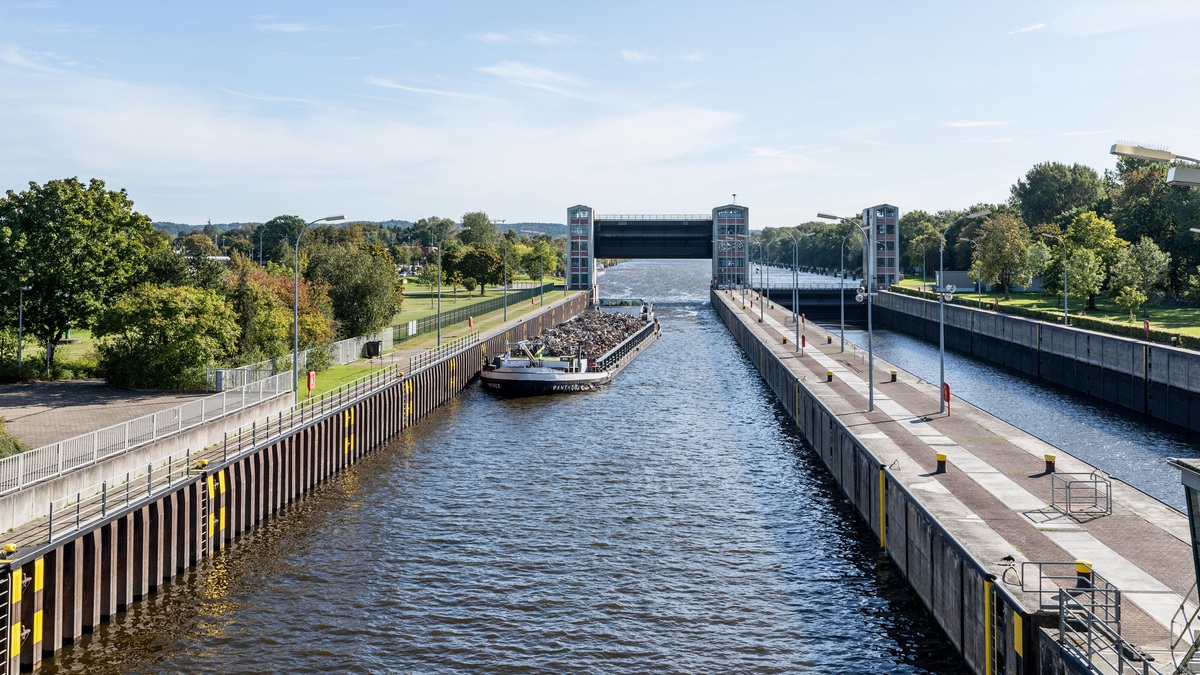
Canals connect rivers whose surfaces sit at different elevations. A navigation lock works as a chamber with gates at both ends. Once a boat enters and the gate closes, controlled flow raises or lowers the water until it matches the next reach of the canal.
Lock technique changes with the hardware. Parks Canada tells crews on the Trent-Severn Waterway to approach under control, follow staff directions and loop lines around drop cables without tying them fast. A line that cannot run as the chamber level changes can place dangerous force on a boat.
The Great Loop includes small historic locks and chambers designed for commercial vessels. Operators may group recreational boats together or place them behind a tow. Fenders protect the hull against rough walls. Bow and stern lines limit movement without fixing the boat rigidly in place.
Closures can interrupt an otherwise navigable itinerary. Maintenance may shut a lock for hours or weeks. Flooding or low water can cause the same interruption. Experienced crews check official notices before committing to a river section with few practical exits.
A lock also concentrates currents near its approaches. Life jackets reduce exposure if someone falls overboard. Controlled speed and clear communication between the helm and line handlers reduce the remaining risk. The calm water inside a chamber can change quickly when filling begins.
Charts remain essential on familiar waterways
Much of the Loop passes close to towns and highways, but visual familiarity cannot replace navigation data. Shoals may shift as aids to navigation move. Dredged channels can also be narrow. Commercial traffic has limited room to maneuver, particularly on bends in inland rivers.
NOAA’s electronic navigational charts cover U.S. coastal waters and many major routes. Canadian waters require the corresponding Canadian Hydrographic Service products. Chart plotters are most useful when their data are current and the operator understands the symbols, datums and scale.
River miles and buoy conventions can change between waterway systems. On some rivers, current affects steering long before a boat reaches a bridge opening. Depth sounders and local notices add present conditions to the broader picture shown on a chart.
Weather sets the pace
The seasonal circuit aims to avoid ice in the north and tropical storms in the south. Even within that broad plan, the Great Lakes can produce steep waves over short distances, while exposed Gulf crossings demand a suitable forecast window. River floods add current and debris; drought can reduce channel depth.
A NOAA Weather Radio receiver and marine forecasts help crews anticipate changing conditions. The National Weather Service network broadcasts warnings around the clock, although reception can vary in remote channels. Marine VHF radio carries bridge and lock calls, along with vessel traffic communications.
Wind direction deserves as much attention as speed. A long fetch across a lake can build waves that make an otherwise moderate breeze uncomfortable. Strong wind across a lock approach or marina fairway may also require more control than wind blowing directly along the channel.
Many crews build spare days into their schedule because waiting is often the safest decision. A date reserved at a distant marina has less value than a comfortable crossing with good visibility.
The Great Loop crosses busy working waters
Recreational boats share much of the inland route with barges and towboats. A tow may extend hundreds of feet and respond slowly. It may also need the deeper part of the channel. Calling the pilot by radio before a tight bend lets both vessels agree on a safe passing arrangement.
Saltwater sections add tides to the planning. A favorable current can shorten a day, while an opposing current may cut speed sharply. Low tide can expose shoals in poorly maintained side channels and high water reduces the clearance beneath fixed bridges.
Fuel range is another practical constraint. Long river stretches have fewer marinas than the Atlantic coast. Consumption rises in current or rough water, so planning from an ideal cruising figure can leave too little reserve.
A circuit built from many kinds of water
The Great Loop links engineering history with living ecosystems. Its course passes freshwater lakes, tidal estuaries, canalized rivers and coastal lagoons. Salinity changes repeatedly, affecting corrosion, drinking-water systems and the organisms visible from the deck.
Boaters can pass national marine sanctuaries and estuarine research reserves along the way. These protected areas preserve coastal habitats while supporting research and their protections also cover reefs or shipwrecks. Local restrictions may govern anchoring and discharge, while separate rules set wildlife approach distances.
Completing the Loop means managing a long series of modest decisions rather than conquering one continuous channel. Boat dimensions establish the possible route. Water levels and closures narrow the options further and daily weather determines when a safe passage actually opens.
The route’s appeal comes from those changing conditions. A vessel can leave an ocean inlet and climb through a historic canal before descending an inland river toward the Gulf. The connected waterways make a continental circuit possible, while each segment demands its own navigation skills.
Related reading: the U.S. states with the most lakes and North America’s largest lakes.





