Glacial isostatic adjustment is the slow movement of Earth after the growth and melting of enormous ice sheets. Land beneath former ice is still rising in parts of Canada and Scandinavia, while some areas beyond the old ice margin are sinking as a broad bulge in the crust relaxes.
NOAA’s explanation of glacial isostatic adjustment compares the response to a mattress recovering after a person gets up. The analogy captures the direction of movement, though the real process involves a rigid outer shell above mantle rock that deforms over thousands of years.
The motion affects measurements made today. It changes local sea level while tilting the Great Lakes. Precise coordinates shift as well. Scientists also have to remove its signal when estimating how much mass modern ice sheets are losing from satellite gravity data.
Ice sheets loaded the crust
During the last glacial maximum about 20,000 years ago, thick ice covered much of northern North America and Europe. The added mass pressed the crust downward and displaced slowly flowing mantle material away from the loaded region.
Land outside the ice margin responded by rising into a peripheral forebulge. The shape was broad rather than a sharp ridge because the lithosphere bends under large loads and the mantle redistributes stress over long distances.
Melting removed most of the load over several thousand years. Depressed land began to rebound as mantle material flowed back. The forebulge started to collapse. Earth has not yet reached a new equilibrium.
The adjustment continues because the mantle behaves like a very viscous material over geologic time. Its response is far slower than the elastic rebound that can occur immediately when a load changes.
NASA’s glacial adjustment simulation models the solid Earth response to changing ice and ocean loads during roughly the past 120,000 years. Different assumptions about ice history and mantle structure produce different present-day predictions.
Some land rises while other land sinks
Uplift is strongest near centers of former ice loading. Parts of Canada rise by several millimeters each year, as do areas around the Baltic in Scandinavia. Newly exposed shorelines and raised beaches preserve the cumulative effect.
Forebulge collapse creates subsidence farther from those centers. The Chesapeake Bay region lay beyond the southern edge of the Laurentide Ice Sheet and now experiences downward motion partly connected to this relaxation.
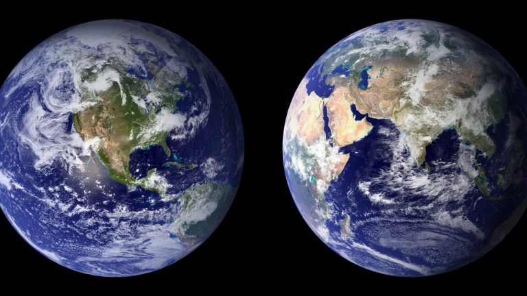
The pattern includes horizontal movement and changes in gravity as well as vertical motion. Earth’s rotation and the shape of the geoid respond to the redistribution of mass. For most people, however, elevation and relative water level are the most visible consequences.
NOAA’s multi-year CORS solution detects strong uplift in northeastern Canada with accompanying subsidence across parts of the northern Midwest. The measured field contains tectonic and local signals alongside the glacial response.
Relative sea level includes land motion
A tide gauge records the height of water relative to the land supporting the instrument. If the ocean surface rises and the coast sinks, the gauge sees both changes together. An uplifting coast can partly offset the local expression of global sea-level rise.
Glacial adjustment also changes the ocean’s gravitational field and basin shape, producing regional differences in sea level. The result is more complicated than adding one vertical land rate to one global ocean rate, especially across long time spans.
Along the Chesapeake, sinking land raises relative sea level and increases the water-level change experienced by coastal communities. Groundwater withdrawal and sediment compaction can add local subsidence that must be separated from the broader glacial signal.
A U.S. Geological Survey study of southern Chesapeake subsidence estimated a regional glacial-adjustment contribution of about one millimeter per year. Rates vary with the method and location across different periods. Planners therefore use local observations rather than a single value for the entire coast.
Flood exposure depends on tides, storms, waves and development as well as long-term relative sea level. Glacial adjustment acts slowly, yet its cumulative motion changes the baseline on which those short events occur.
The Great Lakes are gradually tilting
Northern portions of the Great Lakes basin are generally rising faster than southern portions. Differential uplift tilts lake basins and changes the elevation of outlets, shorelines and control structures relative to one another.
Water remains level under gravity, so a tilting basin changes where shorelines meet the lakes. A location can experience a long-term water-level trend even when the total amount of water does not change for that reason.
Historic beaches provide evidence. Former shorelines that began at similar elevations now rise toward regions that experienced heavier ice loading. Geologists combine those records with modern positioning to reconstruct the rebound.
The USGS account of Great Lakes coastal change explains that differential rebound has affected water levels and outlets during historic time. Climate-driven changes in precipitation and evaporation occur on top of this steady geometric shift.
Geodesy measures millimeters of motion
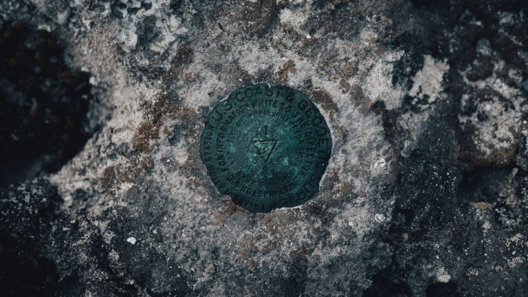
Continuously operating satellite-navigation receivers track the position of fixed stations through time. Long records allow scientists to estimate vertical velocity after accounting for equipment changes, seasonal movement and reference-frame updates.
Very Long Baseline Interferometry measures distances among radio telescopes observing distant quasars. Satellite laser ranging times laser pulses reflected from orbiting targets. These independent techniques help establish a stable global frame.
NASA’s overview of land motion and sea-level measurement shows why a tide gauge and a nearby geodetic station are valuable together. One follows the water relative to land, while the other measures how the land moves within the reference frame.
Repeated leveling surveys and radar interferometry add spatial detail. Radar can map broad patterns of subsidence, although vegetation, atmospheric moisture and changes at the surface complicate interpretation.
Measurements contain several processes at once. Tectonics, groundwater pumping, sediment compaction, earthquakes and construction can move a station. Glacial-adjustment models provide the broad expected pattern, while observations reveal the combined local reality.
Models test ice and mantle history
A glacial-adjustment model needs a reconstruction of when and where ice accumulated, how thick it became and how quickly it disappeared. It also needs estimates of lithosphere thickness and mantle viscosity.
Researchers compare predictions with GPS velocities, raised shorelines, ancient corals and dated sediments. A model that fits one region may perform poorly elsewhere, so ensembles explore many plausible combinations and express uncertainty.
The correction is important for satellite missions that measure gravity. Rising mantle material changes gravity beneath an ice sheet. Without accounting for that solid-Earth signal, an estimate of present ice-mass loss can be biased.
The process is active today
Glacial isostatic adjustment is sometimes called post-glacial rebound, but rebound describes only the rising part. Adjustment includes sinking forebulges, horizontal motion, gravity change and deformation beneath both land and ocean.
Modern ice loss also unloads the crust, creating a faster regional response that overlaps with the continuing legacy of the last ice age. Scientists separate the components by comparing observations across space and time.
For mapping and construction, slow motion changes coordinates and elevations. For coastal planning, it changes relative sea level. For climate research, it is a correction required to measure ice and ocean change accurately.
The old ice sheets disappeared thousands of years ago, but the solid Earth retains their mechanical imprint. Glacial isostatic adjustment shows how a past climate event remains measurable in today’s shorelines, lakes, gravity field and geodetic networks.
Local motion requires local evidence
A continental model can estimate the broad glacial signal, but it cannot replace measurements at a harbor, lake outlet or construction site. Nearby stations may move differently when one sits on bedrock and another rests on compacting sediment.
Combining geologic history, long geodetic records and water-level observations gives the strongest interpretation. The comparison separates a regional legacy of ice loading from a local process that may be manageable, such as groundwater withdrawal.
Related reading: why sea level is not the same everywhere and today’s sea-ice conditions.