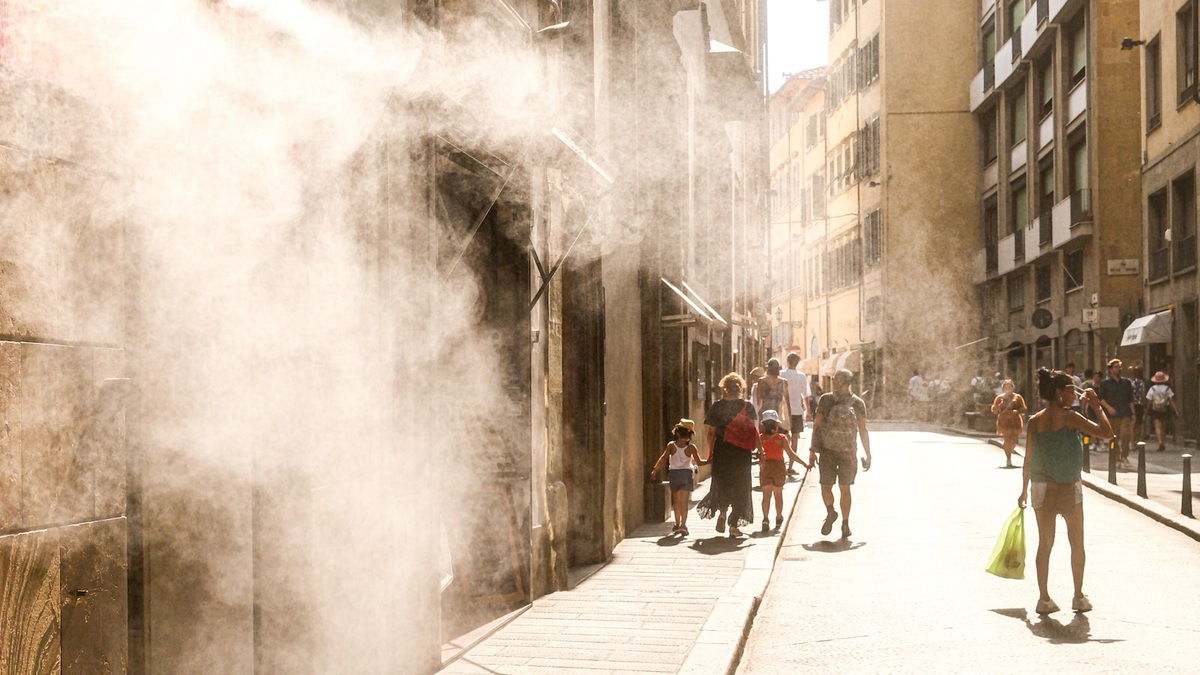
A heat dome is a persistent area of high pressure in the middle and upper atmosphere that helps extreme heat build near the ground. The name describes the pattern’s cap-like effect. Sinking air suppresses cloud growth, sunshine warms the surface and the weather changes slowly enough for hot conditions to intensify over several days.
NOAA’s heat dome explanation connects the phenomenon to a strong high-pressure system that remains over one region. Meteorologists identify it from pressure patterns and the height of pressure surfaces aloft, rather than from a literal boundary enclosing warm air.
The result can be a long, dangerous heat wave. Daytime highs receive much of the attention, but warm nights prevent buildings and human bodies from shedding accumulated heat. Humidity can then raise the physiological burden even when two places record the same air temperature.
High pressure makes air sink
Air within a strong upper-level ridge generally descends. Atmospheric pressure increases as that air moves lower, compressing and warming it. The process is called adiabatic warming because the temperature changes mainly through compression, without heat being added from an outside source.
Descending air discourages the upward motion needed to build tall clouds and thunderstorms. With fewer clouds, more sunlight reaches the ground. Dry soil directs a larger share of that solar energy into heating the surface and air because less energy is spent evaporating water.
The National Weather Service’s JetStream weather guide notes that high pressure commonly sits between about 10,000 and 25,000 feet during heat waves. The system may linger for days or weeks when the larger circulation moves slowly.
Near the surface, wind can also weaken beneath the ridge. Limited ventilation allows heat and pollutants to accumulate, especially in valleys and urban areas. The combination of clear skies, subsiding air and persistence produces the familiar dome analogy.
The jet stream can lock the pattern in place
The jet stream is a band of strong upper-level wind that steers many weather systems. Large north-south bends create ridges of high pressure and troughs of lower pressure. A pronounced ridge can transport warm air poleward and divert storms around the affected region.
Some circulation patterns stall because surrounding waves in the atmosphere change slowly. Meteorologists call these blocking patterns. A blocked ridge keeps returning heat to the same area while neighboring regions may experience cooler or stormier weather.
No single arrangement explains every heat dome. Ocean temperatures, soil moisture, snow cover and tropical weather can influence the ridge’s position. Attribution studies examine a particular event with observations and models before assigning weight to any factor.
Heat domes and heat waves describe different things
A heat dome is an atmospheric setup. A heat wave is a period of abnormally hot weather defined relative to the local climate. A strong ridge often produces a heat wave, though extreme heat can develop through other combinations of warm-air transport and dry ground.
Local definitions matter because 95 degrees Fahrenheit has a different meaning in Phoenix and Seattle. Weather services compare the forecast with local climatology and expected duration. Nighttime temperatures also inform how they communicate heat risk. Some warning systems incorporate humidity.
The urban heat island is another distinct process. Buildings and pavement absorb solar energy where vegetation is sparse. Vehicles or cooling equipment add waste heat. The EPA reports that U.S. cities can be about 1 to 7 degrees Fahrenheit warmer by day than nearby outlying areas, with a typical nighttime difference of 2 to 5 degrees.
A regional heat dome can cover rural land and cities together. Urban surfaces then add a local temperature penalty, particularly after sunset. Neighborhoods with fewer trees or poorly insulated homes may experience much greater exposure than a citywide average suggests.
Humidity changes how the heat feels and how efficiently sweat evaporates. The heat index combines air temperature and relative humidity for shaded, light-wind conditions. Direct sun or strenuous work can impose additional stress that the reported value does not fully capture.
Warm nights increase the health risk
The body moves heat toward the skin and uses evaporation of sweat to cool itself. High humidity slows evaporation. Dehydration reduces the capacity to sweat. Some medicines and health conditions also interfere with temperature regulation.
The EPA’s extreme heat assessment identifies older adults, children and pregnant people among groups with elevated risk. Outdoor workers face sustained exposure and people without dependable cooling may have little relief overnight.
Heat exhaustion can include heavy sweating, weakness, nausea or dizziness. Heat stroke is a medical emergency in which the body can no longer control its temperature. Confusion requires immediate emergency help. So does loss of consciousness or a very high body temperature.
Nighttime minimums provide an important measure of cumulative stress. A person can tolerate a hot afternoon more safely when a cool night follows. Repeated warm nights keep indoor temperatures high and shorten the body’s recovery period.
Forecasters track pressure and temperature aloft
Weather balloons sample temperature and humidity through the atmosphere while recording wind. Satellites observe cloud cover and surface conditions, while numerical models predict how the ridge will develop. Forecasters often inspect the height of the 500-millibar pressure surface, located near the middle of the atmosphere.
Warm air expands, so a given pressure occurs at a greater altitude within a very warm column. Exceptionally high 500-millibar heights indicate a deep layer of warm air and a strong ridge. NOAA’s analysis of a 2016 Southwest heat wave used this measurement to show the strength of the upper-level high.
Forecast confidence depends on persistence. Models may agree that a ridge will form but differ on when it weakens or shifts. A small displacement can move the hottest conditions toward another population center.
Dry ground can intensify the heat
Moist soil uses part of the Sun’s energy to evaporate water. When the ground is dry, more energy becomes sensible heat that raises the temperature of the surface and nearby air. A preceding drought can therefore amplify an atmospheric ridge.
Vegetation also cools the air through transpiration. Heat and water stress may close plant pores, reducing that cooling. The feedback is strongest where soil moisture becomes scarce during the event.
Irrigated land can create cooler pockets, as can forests. Their effect depends on available water and regional humidity. Satellite surface-temperature maps reveal sharp differences among fields, suburbs and dense urban districts beneath the same broad pressure system.
Hot, dry weather raises wildfire danger by lowering fuel moisture. Heat also increases electricity demand while power lines and generators operate less efficiently. Roads can buckle under high temperatures. Rails may expand, while aircraft can face reduced lift in very hot air.
Climate change raises the starting temperature
Natural weather variability still determines where a particular heat dome forms. Human-caused warming increases the background temperature on which that circulation acts, making many heat extremes hotter than comparable patterns would have been in an earlier climate.
Event-attribution scientists compare simulations of the observed climate with models representing a world without the added greenhouse gases. Their conclusions usually concern how warming changed the likelihood or intensity of a specific event, not whether climate change single-handedly created the ridge.
Communities can reduce harm through early warnings and accessible cooling centers. Checks on isolated residents extend that protection. Reflective roofs and added shade lower local exposure over longer periods. Occupational plans move strenuous work away from peak heat while providing water, rest and acclimatization.
A heat dome begins as a pattern high above the surface. Its consequences depend on the ground below as well as the people in its path. Pressure maps explain why the air remains hot. Soil moisture influences how much energy reaches the air. Urban design and access to cooling determine how severely people feel the heat.
Related reading: how bombogenesis develops and the atmospheric horse latitudes.