
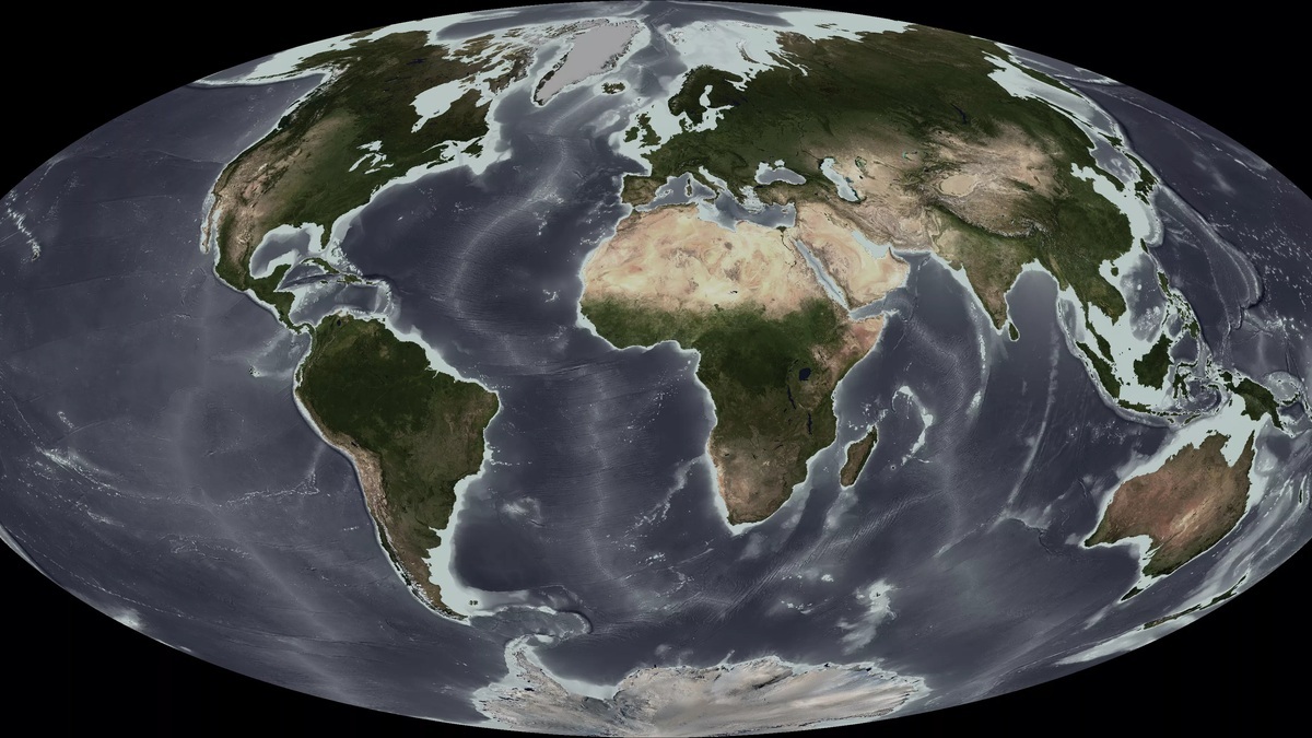
Ocean floor topography is the three-dimensional shape of the seabed. Scientists describe and measure that shape through bathymetry, the underwater counterpart of topographic mapping on land. An ocean-basin profile commonly begins with a shallow continental shelf, drops down a continental slope, crosses a continental rise or trench and continues over the deep basin toward ridges, seamounts and other relief.
The seabed is not a smooth bowl. It contains the longest mountain system on Earth, plains buried under sediment, volcanic peaks, steep canyons and narrow trenches that reach far below the average ocean depth. These features record plate motion, volcanism, erosion and sediment transport. They also steer currents and create habitats that differ sharply over short distances.
Bathymetry turns depth measurements into a map
A bathymetric map uses contours or color bands to show water depth. Early hydrographers lowered weighted lines from ships at individual points. Modern survey vessels generally use multibeam sonar, which sends a fan of sound pulses beneath a moving ship. Travel times and sound-speed corrections allow a system to calculate many depths across a broad strip of seabed.
Ship surveys produce detailed local maps, but ships have not yet measured every patch of ocean at high resolution. Satellites help fill the broad picture. Subtle gravitational effects of underwater mountains and trenches change sea-surface height, allowing researchers to infer large features from space. The National Centers for Environmental Information archives bathymetric data from ships and other platforms.
Resolution matters. A satellite-derived map may reveal a major ridge while missing a smaller canyon or volcanic cone. Direct sonar can resolve finer relief, although coverage takes time. That difference explains why scientists can describe the global basin structure while still reporting that only part of the bottom has been mapped to modern standards.
Bathymetric depth also requires a reference surface and careful positioning. An uncorrected measurement can shift as the tide changes or the vessel moves, while local water conditions alter sound speed. Survey teams combine navigation with motion sensors and water-column profiles before quality control determines whether soundings enter a chart. The USGS ocean glossary provides a common vocabulary for interpreting the resulting landforms.
Continental margins connect land to deep water
The continental shelf is the submerged edge of a continent. It usually slopes gently from shore to a shelf break, often near a depth of about 200 meters, although width and depth vary greatly. Broad shelves can extend hundreds of kilometers. Narrow shelves may end close to land where an active plate boundary lies offshore.
Beyond the shelf break, the continental slope descends much more steeply toward the deep basin. The slope marks the transition from relatively thick continental crust toward oceanic crust. Gravity-driven flows sweep mineral grains downslope together with organic debris. Over time, those materials may accumulate at its base.
A continental rise is a gentler apron built from sediment below many passive continental margins. It grades toward the abyssal plain. An active margin may lack a broad rise because a deep trench interrupts the profile. The arrangement therefore gives geologists clues about the tectonic setting as well as the movement of sediment.
Submarine canyons cut across shelves and slopes
Submarine canyons are steep-sided valleys incised into a shelf or continental slope. Some align with river systems, while others formed through repeated underwater erosion without a direct modern river connection. Dense mixtures of sediment and water called turbidity currents can rush through them and move material into deeper water.
Canyons act as transport corridors. Concentrated currents carry organic matter toward deep communities, while erosion exposes rocky habitat along the walls. They can also carry powerful sediment flows capable of damaging seafloor cables. Their branching shapes may resemble land canyons, but much of their modern development comes from slope failure and sediment-laden water moving downslope.
Canyon heads sometimes cut close to shore, while others begin at the shelf edge. Their walls may reveal layers otherwise buried beneath the margin. Because a canyon focuses both sediment and water movement, its floor can remain active even when the neighboring slope accumulates quiet deposits.
Abyssal plains are deep and remarkably flat
Abyssal plains occupy broad areas of the deep ocean, commonly several kilometers below sea level. They are among Earth’s flattest extensive surfaces because fine sediment gradually blankets irregular volcanic crust. Dust, clay, microscopic shells and sinking biological debris settle there or arrive through downslope flows.
Flat does not mean featureless or lifeless. Low relief is interrupted by fractures as well as isolated peaks. Within the sediment, animal burrows coexist with microbial communities. The material covering these regions is explored separately in what ocean floor sediment is made of. Topography describes the surface form; sedimentology explains the particles and deposits that cover it.
Mid-ocean ridges form a global mountain system
Mid-ocean ridges rise where tectonic plates move apart and magma creates new oceanic crust. The connected ridge system winds through every ocean. Along the crest, volcanic terrain may frame a central rift valley and hydrothermal vents. Spreading rate and tectonic setting determine the exact cross-section.
Ridges can stand thousands of meters above adjacent abyssal plains while remaining submerged. Their relief divides deep-water pathways and influences circulation near the bottom. The recognition of a rift along the Mid-Atlantic Ridge was central to Marie Tharp’s 1956 seafloor map, which helped make the structure of the ocean basin visible during the development of plate tectonics.
The ridge axis is only one part of the system. Fracture zones and transform faults offset spreading segments, producing long scars across the seafloor. The USGS Ocean 101 overview connects this relief with plate creation, earthquakes and volcanic processes.
Seamounts and guyots rise from oceanic crust
A seamount is an underwater mountain, usually volcanic, that rises prominently from the seabed without reaching the sea surface. Seamount chains can trace the movement of a tectonic plate over a long-lived source of magma. Their slopes alter local currents and may concentrate plankton, fish and deep-sea corals.
A guyot is a flat-topped seamount. Its summit may have been eroded by waves when the volcano stood near sea level, then carried deeper as the underlying plate cooled and subsided. A volcanic island can thus become a seamount as it sinks, with a wave-planed summit preserved as a guyot.
Ocean trenches mark the deepest narrow depressions
Trenches are long, narrow depressions commonly associated with subduction zones, where one tectonic plate bends beneath another. The Mariana Trench contains Challenger Deep, the deepest measured region of the ocean. A trench is not the center of every ocean basin and most abyssal plains are much shallower than its extreme depths.
The landward side of a trench may include an accretionary wedge built as sediment is scraped from the descending plate. In other settings, much of the sediment travels into the subduction zone. These alternatives help explain why trench cross-sections differ even though both occur at convergent boundaries.
Plate deformation continually reshapes active trench margins. Earthquakes can destabilize sediment on their steep walls, triggering slides into the depression. Enormous pressure makes sampling difficult, although both remotely operated and crewed vehicles have reached these depths. A useful basin profile therefore ends with no single universal sequence: the shelf, slope, rise, plain, ridge, seamount and trench are components whose arrangement depends on local geology.
Together, these landforms show why a depth number alone cannot describe the ocean floor. Bathymetry supplies the geometry, while geology explains how that geometry formed. Continued direct mapping is revealing smaller features within the broad framework and improving navigation, hazard analysis, habitat research and models of ocean circulation. NOAA’s archive of Marie Tharp’s physiographic map also shows how a coherent visual model can reveal relationships that scattered soundings conceal.
Individual seafloor features are explored in Argo’s guides to submarine canyons, seamounts and guyots, mid-ocean ridges and transform faults and fracture zones.





