
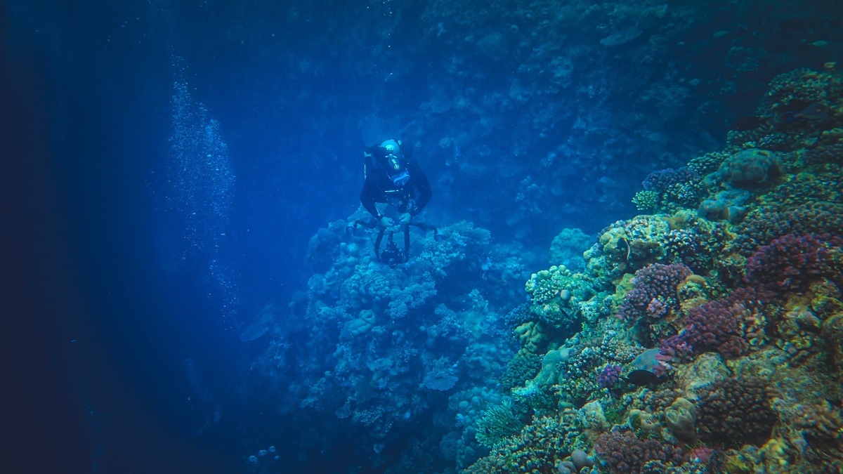
A submarine canyon is a steep-sided valley cut into the seafloor, usually across a continental shelf or slope. Some begin near a river mouth, while others start far offshore. Their channels can descend for kilometers and extend into the deep ocean, giving sediment, organic matter and water a direct route across the continental margin.
Canyons resemble river valleys in maps, but flowing rivers are only part of their story. Sea-level change, underwater landslides and sediment-rich gravity flows all contribute to their development. NOAA Ocean Exploration describes canyons as pathways that connect shallow and deep environments along the U.S. Atlantic margin.
The terrain is scientifically valuable and potentially hazardous. Rocky walls shelter corals, yet powerful flows can move boulders and sever cables. Each canyon develops from its own combination of geology, sediment supply and ocean circulation.
A canyon’s activity is easiest to understand within the full margin. The WHOI deep-ocean overview emphasizes that currents and episodic events continue to alter terrain below the reach of sunlight. Repeat mapping can therefore distinguish an inherited canyon shape from channels that still transport sediment today.
Canyons begin in several ways
When sea level falls during an ice age, a river may extend across an exposed continental shelf. It can cut a valley that later floods as the ocean rises. If the valley reaches the shelf edge, downslope flows may continue eroding it after submergence.
Many canyons have no direct modern river connection. Landslides can carve a headward-growing depression in the slope. Turbidity currents then scour the channel, steepen walls and transport loosened sediment away. Faults or differences in rock strength may guide the canyon’s position.
Erosion and deposition occur together. A fast flow cuts into one bend and leaves sediment in another. Wall failures widen the valley. Farther downslope, the channel may develop levees and divide into distributaries across a submarine fan.
Turbidity currents race through the channel
A turbidity current contains enough suspended sediment to be denser than surrounding seawater. Gravity pulls the mixture downslope. The front can accelerate in a canyon, entrain more sediment and remain energetic over long distances.
Triggers include slope failure, river floods that deliver unusually dense sediment or resuspension during storms. Some canyons experience frequent small flows, while a rare large event dominates others. Instruments are difficult to maintain because the strongest currents can bury or destroy them.
As a flow slows, it deposits a turbidite. Coarse grains settle before fine material in a classic graded layer. Stacked deposits reveal repeated events, though researchers need dating and regional evidence before linking a particular bed to an earthquake or flood.
Argo’s turbidity-current explainer follows this process beyond the canyon. The flow may cross a continental rise, build a fan and ultimately deliver land-derived material to an abyssal plain.
Canyons concentrate food and wildlife
Organic matter entering from coastal water can collect in a canyon or travel downslope. Currents also enhance mixing near steep walls. The resulting food supply may support dense communities compared with an adjacent open slope.
Rocky outcrops give cold-water corals and sponges firm places to attach. Branching colonies create habitat for fish and invertebrates. Muddy canyon floors support burrowing animals, while seeps add chemical energy where methane-rich fluids escape.
Conditions vary from wall to wall. Current exposure, depth and substrate can change across a short distance. One ledge may host coral, while nearby sediment holds worms or clams. Detailed habitat maps therefore require sonar plus direct imagery.
Fishing gear can reach some canyon habitats and lost gear may remain entangled on corals. Cables and proposed seabed development introduce other pressures. Protection decisions rely on knowing where vulnerable communities occur and how they connect with populations elsewhere.
Canyons move carbon into the deep sea
Particles produced near the surface contain organic carbon. Canyons can funnel a portion beyond the shelf, where burial in deep sediment may keep it from quickly returning to the atmosphere. The efficiency of that transfer depends on whether organisms consume the material, currents resuspend it or sediment buries it.
Plastic and other contaminants can follow the same route. Material lost near shore may accumulate in canyon sediment or continue into the basin. A canyon is therefore both an ecological connection and a conduit for human waste.
Transport occurs in pulses. Quiet deposition can be interrupted by a gravity flow that erodes older layers and carries them farther downslope. Scientists use sediment traps, moorings and cores to estimate how much material moves during ordinary conditions versus rare events.
Mapping combines sound with direct observation
Multibeam sonar produces a three-dimensional view of canyon shape. It reveals tributaries, scarps and terraces. Backscatter indicates whether the bottom is likely rough rock or softer sediment, but acoustic intensity alone cannot identify a coral species or determine sediment grain size.
Remotely operated vehicles supply video, close photographs and samples. Their pilots follow sonar targets and document organisms on walls that ships cannot sample safely with a conventional grab. Current meters record water movement and seismic profiles image buried canyon history.
Repeat mapping can expose recent change. Fresh landslide scars, displaced instruments or altered channels show that erosion continues. The USGS ocean program uses such surveys to connect margin hazards with habitats and sediment pathways.
Monterey Canyon begins close to shore and receives frequent observations, while many remote canyons have only a coarse map. Differences in river connection, shelf width and sediment supply make direct comparison useful only when those controls are stated.
On a broader map, submarine canyons cross the boundary between shelf and slope. Argo’s marine geography overview supplies that setting. The canyon is the incision that allows processes in those neighboring provinces to interact directly.
Canyon hazards reach beyond the seabed
Modern communication cables often cross continental margins. A single gravity flow can break several cables in sequence as it travels downslope. The timing of those failures has even helped researchers estimate flow speed where no instrument survived.
A large submarine landslide can displace water and generate a tsunami. Canyon erosion may also undercut slopes or redirect sediment toward infrastructure. Risk depends on local geometry and event size, so the presence of a canyon alone does not establish an imminent threat.
Surveyors identify old slide scars and deposits, then compare them with earthquake records and sediment accumulation. Engineers can route cables away from active channels or design redundancy across different paths.
Every canyon has its own sediment source
A canyon near a large river may receive abundant land-derived mud and sand. Another canyon is supplied mainly by shelf currents, coastal erosion or failure of its own walls. The source influences grain size, chemistry and how frequently flows occur.
Mineral composition can connect canyon sediment to a watershed. Organic markers reveal marine or terrestrial inputs and plastic fragments document modern human influence. Dating several cores shows whether transport was steady or concentrated in exceptional episodes.
Scientists therefore resist using one well-studied canyon as a universal model. Similar shapes can conceal different histories. A reliable explanation combines terrain, modern measurements and the layered record below the floor. Uncertainty remains where observations are sparse and researchers mark it explicitly when comparing transport rates among canyon systems.
During a flow, an instrument may record current velocity, pressure and suspended sediment before being buried. If several sensors fail in sequence, their last transmissions constrain travel time. Surviving moorings show the quieter water that follows.
Researchers pair those modern records with turbidite layers in cores. Grain size reveals changing energy through an event and organic markers help identify where material originated. The combined evidence links a brief flow to centuries of canyon development.
Submarine canyons often cross the continental shelf and incise the continental slope, linking coastal sediment sources with the deep basin.





