
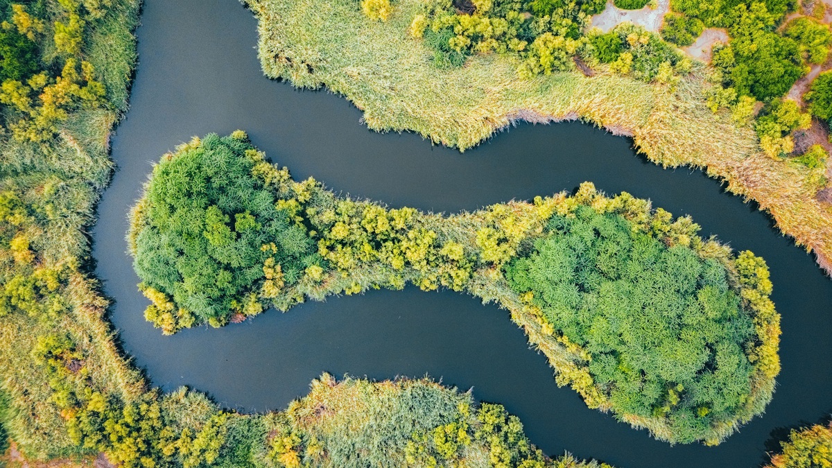
Rivers create landforms through erosion, transport and deposition. The resulting features include valleys, meanders, oxbow lakes, floodplains, natural levees, alluvial fans and deltas. Their shapes preserve a history of changing flows and moving sediment, including shifts in channel position through time.
A river rarely performs only one of those jobs. An outer bend can erode while the inner bend gains sediment and a flood can cut one location while covering another with silt. The National Park Service overview treats the watershed as the basic landscape unit for understanding these connected fluvial processes.
River valleys begin with downward erosion
Near their headwaters, streams often flow down steep gradients. Fast water and transported rock fragments can cut into a channel bed, producing narrow valleys whose sides remain steep because the river has had limited opportunity to migrate sideways. Weathering and slope failures deliver more material from the valley walls.
Vertical incision becomes especially strong when the land rises or the river’s base level falls. A stream may cut into an older valley floor and leave remnants as terraces above the new channel. The USGS description of river terraces in Kentucky shows how former valley surfaces can preserve traces of abandoned meanders.
Valleys broaden downstream when lateral erosion becomes more important. The complete channel relationships are covered in Argo’s river anatomy explainer, while the landforms here describe the longer-lived shapes built around that channel.
Meanders migrate across low-gradient valleys
A meander is a river bend that develops and moves across a valley. Water tends to run faster along the outside of a bend, where it erodes a cut bank. Slower flow along the inside deposits sand or gravel as a point bar. This coupled erosion and deposition moves the bend sideways and often downstream.
The National Park Service’s meander guide explains that maximum velocity shifts toward the outer bank. A curving channel also produces secondary circulation, which helps transfer sediment toward the inner bend. Channel position can therefore change even when its average width stays similar.
Meanders are not decorative loops imposed on a fixed landscape. They are active landforms that erode property on one side and create new deposits on the other. A migrating bend builds bars as it erodes banks. Backwaters left along that shifting channel are used by the organisms described in Argo’s guide to river habitat.
Oxbow lakes are abandoned bends
Adjacent meander limbs sometimes approach until only a narrow neck separates them. Continued erosion can breach that neck, as can a flood. Most flow then shifts into the shorter route. Sediment seals the entrances to the old bend and leaves an oxbow lake on the floodplain.
Satellite images assembled by the USGS Earth Resources Observation and Science Center show repeated cutoffs along the Mamoré River. The isolated water body gradually collects fine sediment and organic debris, so an oxbow can become a marsh and later a dry meander scar.
A cutoff shortens the channel locally and changes its slope. The river may respond with additional erosion or deposition nearby. Oxbow formation is therefore both a recognizable landform sequence and a disruption to the hydraulic balance of the active channel.
Floodplains grow during repeated high water
A floodplain is the relatively flat land beside a channel that is periodically inundated. A migrating river builds part of it through point-bar deposition, while overbank floods spread finer sediment beyond the channel. Repetition over centuries can produce a broad alluvial surface.
The river does not cover every part of a floodplain equally. Abandoned channels form low areas. Ridges develop from point bars, while backswamps retain water behind slightly higher deposits. A USGS classification of Upper Mississippi landforms shows how levee building can reorganize this terrain. It also documents the filling of backwaters and growth of bars.
Floodplains store water temporarily and exchange sediment with the channel. Development can interrupt those functions by constraining the river with embankments. Argo’s page on the world’s largest river by discharge provides scale for the enormous flows some floodplains must accommodate.
Natural levees rise beside the channel
Leaving the channel reduces the speed of floodwater as it spreads over adjacent land. Coarser sediment falls out first near the bank, building low ridges parallel to the river. Repeated floods can raise these natural levees above the more distant floodplain.
Natural levees differ from engineered levees. They are sedimentary landforms with irregular height and composition and they may be breached. The USGS account of Mississippi floodplain deposits describes crevasse splays where water escapes through a breach and lays down a fan-shaped body of sediment.
Low ground beyond a natural levee may drain slowly after a flood. Fine mineral sediment collects there along with organic material. These backswamps become part of the floodplain mosaic rather than a separate river system.
Alluvial fans form where streams lose slope
An alluvial fan develops where a confined mountain stream reaches a flatter valley or plain. The abrupt decline in gradient reduces carrying capacity. Gravel commonly settles near the fan’s apex, while finer sediment travels farther toward its margins.
The USGS definition of an alluvial fan emphasizes this transition from fast mountain flow to open terrain. Channels can shift across the fan surface during later floods, placing new sediment on a different sector.
Fans resemble deltas in plan view but form mainly on land where slope changes. A delta forms at a standing body of water. An alluvial fan can still create serious flood hazards because a channel that occupied one route in the past may abandon it during a sediment-rich event.
Deltas build outward at river mouths
A delta can form where a sediment-bearing river enters a lake or sea and slows enough to deposit part of its load. Channels divide into distributaries as sediment blocks older routes and water seeks new paths. The balance among river discharge, waves, tides and subsidence controls the resulting form.
Not every river mouth has a delta. Strong waves or currents may remove sediment faster than the river supplies it, producing an estuary or a comparatively open coast. Dams can also trap sediment upstream, reducing the material available to maintain a delta plain.
The lower Mississippi illustrates how a shifting channel interacts with its broad deltaic wetlands. Deposits left by the river preserve part of that relationship. The National Park Service summary traces how changing glacial runoff and sea level influenced the river valley and its terraces.
River landforms remain in motion
Rock type, slope, vegetation, sediment supply and flow regime determine which landforms develop. A steep bedrock river may cut a gorge, while a sand-bed river on a broad plain can migrate rapidly. Human structures alter those controls by changing flow timing or holding sediment.
The assigned source, a USGS review of the Willamette River floodplain, shows why vegetation belongs in the explanation. Plants can stabilize a fresh deposit. When the channel later moves across it, established vegetation is removed and bare surfaces open again. Physical and biological processes operate together.
A map captures the channel on one date, yet scars, terraces and oxbows reveal earlier positions. River landforms are best read as parts of an evolving system in which erosion supplies sediment, transport redistributes it and deposition builds the next surface.
Timescale is essential. One flood may cut a new channel or lay down a fresh splay, but a broad valley records thousands of such events plus long intervals of ordinary flow. A terrace can preserve a former floodplain long after the active river has cut to a lower elevation.
Base level provides another control. A river cannot keep cutting indefinitely below the level of its receiving lake or sea. A fall in that receiving level may renew incision. A rise has the opposite effect because sediment can accumulate upstream and bury an older valley floor.
Where channels meet saturated ground, river processes create or reshape many of the features in Argo’s wetland landform guide. The people who measure those changes are profiled in what a fluvial geomorphologist does.
River planform controls where many of these landforms develop. The comparison of braided and meandering rivers explains why some channels divide around bars while others migrate through sweeping bends.





