
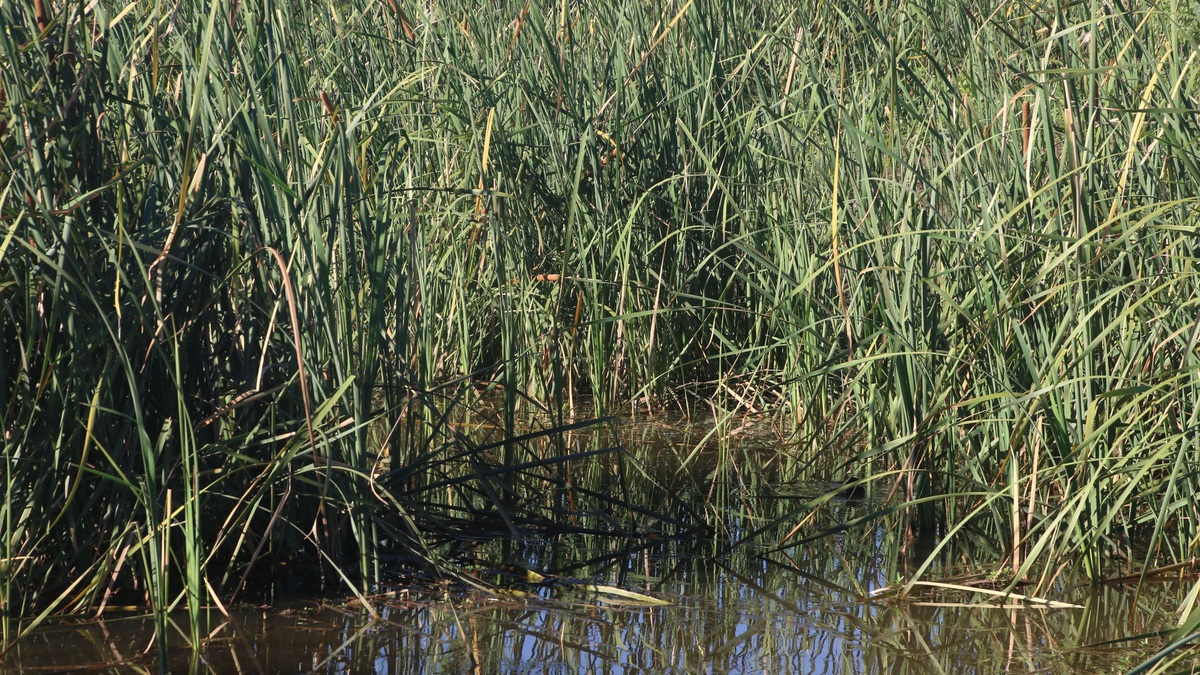
Wetland landforms are landscape settings where water remains at or near the ground surface long enough to create wetland soils and support water-tolerant life. They include closed depressions and river floodplains as well as deltas, coastal flats, peat-filled basins and smaller settings associated with dunes or karst. The wetland designation comes from hydrology and ecosystem conditions rather than a single origin or surface shape.
The U.S. Environmental Protection Agency definition centers on water covering the soil or saturating it near the surface for all or part of the year. Topography determines where water gathers, but climate, groundwater and surface flow determine how long it stays. Vegetation and soil then respond to that water regime.
Wetland is a hydrologic category
A low spot can hold a wetland, yet low elevation alone does not prove one exists. Field identification commonly considers wetland hydrology, hydric soils and vegetation adapted to saturation. The evidence may persist even during a dry season when no surface water is visible.
Different classification systems answer different questions. The Cowardin system used by the National Wetlands Inventory organizes wetlands by broad ecological system, vegetation and water regime. A hydrogeomorphic approach groups them by landscape position, dominant water source and the way water moves, as summarized by the EPA wetland classification guide.
The same visible plant community can therefore occupy different geomorphic settings. A marsh on a lake fringe exchanges water differently from a marsh in a closed prairie pothole, even if both contain emergent plants.
Depressional wetlands collect water in low ground
A depressional wetland occupies a topographic hollow with closed elevation contours. Rain falls directly onto the basin while surrounding slopes contribute runoff; groundwater can add water from below. An outlet may activate during wet periods. If the basin lacks one, water returns to the atmosphere through evaporation or seeps into the ground.
Prairie potholes belong to this broad setting because glacial ice left thousands of small basins. Playas occupy dry regions where runoff briefly ponds. Vernal pools also fill seasonally, then dry long enough to exclude permanent fish populations.
Hydroperiod controls which organisms can complete their life cycles. A depression that holds water for weeks supports different plants and invertebrates from one that remains flooded for years. Seasonal drying does not remove its wetland identity when the soil and biological evidence show recurring saturation.
Depressional wetlands can be difficult to map from a single image. A dry-season photograph may show bare soil, while spring imagery reveals ponding. Repeated observations and soil indicators capture the full cycle.
Floodplain wetlands follow rivers
Riverine and floodplain wetlands occupy channels and backwaters along low surfaces reached by river flow or connected groundwater. Floodwater can spread across the valley floor. The wider area then slows the current and promotes sediment deposition. Abandoned channels may become oxbow wetlands, while natural levees separate lower backswamps from the main stem.
The physical processes overlap with the landforms created by rivers. A meandering channel erodes outer banks and builds inner bars, gradually rearranging where wet surfaces occur. The surrounding river habitat remains connected through floods, side channels and the movement of organisms.
Floodplain wetlands often receive mineral sediment and nutrients from upstream. Their productivity can be high, but levees, channel incision and altered flow may reduce the frequency of connection. A wetland cut off from floods can change vegetation even when rainfall remains the same.
River regulation can change timing as well as total water. A shorter flood may fail to recharge a backwater even when annual discharge looks similar, because the water never remains above the connecting sill long enough.
Deltas build wetlands where rivers lose speed
A delta wetland develops where a river enters a lake or sea and loses enough energy to deposit its sediment load. Bars and low islands divide flow into distributary channels. In the protected water between channels, emergent marsh may border a tree-covered swamp or an unvegetated mudflat.
An EPA Great Lakes wetland profile describes how delta deposition creates shallow channels and abandoned meanders with contrasting substrates. Swift main channels may carry sand or gravel, while quiet secondary water accumulates organic material.
Deltas migrate as sediment builds one route and flow abandons another. Waves, tides, dams and subsidence alter the balance. A delta is a landform created by deposition; the wetland communities occupy suitable parts of that moving surface.
Coastal flats respond to tides and sea level
Coastal fringe wetlands occur along sheltered shorelines influenced by sea level. Estuaries and lagoons provide common settings. Tides repeatedly flood salt marshes and tidal freshwater wetlands. Mangrove swamps occupy tropical or subtropical settings where woody plants tolerate salinity and inundation.
Mudflats or sand flats may sit seaward of dense vegetation. Fine sediment settles where waves and currents are weak enough, while vegetation further reduces local water velocity. The EPA coastal wetlands overview explains that both freshwater and saltwater wetlands occur within coastal watersheds.
Relative sea-level rise can push a wetland inland if undeveloped low ground remains available. Armored shorelines and steep terrain can prevent that migration, compressing habitat between rising water and fixed infrastructure.
Storms can redistribute sediment within hours, yet the wetland’s long-term position depends on whether deposition and organic growth keep pace with relative sea-level rise. Local subsidence can increase the apparent rate of water-level change.
Peat basins build their own surface
Peatlands form where plant production exceeds decomposition for long periods, allowing partly decayed organic material to accumulate. A lake basin or shallow depression can gradually fill with peat. As the deposit thickens, its surface may become less connected to mineral-rich groundwater.
Bogs receive most water from precipitation and are commonly acidic and nutrient-poor. Fens retain a stronger groundwater connection and usually receive more dissolved minerals. The marsh versus bog comparison uses water source first, then checks whether vegetation and peat support the name.
Peat growth can soften the original topographic boundary by creating broad raised or level surfaces. The modern landform therefore records both the older mineral basin and centuries or millennia of biological accumulation.
Karst and interdunal wetlands occupy specialized hollows
Karst wetlands can develop in sinkholes or broad depressions created as soluble rock dissolves. Rain supplies some water directly, while the water table or temporary underground conduits may supply the rest. Rapid drainage can alternate with flooding when the water table rises.
Between coastal or inland dunes, wind-built ridges leave interdunal depressions. Water collects where the hollow intersects the water table or receives enough seasonal precipitation. An NPS description of a Great Lakes dune wetland mosaic shows marsh, bog and conifer swamp occupying adjacent positions created by sand relief and water level.
Small elevation differences can produce sharp ecological boundaries in both settings. A few feet of relief may separate saturated soil from dry upland, making detailed terrain and groundwater measurements more informative than a broad regional map.
Maps combine terrain with wetland evidence
Topographic maps reveal depressions or floodplains and help trace the elevation of coastal flats. Aerial imagery adds water patterns and vegetation. Soil surveys provide field indicators, while water-level records establish whether saturation lasts long enough to meet a formal wetland definition. The National Park Service wetland overview emphasizes that these ecosystems occur from Arctic tundra to coastal salt marshes.
A useful wetland map therefore layers geomorphology with hydrology instead of coloring every low spot alike. The surrounding river anatomy may explain a floodplain site, while a closed contour and seasonal water record explain a depressional one.
Wetlands occupy landforms produced by ice, rivers, waves, wind, dissolved rock and peat accumulation. Their shared feature is persistent or recurring saturation, not a single geological origin.





