
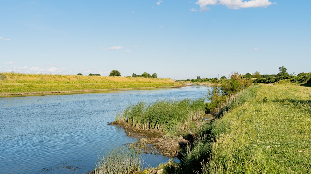
A river habitat combines flowing water with channel features and connected land. Together they supply organisms with food and oxygen as well as shelter for reproduction. Habitat extends beyond the wetted channel because conditions for aquatic life also respond to the streambed and banks. The riparian corridor connects those features to the floodplain, while tributaries and groundwater deliver water from the larger basin.
River habitat changes from cold headwaters to broad lowland channels and also across a single bend. Fast riffles, steady runs, deep pools, undercut banks and quiet backwaters offer different velocity, depth and substrate. A healthy river does not have one ideal appearance; it maintains the variety and connectivity expected for its natural region and river type.
Habitat changes from headwaters to the mouth
A forested headwater stream is often narrow enough for canopy shade to keep its water relatively cool. Falling leaves become its food base. Twigs add larger organic debris and terrestrial insects provide seasonal prey. Where the gradient is steep, flow descends through steps into turbulent riffles. Groundwater can moderate both temperature and discharge.
Each downstream tributary adds discharge, allowing the channel to widen. The wider opening may admit enough sunlight for algae or aquatic plants where turbidity and depth permit growth. Slower reaches retain more fine sediment. Cover forms where large wood interrupts the current or the channel divides around an island.
Large lowland rivers contain deep channels, bars, floodplain lakes, backwaters and seasonally inundated forests or wetlands. These are not simply enlarged headwater streams. Their food webs and hydraulic patterns depend on exchanges across the channel, floodplain and tributary network described in river anatomy.
Riffles, runs and pools create local variety
A riffle is a shallow section where relatively fast water turns turbulent over gravel or cobble. Turbulence promotes gas exchange. Beneath it, spaces among coarse particles shelter insect larvae. Small fish also hide within the larger gaps. Eggs of some species require clean gravel through which oxygenated water can pass.
A run has smoother flow than a riffle and usually moderate depth. A pool is deeper and slower, often with finer substrate. Its reduced current lets fish rest, while greater depth supplies cover from predators and can preserve refuge when surface water warms.
The EPA physical habitat framework stresses that natural streams commonly contain sequences of faster riffles and slower pools. One unit is not inherently better than another. The mix allows organisms with different life stages and feeding strategies to share a reach.
Substrate shapes life on the riverbed
Substrate is the material forming the bed. It ranges from exposed bedrock through boulders and cobble to gravel, sand or fine mud. Particle size determines whether the surface offers firm attachment or spaces suitable for burrowing and concealment. Stable stones can support algae and grazing insects, whereas a shifting soft bottom favors a different community.
Excess fine sediment can fill gaps between gravel, a process called embeddedness. It may reduce oxygen flow to eggs and eliminate shelter for macroinvertebrates. Yet fine sediment is natural in many low-gradient rivers, so its presence must be judged against the expected setting rather than a universal gravel-stream standard.
Living plants and roots function as both substrate and cover, while fallen wood adds a more durable structure. A log interrupts flow so organic material collects upstream and a scour pool develops around its exposed edge. Fish use the resulting slack water to avoid a strong current or predator.
Flow controls the usable space
Flow regime includes the magnitude, timing, duration, frequency and rate of change of discharge. Organisms respond not only to average flow but also to seasonal floods, low-water periods and rapid fluctuations. A flood can reconnect side channels and move sediment, while an extended low flow can isolate pools.
Velocity affects how much energy an animal must spend to hold position. Streamlined fish and insects with gripping adaptations can use swift riffles. A juvenile or weak swimmer instead moves toward a quiet margin, slipping into an eddy or backwater. Variation creates both feeding lanes and refuges.
A dam can change the timing of downstream flow. Water withdrawals separately reduce its volume, while urban pavement shortens the delay between rainfall and runoff. A stable-looking channel may still have impaired habitat if releases fluctuate too quickly. Spawning cues can disappear, or a prolonged low flow may leave an important reach dry.
The EPA review of urbanization and physical habitat links altered runoff with channel change, simplified pool-riffle structure and shifts in bed material. Effects vary by watershed, but paved surfaces can deliver stormwater faster than vegetated land.
Temperature and oxygen set physiological boundaries
Water temperature controls metabolism and influences how much oxygen water can hold. Cold water generally retains more dissolved oxygen than warm water. Trout and some aquatic insects require cool, oxygen-rich conditions, while other species tolerate warmer and slower habitats.
Oxygen diffuses across the water surface and enters faster where turbulence promotes exchange. Photosynthesis adds more during daylight, while respiration and decomposition consume it. Riffles can promote aeration. Dense organic pollution may fuel microbial activity that removes oxygen, especially in warm or sluggish water.
Daily and seasonal cycles matter. Sunlight warms shallow water during the day, whereas a groundwater seep can maintain a cool pocket and a shaded tributary can feed that refuge from upstream. A temperature measurement at one time may miss the stressful peak that determines whether an organism can remain in a reach.
EPA dissolved-oxygen guidance treats low oxygen as a stressor whose causes can include nutrients, organic matter, altered flow and higher temperature. Habitat observations and water chemistry are most useful when interpreted together.
The riparian corridor connects land and water
The riparian zone is the land alongside a river where water and terrestrial processes interact. Its trees cast shade and drop insects or leaves into the channel. As branches fall, they become woody cover; below ground, living roots bind bank soil. Flood-tolerant plants occupy lower surfaces, while different communities grow farther from frequent inundation.
Riparian vegetation can filter some runoff and slow erosion before sediment reaches the channel. It also forms a wildlife corridor. Birds, mammals, amphibians and insects move along the river edge and transfer energy between land and water.
A narrow strip cannot solve every watershed problem, but removing it can simplify habitat while exposing the channel to more heat and eroded sediment. Appropriate width depends on how the river occupies its valley and how far floods extend. Restoration goals then determine which vegetation should return.
A U.S. Forest Service research synthesis describes fluvial-riparian ecosystems as an integration of aquatic, riparian and upland domains. Their influence therefore reaches across the ordinary waterline rather than ending there.
Floodplains and side channels provide seasonal habitat
A connected floodplain stores water when discharge exceeds the channel. Floodwater carries nutrients into shallow nursery areas where fish can feed and part of that water recharges wetlands. As the river falls back within its banks, mobile organisms return to the channel alongside transported organic matter.
Low-velocity habitat persists in an oxbow lake or slough and a side channel provides another route around the main current. A levee or road embankment can block that connection; channel incision can strand it above ordinary flow. Reconnection may improve habitat, but a project must first account for property exposure and flood risk. It must also prevent invasive species from exploiting the new route.
The channel creates river landforms as bars migrate and banks retreat across the floodplain. Physical change is natural. Habitat assessments distinguish natural movement from alterations that remove complexity or exceed the system’s ability to adjust.
Food webs link habitat features
River food begins with local photosynthesis by algae or aquatic plants. Organic matter also enters from land and arrives from upstream. Grazers scrape attached growth, while shredders break down leaves and collectors capture fine particles. Predatory insects and fish consume them, forming the connected routes outlined in aquatic food chains.
A riffle may support insects that cling to rocks and filter particles from fast flow. A shaded headwater may depend heavily on leaves broken down by microbes and shredding invertebrates. A floodplain wetland may produce abundant plankton and juvenile fish prey.
Connectivity lets energy move among these patches. A migratory fish carries nutrients across reaches, while drifting insects colonize habitat downstream. When aquatic insects emerge as adults, terrestrial predators capture part of the river’s production. Barriers can interrupt movement even where water chemistry remains acceptable.
How scientists assess river habitat
Field teams measure depth and velocity before documenting the substrate, bank condition and available woody cover. Riparian vegetation and the frequency of pools or riffles add reach-scale context. They may also record temperature, dissolved oxygen, turbidity and conductivity. Biological response emerges from surveys that identify fish and algae alongside the macroinvertebrate community over time.
The EPA stream habitat guide defines channel, pool, riffle, run and substrate as interacting components. Modern assessments compare a site with reference conditions expected for its climate, geology and watershed size. A naturally sandy prairie river should not be graded against a steep forested trout stream.
Habitat quality is therefore contextual. A diverse reach has little value if a barrier isolates it, while connectivity cannot compensate for the loss of natural flow processes. A functioning river offers organisms routes through daily conditions, seasonal change and occasional disturbance instead of holding every reach in a fixed state.
The National Rivers and Streams Assessment combines biological, chemical and physical indicators across standardized sites. Such surveys reveal broad patterns, while local studies provide the detail needed for restoration design.
River corridors often merge with wetlands and lake margins. Compare them with lakeshore habitat, marshes and bogs and trees that grow in wetlands.





