
Lake Superior reaches a published maximum depth of 1,332 feet, or 406 meters. That figure places the deepest water far below the surface, deeper than any point in the other Great Lakes. It also helps explain why Superior can feel more like an inland sea than a typical lake.
The number needs a little context before it becomes a useful picture. The National Park Service lists both the deepest point and the lake’s much smaller average depth in its Lake Superior facts. Together, those measurements describe a huge basin with deep central water, broad slopes and shallower areas around much of its edge.
The short answer: 1,332 feet
For the direct answer, Lake Superior’s deepest mapped water is 1,332 feet below the low-water reference used for the published Great Lakes figures. That equals 406 meters. The U.S. Environmental Protection Agency gives the same values in its physical-features table. The table also identifies Superior as the deepest of the five lakes.
Depth is measured vertically from the water-surface reference down to the lake floor. A depth of 1,332 feet is close to a quarter of a mile. It is an enormous distance for a freshwater lake, yet it represents one deepest location instead of the depth encountered across the whole lake.
NOAA describes Lake Superior as the largest and deepest of the Great Lakes. Its regional status page gives the rounded equivalent of up to 406 meters, or 1,333 feet. That one-foot difference comes from rounding the metric and customary-unit figures separately. The agencies’ values point to the same published maximum: 1,332 feet and 406 meters.
Numbers of this size also show why Lake Superior holds so much water. EPA lists its water area as 31,700 square miles and its volume as 2,900 cubic miles at low water. A vast surface collects water across a wide basin, while the deep parts add a large vertical dimension. Those figures belong together when comparing Superior with other lakes, although each describes a different feature of the lake.
EPA’s low-water table also puts Superior’s depth in Great Lakes context. Lake Michigan’s maximum is 925 feet, Lake Huron’s is 750 feet, Lake Erie’s is 210 feet and Lake Ontario’s is 802 feet. The shared reference makes the comparison meaningful and shows why Superior holds the deepest-water record among the five lakes.
Where the deepest water lies
The lake floor is shaped like a large, uneven basin. Water near a beach can be shallow enough for waves to stir the bottom. Farther offshore, the floor drops through deeper basins and ridges formed by ancient geologic processes and later sculpted by ice. The deepest value belongs to the low point revealed by that underwater landscape.
Lake Superior stretches about 350 miles from east to west and covers 31,700 square miles, according to the National Park Service. Its scale gives the basin room to vary greatly from place to place. A single depth reading at the deepest spot cannot describe a harbor, a nearshore reef or the broad shallows surrounding an island.
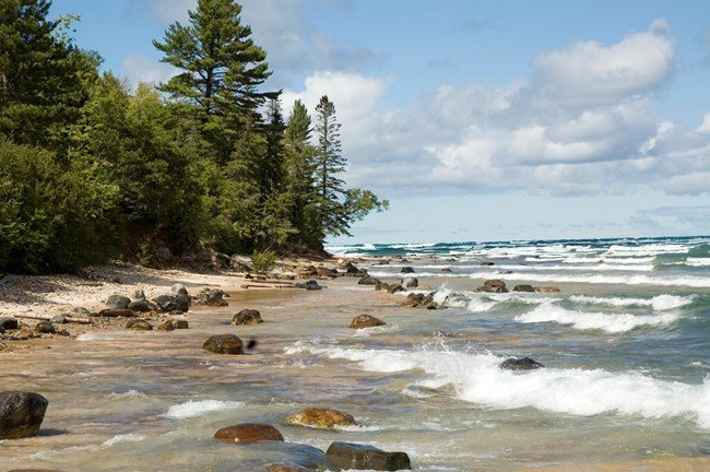
For visitors, this variation matters. A shoreline can slope gently for a distance, while a nearby offshore basin may be far deeper. The maximum figure captures the lake’s extreme. Local navigation and safety depend on local conditions, current charts, weather and water levels.
Maximum depth and average depth measure different things
Average depth gives a wider view of the lake. EPA and NPS list Lake Superior’s average depth as 483 feet, or 147 meters. Scientists arrive at an average by relating the lake’s water volume to its surface area. It describes the basin as a whole instead of focusing on its deepest hollow.
The difference between 483 feet and 1,332 feet shows how uneven the floor is. Much of the lake has less water overhead than its maximum basin. At the same time, the average remains strikingly large because Superior holds an immense volume. EPA lists 2,900 cubic miles at low water. The equivalent is 12,100 cubic kilometers.
These two measurements answer different questions. Maximum depth answers, “How far down is the deepest point?” Average depth answers, “How deep is the lake overall when its water is spread across its surface?” Keeping the terms separate prevents a dramatic extreme from becoming a misleading description of every part of Lake Superior.
Why the figures say “measured at low water”
EPA labels both the average and maximum depth values as measured at low water. Lake levels change over time in response to precipitation, runoff, evaporation, ice and wind-driven shifts. A shared low-water reference gives scientists and agencies a stable basis for comparing lake dimensions.
That reference is a datum, or a chosen level used as a measuring baseline. It lets a depth map relate many soundings to the same vertical frame. Published depths are adjusted or expressed against a common low-water reference, even though surveys occur at different physical water levels.
Water levels can rise or fall around that baseline, so the distance from today’s surface to the same patch of lake floor can differ. The 1,332-foot figure remains the standard published maximum for comparison. It should be read as a mapped, datum-based lake characteristic, rather than a promise of the exact water depth at any location on any particular day.
The low-water convention also keeps related figures aligned. Average depth, maximum depth and volume can be compared when they use the same reference level. Without that common frame, a change in the lake’s surface height could be mistaken for a change in the shape of the basin. The floor itself changes much more slowly than the surface, although waves and sediment can reshape particular shorelines and shallow areas.
How scientists map a lake floor
The science of measuring underwater shape is called bathymetry. Survey crews use sonar to send sound pulses toward the bottom and time their return. With the boat’s position, water-level reference and many repeated measurements, those soundings can be assembled into a picture of underwater slopes, channels and basins.
A U.S. Geological Survey project at Minnesota Point in Duluth shows the method at local scale. Its 2020 data release combined terrestrial LiDAR, multibeam sonar and single-beam sonar. The resulting digital elevation model used 10-meter cells and extended to about 1.3 kilometers offshore. It is a detailed survey of one nearshore area, not a replacement for a lake-wide depth map.
Lake-wide bathymetry brings together many surveys and must account for differences in coverage, instruments and spacing. NOAA’s regional bathymetry model describes a roughly 90-meter grid compiled from Great Lakes lake-floor data. Such grids are excellent for showing broad patterns, while every cell also represents an area rather than a pinpoint measurement.
Resolution helps readers judge what a map can show. A 10-meter local model can describe more small-scale detail than a roughly 90-meter regional grid, provided the surveys cover the same kind of terrain. Both are useful products with different purposes. A regional map reveals the shape of an entire basin. A close nearshore survey can help researchers study beaches, underwater slopes and changes near the coast.
That is why depth figures deserve both respect and restraint. The published 1,332 feet and 406 meters give a dependable answer to how deep Lake Superior gets. A bathymetric map adds the richer story: the answer comes from a vast, varied lake floor whose measured shape depends on reference levels, survey coverage and the resolution of the map.
Superior’s depth is one part of the larger freshwater system. Compare the lake with the full five Great Lakes and the largest lakes in North America.
For a direct comparison between two neighboring basins, see how deep Lake Huron is.
Superior’s depth and stored heat also shape Lake Superior’s winter ice, storms and lake-effect snow.
Depth is only one part of the lake’s ecology. See Argo’s guides to invasive species in Lake Superior and plants of the Great Lakes.





