
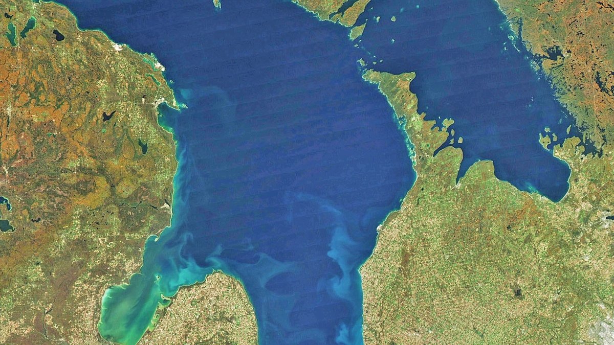
Lake Huron reaches a maximum depth of 750 feet, or 229 meters, according to the standard Great Lakes measurements published by the U.S. Environmental Protection Agency. Its average depth is much lower at 195 feet, or 59 meters. The two figures describe different features: maximum depth marks the deepest recorded point, while average depth spreads the lake’s total volume across its entire surface.
Depth also varies sharply from one part of this enormous lake to another. Shallow Saginaw Bay lies along the Michigan shore, while deeper troughs occupy the main basin farther north and east. Georgian Bay and the North Channel add more complex underwater terrain to the broader Lake Huron system.
NOAA’s Lake Huron bathymetry project combines generations of depth measurements into maps and downloadable grids. The project brings together work by the National Centers for Environmental Information, the Great Lakes Environmental Research Laboratory and the Canadian Hydrographic Service. Its records show why a single depth number can answer a basic question without capturing the lake floor’s full relief.
Maximum depth and average depth measure different things
The maximum depth is the vertical distance from a defined lake-level reference to the deepest mapped bottom. EPA lists Lake Huron’s maximum as 750 feet. Historical descriptions place the deepest recorded area in the main lake southwest of the entrance to Georgian Bay, where the bottom drops well below the broad shelves nearer shore.
The average depth of 195 feet describes the entire lake rather than a particular spot. Researchers can derive it by dividing water volume by surface area. Lake Huron covers about 23,000 square miles. Its roughly 850 cubic miles of water are spread across extensive shallow areas, pulling the average far below the deepest sounding.
Water level is part of the definition. The EPA’s Great Lakes physical-features table reports depths measured from low-water datum. Actual water above a specific point changes as lake levels rise and fall, but the published 750-foot reference remains a consistent number for comparing the lakes.
Lake Huron contains several underwater basins
A flat blue surface hides a lake floor divided by ridges, sills and deep depressions. NOAA maps identify features including the Manitoulin Basin, Mackinac Basin, Goderich Basin and Port Huron Basin. Sills between some of these depressions restrict the way deep water moves from one region to another.
A NOAA technical assessment of the main basin describes the Manitoulin Basin as reaching about 227 meters, while the Mackinac Basin reaches about 137 meters. The southern Goderich and Port Huron basins are shallower. Such regional values depend on the boundaries used in the analysis, which is why a study of the main basin can report a different mean depth from a whole-lake summary.
Saginaw Bay offers the clearest contrast. Its inner waters average only several meters deep and respond quickly to sunlight, wind and river inputs. The outer bay is deeper and has stronger exchange with the main lake. Treating both areas as if they shared the same depth would conceal major differences in temperature and water chemistry.
How NOAA mapped the bottom
Bathymetry is the underwater counterpart of land topography. A bathymetric map uses measured soundings and contour lines to show depth as well as the form of the bottom. NOAA’s Lake Huron compilation grew from measurements collected for nautical charting over at least 150 years by U.S. and Canadian agencies.
The NCEI Great Lakes bathymetry collection preserves those observations as contour files and gridded data. Surveyors historically measured depth along vessel tracks. Modern systems can collect far denser acoustic measurements, yet the regional compilation still incorporates older records because they cover a vast lake that cannot be remapped everywhere at once.
Researchers convert soundings to common units and reference them to a shared vertical datum before drawing contours. A grid then estimates the bottom elevation between measured locations. The result is a practical GIS base layer for circulation models, habitat work and coastal research. NOAA warns that the poster map depicts bathymetry and should not replace current nautical charts for navigation.
How Lake Huron compares with the other Great Lakes
Lake Huron ranks in the middle of the five Great Lakes by maximum depth. Lake Superior is deepest at about 1,332 feet, followed by Lake Michigan at 925 feet and Lake Ontario at 802 feet. Huron’s 750-foot maximum exceeds Lake Erie’s 210 feet by a wide margin.
Average depth changes the order slightly. Huron’s 195-foot average remains greater than Erie’s 62 feet, but it is below Ontario’s 283 feet and Michigan’s 279 feet. Readers can place those figures in the wider system through Argo’s overview of the five Great Lakes and the separate account of Lake Superior’s depth.
Surface area adds another dimension. Huron is the second-largest Great Lake by surface area, behind Superior, yet it ranks third by volume. Its 850 cubic miles of water exceed Lake Ontario’s volume because Huron covers far more area, even though Ontario is deeper on average. A surface-area comparison of North American lakes shows how depth and area produce different rankings.
Depth controls temperature and lake circulation
Deep water warms and cools more slowly than a shallow bay. During summer, the open lake develops a warm upper layer above colder, denser water. The transition zone between them is the thermocline. Wind can mix the upper layer readily, while exchange with deep water requires stronger seasonal cooling or other circulation processes.
Bathymetric ridges guide currents and can partly separate neighboring basins. Water moving through a shallow sill behaves differently from water circulating inside a deep depression. Accurate bottom geometry therefore improves models used for water levels, currents and the movement of floating material.
Depth also helps determine where ice forms. NOAA research describes the lake’s shallow perimeter and bays as the first areas to freeze, while water deeper than 100 meters in the main lake freezes later and loses ice earlier. The larger heat reservoir in deep water slows temperature change during seasonal transitions.
Deep and shallow habitats support different ecosystems
Sunlight fades with depth, so photosynthesis is concentrated in the upper water column and nearshore habitat. Cold deep water remains dark throughout the year. Many deep-water organisms depend on food produced above and material that sinks from the surface. Unusual local environments can support other energy pathways.
Lake Huron also contains submerged groundwater features and sinkholes where water chemistry differs from the surrounding lake. Those specialized sites show how bottom form can create small habitats within the broader deep-water environment. Their biology should not be generalized across every deep part of the lake.
Sampling plans must account for the vertical structure. The EPA’s Great Lakes water-chemistry program collects samples at several depths from the surface toward the bottom. Measurements through the water column reveal conditions that a surface sample alone could miss, particularly when summer stratification limits mixing.
Why depth figures are estimates rather than perfect measurements
Published lake depths look exact, but every bathymetric product has limits. Older soundings were taken along widely separated tracks, leaving unmapped space between observations. Contours and grid cells interpolate across those gaps. A narrow depression between tracks could be missed, while later surveys can refine a previously mapped feature.
Measurement technology also changes over time. Lead lines and early acoustic sounders sampled the bottom less densely than modern multibeam sonar. Nearshore lidar can map clear shallow water at high resolution, although turbidity, breaking waves and dark bottom material can leave gaps. Combining surveys requires a common position system plus uniform units. Each observation must also be tied to an appropriate water-level datum.
Official sources sometimes display 229 meters for Lake Huron’s deepest water. Other products round the value to 230 meters or show a depth slightly beyond that contour. Conversion and map resolution explain part of the difference. Some technical studies also define the main basin differently from the whole lake system. For a general answer, 750 feet (229 meters) is the stable agency figure; detailed modeling should use the bathymetric dataset and its metadata.





