
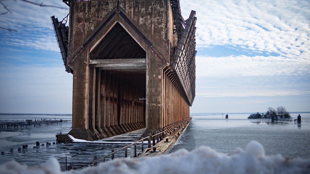
Lake Superior does not freeze completely in a typical winter. Ice forms first in shallow bays and along protected shores, while deep open water often remains exposed. Coverage varies greatly between winters. Neither one low-ice season nor one high-ice season represents the lake’s permanent winter state.
Open water continues exchanging heat and moisture with cold air. That interaction can fuel lake-effect snow and strengthen local cloud bands, while strong winter winds build dangerous waves. Spreading ice suppresses evaporation. It also leaves less open water available to supply atmospheric moisture.
Why Lake Superior is slow to freeze
Superior is the deepest and largest Great Lake by surface area. Its great volume stores summer heat well into fall, even after air temperatures drop below freezing. Wind keeps mixing exposed water and can prevent a stable ice sheet from forming over the central basin.
The Lake Superior climatology from GLISA explains the competing influences. Its northern latitude favors ice, while depth increases heat storage. The result is strong winter-to-winter variability rather than a simple rule that a northern lake must freeze solid.
Argo’s guide to Lake Superior’s depth shows why the central basin behaves differently from a shallow bay. Deep water has much more heat to lose before surface freezing becomes widespread.
Ice begins near shore and in sheltered bays
Shallow water cools faster because it stores less heat per unit of surface. Protected bays also experience less wave action, allowing a thin skin of ice to persist. Harbors and narrow channels may freeze while the horizon beyond them remains open.
The GLISA lake-ice overview notes that ice typically forms first near shore and last over the deepest water. Wind and currents can break new ice or bring warmer water upward, so subfreezing air alone does not guarantee safe conditions.
Shore ice can be deceptive. Pressure ridges can hide weak zones and fractures may open without warning. Current near river mouths creates another distinct hazard. Official local guidance is essential before any travel onto ice, especially around the Apostle Islands or exposed points.
Annual ice cover can swing widely
Satellite records since 1973 contain winters with little Lake Superior ice and others with nearly complete cover. NOAA’s Lake Superior ecosystem dashboard tracks annual maximum percentage rather than implying one fixed normal.
Cold-air outbreaks affect the seasonal maximum, but wind can reinforce or disrupt their effects. The temperature carried forward from autumn also influences how quickly ice develops. Natural climate patterns such as El Niño can shift the odds toward lower cover, while repeated Arctic-air intrusions can still produce extensive ice during a generally warmer era.
Long-term ice cover has declined, yet individual cold winters remain possible. Climate trend and seasonal weather describe different time scales. A downward average does not predict the exact ice extent of the next February.
Open water creates lake-effect snow
Lake-effect snow begins when cold air crosses relatively warmer water. Heat and vapor enter the lower atmosphere, making the air more buoyant. The moist air rises and cools. Clouds then organize along the wind before releasing snow downwind.
NOAA’s satellite explanation of lake-effect snow shows cloud streets over Lake Superior during cold northerly or westerly flow. Wind direction determines where the strongest band forms. Its intensity also depends on the fetch across open water and on how much warmer the lake is than the air.
Snowfall is highly local. One shore can receive a persistent band while a community farther inland or upwind sees little. The Keweenaw Peninsula and parts of Michigan’s Upper Peninsula lie in a major snowbelt because prevailing winds often carry Superior’s moisture toward them.
Ice reduces the lake’s moisture supply
A broad ice cover separates water from the atmosphere. It cuts evaporation and reduces the heat transferred into passing air. Lake-effect production then weakens over covered sections, though open leads can still provide narrow sources of moisture.
GLISA’s Great Lakes snow assessment explains that lake-effect snowfall requires open water. Less ice can extend the moisture supply, but sufficiently warm air may produce rain or mixed precipitation instead of snow.
Less ice does not guarantee more snow in every place or year. The temperature must support snow and the wind must carry moisture toward a community. A favorable storm track is also necessary. A warmer lake can increase available vapor while a warmer atmosphere simultaneously reduces the time when precipitation falls as snow.
Winter storms build steep waves
Strong low-pressure systems cross the Great Lakes in late fall and winter. Wind transfers energy into the surface during a long passage over open water. High waves emerge as that energy accumulates. Ice near shore can pile into ridges or be driven against structures when wind changes.
Cold-season storms are especially dangerous because spray can freeze on vessels and shore infrastructure. Visibility can collapse in snow or freezing fog. Water temperatures make survival time short after an accidental immersion.
The lake does not need hurricane-force wind to become hazardous. Wave period determines how rapidly each crest arrives. Direction controls the angle of approach, while local shoals reshape the water near a harbor entrance. Current Great Lakes conditions are more useful for immediate decisions than a monthly climate average.
Lake-effect snow differs from a regional storm
A large winter cyclone can bring snow across several states regardless of the lake. Lake effect is generated or enhanced locally by air moving over open water. Both processes can occur together, making a storm total larger downwind of Superior than it would be from the regional system alone.
The GLISA lake-effect assessment identifies southern and eastern shores as favored downwind zones under common cold-season flow. A change in wind direction shifts the snow band rather than simply weakening it.
Forecasts therefore distinguish synoptic snow from lake-effect bands. Broad storm warnings describe the regional system, while shorter-fused advisories track narrow zones where visibility and accumulation can change over a few miles.
Ice changes evaporation and water levels
Evaporation often peaks in late fall and early winter because the lake remains warm relative to the air. Strong wind continually replaces moist air above the surface with drier air, allowing more water to escape. Widespread ice then reduces that loss.
Winter evaporation contributes to the lake’s seasonal water-level cycle, though precipitation, runoff and regulated outflow also matter. Spring snowmelt usually increases basin inflow. A single snowy winter does not translate directly into one predictable lake level because storage and evaporation interact.
High water combined with wind can flood or erode exposed shorelines. The planned explanation of how lakes can flood distinguishes basin-wide high water from temporary wind setup and wave runup.
Winter continues below the ice
Ice alters light and gas exchange but does not stop the lake’s ecosystem. Plankton remain active at seasonally changing rates. Fish continue moving beneath the surface, while bottom organisms persist in deep water. Open water and cracks maintain additional exchange with the atmosphere.
Superior’s depth preserves a large cold-water environment through the year. Ice distribution mostly changes the surface boundary rather than freezing the full water column. Life at the bottom of Lake Superior occupies water hundreds of feet below winter weather.
Snow on ice can reduce light penetration, while clear ice transmits more. Currents continue below the surface and can weaken ice from underneath. Ecological winter is active even when the shore looks still.
No single winter defines Lake Superior
Lake Superior’s winter is a moving balance of stored heat, cold air, wind and ice. Open water supplies heat and moisture that can intensify snow downwind. Expanding ice limits that exchange. Storms can still fracture the cover or move it across the lake.
Annual maximum ice extent is the right measure for comparing seasons, but it does not describe every bay or date. Local safe-ice decisions require current observations. Snowfall comparisons likewise need wind direction and temperature, not merely the amount of open water.
The durable pattern is variability. Superior’s deep basin usually retains open water. Shore ice forms first, but atmospheric conditions in each year determine how far freezing spreads. Winter on Superior is a connected system rather than one fixed image of a frozen lake.





