
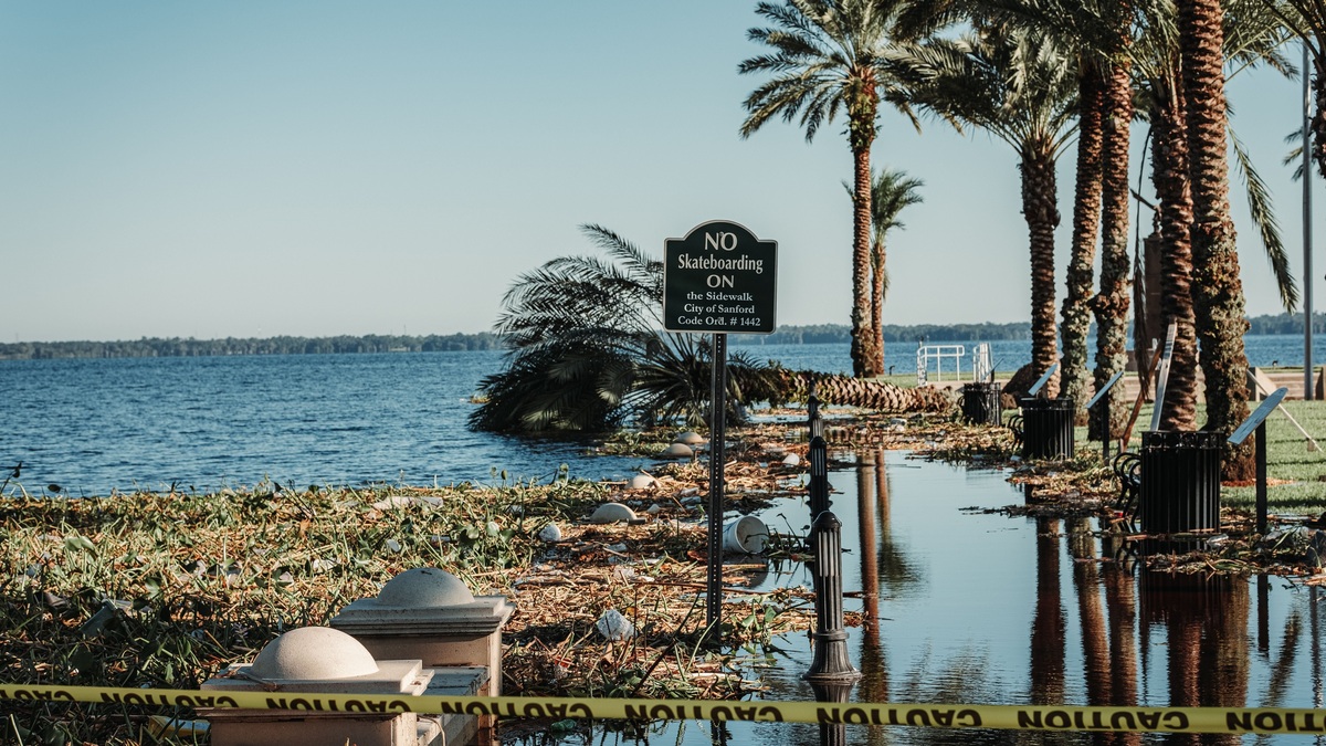
Yes, lakes can flood. Flooding occurs when the lake surface rises high enough to cover normally dry shoreline, damage structures or block access. Heavy rain, snowmelt, river inflow, rising groundwater, a restricted outlet, reservoir operations and wind-driven water movement can all contribute.
A lake flood may build over hours or over several wet seasons. The cause controls how quickly the water arrives, how long it remains and which shore receives the greatest effect. Current gauge data provide the most direct starting point for judging the threat. A local forecast and an understanding of the lake’s outlet add context that its ordinary appearance cannot provide.
Rain can raise both the lake and its inflows
Rain falling directly on a lake adds water immediately. A much larger volume may arrive as watershed runoff. Natural streams collect part of that precipitation, while storm drains accelerate its delivery from developed land. Saturated hillsides add runoff from an area many times larger than the lake surface.
Short intense rain can produce a rapid rise where tributaries respond quickly. Repeated storms create a slower cumulative problem by saturating soils and keeping inflow elevated. If the outlet cannot release water at the same rate, lake storage increases.
The National Water Prediction Service distinguishes stage, the water-surface elevation, from flow, the volume moving past a point. Lake flooding is usually described by stage, while tributary flow helps explain how the lake reached it.
Snowmelt can synchronize a basin-wide rise
A deep snowpack stores winter precipitation on land. Rapid warming or rain on snow can release that water across much of a watershed at once. Frozen or saturated soil allows more meltwater to run into channels rather than soaking into the ground.
Lake ice does not prevent the water level beneath it from rising. Moving ice can damage docks and shore structures when high water pushes it landward. Ice can also obstruct an outlet or connecting river, temporarily reducing drainage.
Timing varies with elevation and slope direction. A large basin may send separate melt pulses from lowlands and mountain headwaters. Forecasting requires snow-water measurements and weather information rather than snow depth alone.
River inflow can exceed outlet capacity
A drainage lake receives water from upstream channels and releases it through an outlet. When inflow rises faster than outflow, the lake temporarily stores the difference. A narrow outlet can slow the release. High water downstream creates a similar restriction, while a control structure may deliberately limit discharge.
A downstream river can sometimes back water into a lake or prevent normal discharge. Confluences become especially complex when two systems peak at similar times. Argo’s river levels dashboard helps readers distinguish current stage from broader lake conditions.
Floodwater does not need to cross the entire shoreline evenly. Low bays and tributary mouths may flood first. Damage follows the local shape of the lake bottom and the elevation of adjacent shore. Roads can redirect that water or become the first structures it overtops.
Groundwater can flood closed-basin lakes
Sustained precipitation recharges aquifers as water seeps below the surface. A rising water table can feed a lake from below. It may instead reduce the amount of water leaving through the lakebed. Both effects can occur together and nearby low ground may flood even without dramatic stream flow.
The Wisconsin Department of Natural Resources warns that groundwater flooding can be long-lasting because the aquifer must drain before the water table falls. Seepage lakes are particularly sensitive because they have no stream outlet for excess volume. Its broader lake-level guidance also explains that the response to rainfall may be delayed for months.
Argo’s definition of a seepage lake explains why a lake without visible inflow can still rise months after wet weather. Groundwater response depends on soil and aquifer properties, so the delay varies among lakes.
A blocked outlet can trap rising water
Debris, ice, sediment or beaver activity can restrict a natural outlet. A culvert may also be too small or clogged. Water then accumulates until it overtops a low point, the obstruction clears or managers intervene.
Removing a blockage can release water rapidly downstream and may require permits or engineering review. An improvised trench can erode until it fails. Even if it remains open, the trench may simply transfer floodwater to another property. The safe response depends on ownership and the outlet’s legal status.
Closed lakes lack a regular outlet by definition. Pumping water away is often difficult because the receiving location may already be wet and the water may return through the groundwater system.
Dams can reduce or worsen high water
A reservoir operator can store some flood inflow when empty capacity is available. Controlled releases may lower downstream peaks. The available storage remains finite. A reservoir already near its operating maximum therefore cannot absorb an unlimited flood.
Required releases can raise downstream water levels, while restricting discharge can raise the reservoir shoreline. Operators balance structural safety, forecast inflow and downstream risk under rules specific to each facility.
A natural lake with a regulated outlet can behave similarly on a smaller scale. Changing a control structure affects both lakefront property and downstream users, which is why unauthorized manipulation is unsafe.
Wind setup can flood one shore of a large lake
Strong persistent wind pushes surface water toward the downwind end of a large lake. This wind setup raises water locally while lowering it on the opposite shore. Waves ride on the elevated surface and can run farther inland.
NOAA’s guidance on stormwater inundation identifies seiches as a surge-related flooding phenomenon on large lakes. Nearshore depth, wind direction and shoreline form influence the final water level and wave damage.
The Great Lakes are especially well monitored. NOAA explains that short-term level changes come from wind and storms, while seasonal and longer changes reflect the broader water budget. Argo’s Great Lakes conditions page provides current context rather than assuming one episode represents the whole system.
A seiche is an oscillation, not ordinary high water
Wind or an atmospheric-pressure change can push water toward one end of a lake. The basin then sloshes back at its natural period. This standing-wave oscillation is called a seiche. One shoreline may experience a rapid rise before the high water shifts during the rebound.
NOAA’s seiche explanation separates these longer standing waves from meteotsunamis, which are progressive waves in a shorter period band. Astronomical tides on the Great Lakes are only a few centimeters and are masked by much larger weather-driven changes.
A tsunami results from an abrupt displacement such as an earthquake or landslide. Ordinary lake flooding, wind setup, seiches and tsunamis are not interchangeable terms even when each can bring water onto shore.
High lake levels increase wave damage
A lake can remain above its seasonal average after months or years of high net water supply. A storm arriving on that elevated baseline gives its waves a shorter path to structures. Bluffs normally set back from the water may also receive direct wave attack.
NOAA Great Lakes records show annual cycles governed by precipitation, snowmelt and evaporation. The agency’s long-running gauge network also reveals multi-year rises and falls. One station can capture a local surge, while a lake-wide average describes the broader storage state.
Erosion is related to flooding but not identical. A wave can erode a bluff without leaving standing water behind, while a calm groundwater rise can inundate land with little wave action.
How to assess a lake-flood risk
First identify the lake type and outlet. A seepage lake responds differently from a reservoir or a river-connected lake. Then check current stage, tributary forecasts, precipitation history and wind direction.
Local flood maps and emergency managers provide property-level guidance. A forecast lake level cannot by itself determine whether one building will flood because floor elevation, shoreline protection and wave exposure differ.
The direct answer remains yes: lakes flood whenever incoming water or local water displacement raises the surface above the capacity of the normal basin and shoreline. Calling the mechanism correctly helps determine whether the threat will last minutes, days or seasons.
Residents should also separate a lake-wide rise from wave runup at one exposed property. The first changes the stored volume across the basin, while the second carries water above the local still-water level. Both can occur together during a storm and require different protective designs.
Lake level reflects a balance of inflows, outflows and changing storage. A lake water budget accounts for each term, while endorheic basins show why lakes without surface outlets can expand sharply during wet periods.





