
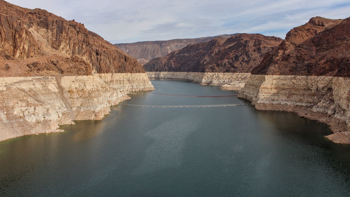
A lake water budget accounts for every major way water enters or leaves a lake, together with the resulting change in storage. Inputs commonly include precipitation on the lake, stream inflow and groundwater. Outputs include evaporation, stream outflow, groundwater loss and withdrawals. If inflow exceeds outflow, the lake stores more water and its level generally rises.
The basic equation is simple: inputs minus outputs equal the change in storage. Measuring each term is much harder. A large stream can be gauged directly, but groundwater exchange and evaporation often have substantial uncertainty. Lake managers use the budget to understand water-level changes rather than assigning every rise or fall to rainfall alone.
What enters a lake
Rain and snow falling directly on the lake surface are the most visible inputs. Their volume depends on the amount of precipitation and the lake’s surface area at the time. Snow stored on the frozen surface may not join the liquid lake until thaw.
Streams and overland runoff bring water from the surrounding drainage basin. The watershed can be many times larger than the lake, so a moderate storm across the basin may supply much more water than the same storm falling on the lake alone. Argo’s overview of rivers and drainage basins explains how topography directs those contributions. Groundwater enters where the aquifer’s hydraulic head is higher than the lake surface. Springs make some inflows obvious, while diffuse seepage across the lakebed is difficult to see. Water can also arrive through pipes, diversions or managed releases from an upstream reservoir.
How water leaves
A lake with a surface outlet loses water through a river or controlled structure. The outflow may dominate the budget in a lake fed by large tributaries. Operators can regulate a reservoir outlet, but natural lakes respond to the height and shape of their outlet channel.
Evaporation transfers liquid water to the atmosphere. The rate responds to available energy, humidity and wind over the water. Because the exposed surface area changes with lake level, evaporation volume can change even if the rate per unit area remains similar.
Groundwater outflow occurs where the lake stands above the adjacent water table. Pumps and diversions add human withdrawals. Plants in shallow margins return water to the atmosphere through transpiration, a component that may be combined with evaporation as evapotranspiration.
The water-budget equation
The USGS summarizes lake budgets as income equaling outgo, adjusted for the change in stored lake water. Written conceptually, precipitation plus surface-water inflow plus groundwater inflow equals evaporation plus surface outflow plus groundwater outflow plus withdrawals, with storage balancing the two sides.
Every term must cover the same time period and use compatible units. Hydrologists often convert a flow rate into a volume for a month or water year. They may also express each component as an equivalent depth spread across the lake, which makes precipitation and evaporation easier to compare.
Storage change is estimated from water-level measurements and a stage-area-volume relation. One centimeter of level change represents far more water in a broad lake than in a small pond. Sloping shorelines also cause area to expand as the lake rises.
Why a lake level rises after rain
Direct rainfall raises the surface immediately, but runoff often arrives later. Tributary flow can continue increasing after the storm has passed over the lake. Saturated soils release water faster than dry soils, while wetlands and floodplains can delay its delivery.
A rising lake may also reduce groundwater inflow or increase seepage outward by changing the hydraulic gradient. The outlet carries more water as stage increases in many natural systems. The observed crest reflects all of these responses rather than precipitation alone.
Lake levels are discussed separately in Argo’s article on how lakes flood. A water budget supplies the accounting behind that behavior, including delayed watershed inflow and the capacity of the outlet.
Groundwater is the hardest term to see
Lakes can receive and lose groundwater at different parts of the shoreline. A single basin may gain water along one shore and leak through another. The net exchange can be small even though large volumes move in both directions locally.
Monitoring wells show groundwater elevation around the lake. Seepage meters measure flow through small areas of the bed, while temperature and dissolved chemicals can trace water sources. Models combine those observations with aquifer properties and the known surface-water budget.
A recent USGS groundwater budget for Lake Nokomis illustrates the process. Researchers monitored wells and estimated evaporation, lake storage and other components to constrain groundwater exchange. The remaining uncertainty was reported rather than hidden in a perfectly balanced equation.
Closed lakes lose most water to evaporation
A closed-basin lake has no surface river carrying water to the sea. Its long-term inputs must be balanced mainly by evaporation, groundwater loss or human removal. Dissolved salts remain when water evaporates, so many terminal lakes become saline.
Great Salt Lake offers a clear budget. The USGS historical analysis expressed inflow as surface water, groundwater and precipitation, with evaporation as the principal outflow and lake storage absorbing year-to-year differences.
Closed lakes can fluctuate dramatically because they lack an outlet that increases discharge as the surface rises. Their area expands across shallow margins in wet periods and contracts during drought. Argo’s explanation of salty brine pools covers a different setting where density, rather than a landlocked basin, keeps saline water distinct.
Water budgets guide management
A budget tests whether proposed withdrawals fit the lake’s hydrology. It can show how much of an apparent surplus is already needed to support outlet flow, wetlands or groundwater discharge. Scenario models estimate how altered precipitation, evaporation or land use could shift storage.
Managers also use budgets to interpret water quality. A lake with slow replacement retains dissolved substances longer than one flushed by a large outflow. Residence time affects nutrient accumulation and the response to pollution controls.
The USGS water-budget program lists precipitation, evapotranspiration, surface flow, groundwater flow, storage and human transfers as central components. A useful management budget includes uncertainty ranges because decisions can be sensitive to a poorly known term.
How to read a lake water budget
First check the boundary. A budget for the lake alone differs from one covering its entire watershed or the connected aquifer. Next check the time step, since a balanced long-term average can conceal severe seasonal shortages.
Look for measured, estimated and residual components. If groundwater is calculated as whatever remains after every other term, its value also contains the errors in those terms. Reported precision should match the quality of the observations.
A water budget does not promise that lake level will remain constant. It explains the rise or fall as accumulated imbalance. Repeated measurements reveal which inputs and outputs drive that imbalance and how quickly the lake responds.
Uncertainty belongs in the final balance
Each measured component carries error. Rain gauges may miss snowfall, a stream rating curve becomes less certain during floods and evaporation estimates depend on the chosen method. Adding apparently precise numbers can therefore leave a residual even when no major water source is missing.
Hydrologists test the sensitivity of the budget by varying uncertain terms within plausible ranges. If lake storage can be reproduced only with an implausibly large groundwater inflow, the result points toward a measurement problem or an omitted pathway. The residual is evidence to investigate rather than a convenient label for groundwater.
Publishing an uncertainty range makes the budget more useful. A management decision based on a small calculated surplus is risky when the error range is larger than that surplus. Transparent limits show which additional gauge, weather station or groundwater observation would most improve the next estimate.
Budgets should be updated when the lake changes enough to invalidate old relationships. Shoreline construction, a modified outlet or prolonged decline can alter both surface area and groundwater gradients. Reusing a decades-old balance without checking those conditions may give a precise answer for a lake that no longer behaves the same way.





