
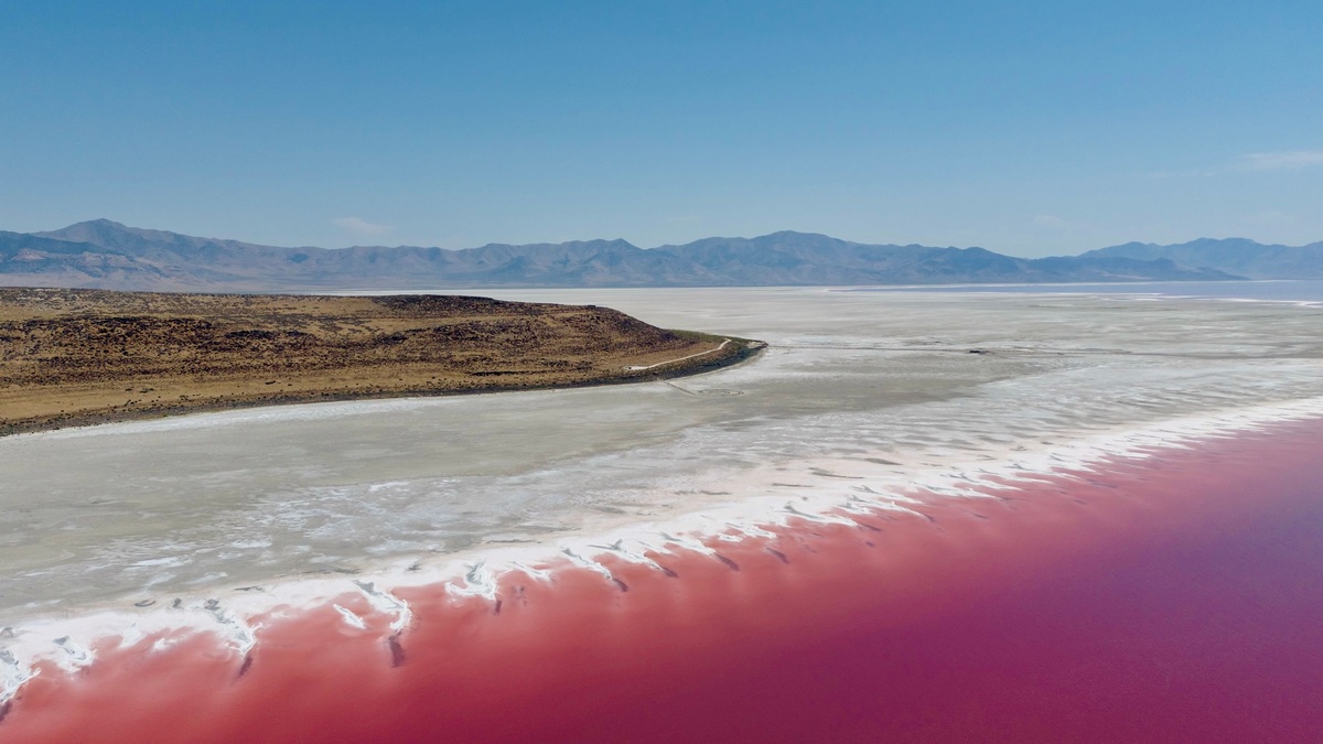
An endorheic basin is a drainage basin with no surface-water outlet to the ocean. Rivers and runoff flow toward an interior low point, where water collects in a lake, wetland or salt flat. Water leaves mainly through evaporation or seepage into the ground rather than through a river crossing the basin boundary.
Endorheic basins are also called closed or internal drainage basins. Many occur in dry continental interiors and rain-shadow regions, but aridity alone does not create them. Topography must enclose the drainage so that surface water cannot reach an external river system.
How a closed basin works
Every drainage basin is bounded by higher ground that directs runoff. In an externally drained basin, the channel network eventually connects to the sea. In an endorheic basin, the lowest route remains inside the boundary, so the network ends at a terminal water body or depression.
The USGS Hydrofabric explanation of drainage area identifies southeastern Oregon’s Harney Basin as a closed system. The Silvies and Donner und Blitzen rivers enter Malheur and Harney lakes, but no channel carries their water downstream to another basin.
Groundwater can cross a surface drainage divide, which makes the full hydrology more complicated than a map of rivers. “Closed” refers primarily to the lack of surface outflow. Some endorheic lakes leak underground, while others receive groundwater from beyond their mapped surface basin.
Why terminal lakes often become salty
Rivers dissolve small amounts of minerals from rock and soil as they cross a watershed. An ocean-bound river exports those dissolved substances. A terminal lake receives them, then loses relatively pure water through evaporation, leaving much of the dissolved load behind.
Repeated concentration can make a lake saline or create salt crusts after it dries. Chemistry depends on the source rocks, groundwater and the minerals that precipitate as concentration rises. Closed lakes are therefore not chemically identical and some remain fresh where inflow is high or groundwater removes enough dissolved material.
Great Salt Lake is a prominent example. Its surface changes with the balance between watershed inflow and evaporation. The USGS water-budget analysis for Great Salt Lake shows how a terminal lake stores the difference when annual inflow and evaporation do not match.
Endorheic lakes expand and contract
Without a surface outlet, a closed lake can respond strongly to climate. Several wet years raise the water level and spread the lake across a shallow basin floor. Drought and high evaporation expose broad areas of sediment or salt.
The shifting shoreline changes the lake’s surface area, which then changes evaporation volume. A larger lake presents more water to the atmosphere. This feedback can moderate continued growth, although exceptional inflow may still produce flooding.
Argo’s guide to lake flooding explains why even a basin without an ocean outlet can inundate surrounding land. Historical pluvial lakes in now-arid regions record times when precipitation and runoff greatly exceeded modern conditions.
Where closed basins form
Tectonic basins surrounded by mountains provide natural traps for water. Faulting can lower an interior block or raise ranges that block an older drainage route. Volcanic deposits, glacial landforms and dunes can also close local outlets.
Many endorheic regions occupy continental interiors where rainfall is limited and evaporation is strong. Dry conditions help preserve internal drainage because rivers rarely fill the basin enough to cut an outlet. In wetter climates, persistent overflow is more likely to erode a route into a neighboring basin.
The Great Basin of the western United States contains numerous separate closed basins rather than one river network. The USGS Great Salt Lake Basin report describes a landscape where water availability, consumption and lake decline are connected across tributaries and terminal waters.
Not every desert lake is endorheic
A lake in a dry region may still have an outlet that connects to the ocean during ordinary or wet conditions. Conversely, a closed basin can contain no permanent lake if water evaporates or infiltrates before accumulating. The drainage connection, rather than the appearance of the lake, determines the classification.
Reservoirs need careful treatment. A dam can create a lake where water leaves through controlled releases in the same river, so the basin remains externally drained. Diversions may move water across natural divides without changing the topographic definition of the watershed.
Water use changes terminal lakes quickly
Irrigation and municipal withdrawals reduce the river flow reaching a terminal lake. Because the lake has no downstream outlet to shrink, the loss appears mainly as declining storage and a smaller surface area. Salinity can rise as the same mineral mass occupies less water.
Exposed lakebed may release dust when wind crosses dry sediment. The dust can contain salts and other accumulated substances, creating health and agricultural concerns. Habitat also changes as shallow wetlands disappear or salinity exceeds the tolerance of organisms that support birds and fisheries.
A water budget separates climate effects from consumptive use. Argo’s explanation of why lakes matter to people and ecosystems shows what is put at risk when storage declines. For a terminal lake, even a modest long-term reduction in inflow can produce a large cumulative loss of water.
How scientists reconstruct past climates
Closed basins preserve shorelines above modern lake level, sediments below the lakebed and minerals deposited during dry phases. Researchers date those records to reconstruct changes in effective moisture, the balance between precipitation and evaporation across a region.
Pollen, fossils and chemical ratios in sediment cores add environmental detail. A high shoreline indicates enough sustained inflow to fill the basin to that elevation, but interpreting it requires knowledge of any former spillway and changes in basin shape.
The evidence provides a regional climate archive because terminal lakes integrate runoff from their watersheds. It does not translate directly into rainfall at one location. Temperature affects evaporation, snow storage changes runoff timing and vegetation influences how much precipitation reaches channels.
Reading an endorheic basin map
Trace the rivers downstream. If they converge on an inland lake or fade into a playa without a channel crossing the surrounding divide, the area has internal drainage. Topographic elevation is more reliable than political borders or the word “basin” in a place name.
Argo’s overview of where lakes and ponds collect places terminal waters among the many ways surface water occupies low ground. A closed basin is distinct because the entire upstream network ends there.
The defining fact remains simple: surface water enters but has no route to the sea. From that constraint follow the large water-level swings, salt accumulation and sensitivity to both climate and human withdrawals that make endorheic basins scientifically important.
When a closed basin begins to overflow
Endorheic drainage can change over geologic time. If a lake rises to the lowest point on its rim, overflow may cut a channel into a neighboring basin. Continued erosion lowers the outlet and can permanently connect the former closed system to an ocean-bound river.
The reverse can occur when tectonic uplift, lava or sediment blocks an outlet. A newly isolated lake begins retaining dissolved minerals that once moved downstream. Its salinity does not jump immediately because concentration develops through the cumulative balance of inflow, evaporation and mineral precipitation.
Some basins spill only during rare wet intervals, so classification depends on the time scale being described. Geologic shorelines and spillway deposits help determine whether a modern terminal lake once overflowed. Current maps describe present drainage, while sediment and landforms preserve its earlier connections.
Overflow can reorganize a much larger river network through stream capture. Once an external channel cuts into the basin, it may lower the terminal lake and begin exporting sediment and dissolved salts. The new connection changes erosion upstream from the outlet and creates habitat pathways that did not exist while the basin remained closed.





