
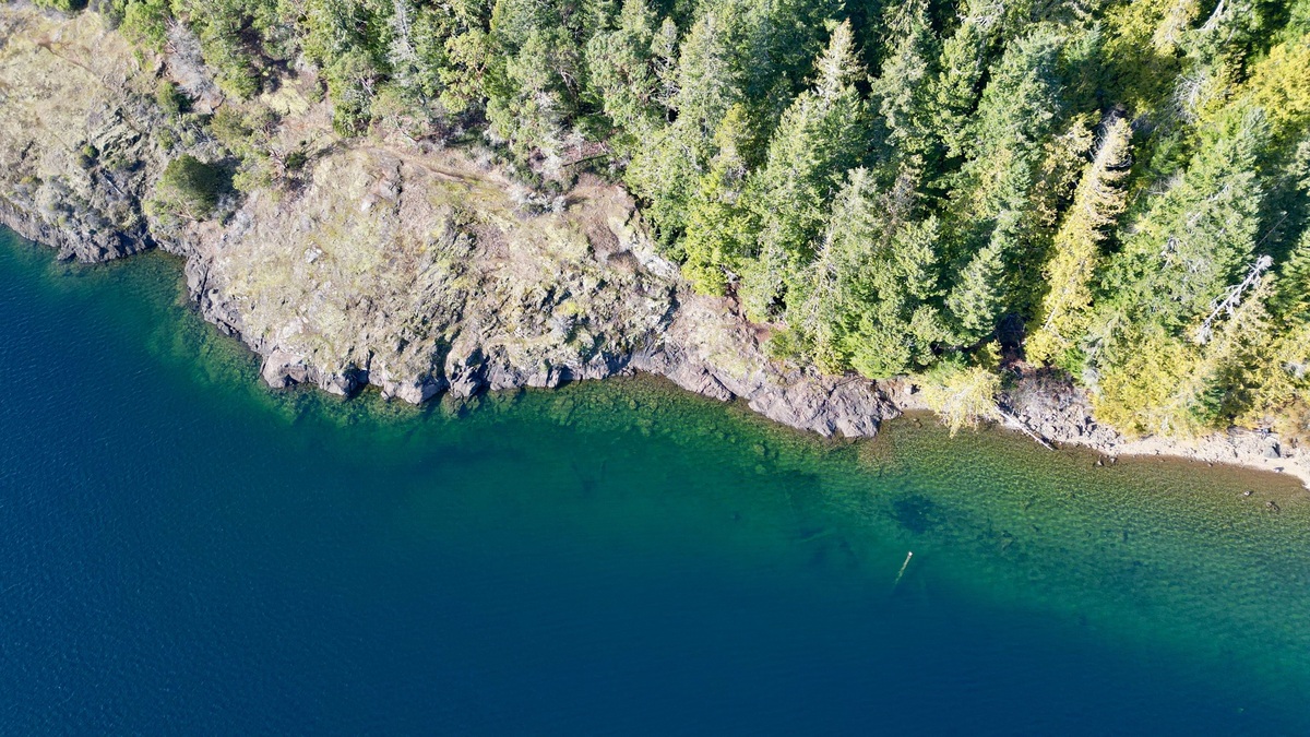
A seepage lake is a lake with no regular surface-water inlet or outlet. It receives water from precipitation, limited runoff and groundwater exchange, then loses water mainly through evaporation or seepage into the ground. It may overflow occasionally during unusually high water without becoming a normal drainage lake.
The definition describes surface connections, not one universal groundwater direction. A seepage lake can receive groundwater through part of its bed, lose lake water to an aquifer elsewhere or do both at the same time.
No stream inlet or outlet defines the type
The Wisconsin DNR lake classification defines seepage lakes as landlocked waterbodies without an inlet or outlet that only occasionally overflow. In that regional framework, precipitation supplies much of the water. Runoff contributes from nearby land, with groundwater supplementing both sources from the immediate drainage area.
A lake with both a stream inlet and outlet is classed as a drainage lake. A lake with no inlet but a continuously flowing outlet may be called a spring lake or a drained lake, depending on whether groundwater or precipitation supplies most of its water.
These labels simplify a complex water budget. An artificial ditch may create a connection that natural topography lacks. Culverts can do the same, while a high-water connection might operate only intermittently. Researchers may need level records and groundwater measurements rather than a single site visit.
Water arrives from the sky and surrounding land
Rain and snow fall directly on the lake surface. Additional precipitation lands on the local catchment and reaches the basin as shallow runoff or water moving through soil. The small surface watershed limits how quickly some seepage lakes respond to an individual storm.
Snowmelt can supply a strong seasonal pulse in cold regions. Meltwater moves quickly over frozen ground, but thawed soil allows some of it to recharge the aquifer. That underground component reaches the lake later. The delayed response helps explain why a lake may keep rising after visible runoff has ended.
The USGS describes lakes as temporary water storage within the water cycle. Water remains only while inputs exceed losses through an outlet, groundwater seepage, evaporation or withdrawal.
Groundwater may enter and leave the same lake
Groundwater moves from higher hydraulic head toward lower head through permeable sediment or fractured rock. Where the water table stands above the lake, groundwater can discharge through the bed. Elsewhere, lake water may seep outward to the aquifer.
A USGS groundwater-lake diagram shows three basic patterns: inflow across much of the bed, seepage loss across much of the bed or inflow and loss in different areas. The third pattern is common enough that calling every seepage lake “groundwater-fed” can be misleading.
Organic bottom deposits can slow exchange. A bed of permeable sand transmits water more readily, as may a gravel deposit. Local geology and the lake’s position within regional groundwater flow determine which pattern develops.
Water levels can fluctuate widely
Without an outlet stream, rising water cannot simply increase downstream discharge. Storage expands across the lake basin or water leaves through evaporation and groundwater. The level can consequently follow multi-month or multi-year changes in precipitation and the water table.
The Wisconsin lakes FAQ notes that seepage lakes may show the effect of rainfall only after months. Drought lowers recharge directly. Groundwater pumping can compound the decline. Development that limits infiltration likewise leaves less water available to refill both the aquifer and lake.
Closed-basin lakes can also rise high enough to cover beaches, roads or buildings. Argo’s answer to whether lakes can flood explains why groundwater-driven flooding may persist until a broad part of the aquifer drains.
Seepage lakes retain dissolved material
A lake without a regular surface outlet does not export nutrients and dissolved chemicals through a stream. Some material settles into sediment, some leaves with groundwater and some remains in the water column. Evaporation removes water while leaving most dissolved minerals behind.
Retention does not make every seepage lake salty or polluted. Chemistry depends on groundwater, bedrock, atmospheric deposition and biological uptake. A humid-region lake with substantial seepage loss can behave differently from a terminal lake in an arid basin.
The USGS review of groundwater interactions notes that lakes without stream outflow tend to retain chemicals. It also emphasizes that lake sediments and groundwater chemistry influence what ultimately remains available to organisms.
Shorelines shift with the water table
A shallow-sloped basin can expose a wide band of lakebed after a modest vertical decline. Plants soon colonize the newly dry ground. Docks may become stranded as nearby access channels lose enough depth to block boats. A steep-sided lake may show the same vertical change with much less shoreline movement.
When levels return, water covers young vegetation along with exposed shoreline soil. Decomposition can release nutrients into the lake. Floodwater reaching a septic system or well creates a separate health concern. Fluctuation is natural, but buildings placed close to a historic low-water shoreline remain vulnerable to later recovery.
USGS modeling in the Twin Cities found that precipitation and groundwater pumping can both affect closed-basin lakes. The size of the response depends on sediment permeability, well placement and pumping depth.
Seepage lakes differ from spring-fed lakes
“Seepage” describes the absence of regular surface inflow and outflow in the cited classification. Spring-fed describes the importance of groundwater input. The concepts overlap in everyday language, but they are not interchangeable.
A lake may have obvious spring discharge yet also possess an outlet stream. Wisconsin classifies a groundwater-fed lake with no inlet and a continuous outlet as a spring lake. Argo’s spring-fed lake explainer develops that distinction.
Likewise, a seepage lake may lose water to groundwater rather than receive a dominant spring input. The hydrologic label should follow measured connections instead of assumptions based on clear water or a sandy bottom.
Seepage lake is not another word for pond
Lake and pond terminology usually concerns size, depth, plant growth or local convention. Seepage classification concerns the water source and surface outlets. A small pond can be a closed seepage waterbody and a much larger lake can share the same hydrologic pattern.
Argo’s comparison of lakes and ponds explains why no universal acreage cutoff settles that naming question. The presence of a stream is a separate observation.
A seepage lake also differs from a river because it stores water in a basin without a channelized through-flow. The broader lake-versus-river comparison focuses on current, residence time and water movement.
How scientists determine the water budget
Researchers monitor lake stage, precipitation and evaporation, then measure nearby groundwater levels. Seepage meters or models can estimate exchange through the bed. Stable isotopes provide another way to infer the balance between evaporation and inflow.
An EPA assessment explains that lake residence time and flow-through status are difficult to measure directly across thousands of lakes. A single water sample can preserve an integrated isotope signal, but interpretation still relies on a hydrologic model.
The definition is simple: no regular inlet or outlet. The behavior is not. A complete explanation requires precipitation, runoff, groundwater flow, evaporation and the changing geometry of the basin.
Management must follow the hidden water connection
Adding or removing surface water does not necessarily create a lasting level change. Pumped water may seep back into the surrounding aquifer, while lowering the lake can increase groundwater inflow. Any proposal needs a water budget and a lawful receiving point.
Land use beyond the visible shore can influence recharge. Pavement routes rainfall away and high-capacity wells can lower hydraulic head. Wetland loss may change how water reaches the aquifer. The effect varies with geology, so a general setback distance cannot predict every lake’s response.
Long monitoring records are more informative than one unusually wet or dry year. Paired lake and observation-well measurements can reveal whether the surface follows groundwater, while precipitation records help separate pumping effects from climate variability.
Managers also need a baseline for chemistry. With no regular outlet, a new nutrient or salt source may persist differently than it would in a rapidly flushed drainage lake. Repeated sampling can distinguish a pollution signal from concentration caused by evaporation. Groundwater measurements help test whether underground inputs offer the better explanation.





