NOAA’s National Ocean Service explains that Earth’s highest point depends on the ruler being used. Mount Everest remains the world’s highest peak above global mean sea level, while Ecuador’s Chimborazo reaches farther from Earth’s center because the planet bulges near the equator.
The finding turns a familiar classroom fact into a sharper lesson about measurement. Everest rises to 29,031.69 feet above sea level, based on the official height announced by Nepal and China in 2020. Chimborazo reaches only about 20,564 feet above sea level. Yet its summit sits farther from the center of the planet than Everest’s summit does.
The reason lies under the mountains. Earth spins and that spin gives the planet a slightly swollen middle. Chimborazo stands near that swollen equatorial zone, which gives it a head start before its volcanic height is even added.
Everest Keeps the Sea-Level Crown
Mount Everest still holds the title most people mean when they ask for the highest mountain on Earth. Its summit is the highest point above global mean sea level, the average ocean surface used as the reference point for elevations.
That measurement matters because sea level gives mapmakers, climbers and scientists a shared baseline. When a mountain’s elevation appears on a map, the number usually describes height above that ocean-based reference. By that standard, Everest rises higher than any other summit on the planet.
The 2020 announcement by Nepal and China placed Everest at 29,031.69 feet. That official value confirmed the mountain’s place in the familiar ranking of Earth’s highest peaks. It also helped settle years of debate about snow depth, rock height and survey methods.
Chimborazo, by comparison, is much lower by the same sea-level measurement. Its summit stands roughly 8,465 feet below Everest’s summit when both are measured from the ocean’s average surface. On a traditional elevation chart, Everest wins by a wide margin.
Still, a mountain can be measured in more than one scientifically valid way. Elevation above sea level is one ruler. Distance from Earth’s center is another. The second ruler changes the story because Earth itself changes shape from pole to equator.
Earth’s Shape Changes the Winner
Earth looks round from space and for many everyday purposes that picture works well. A more precise view shows a planet that is slightly wider around the equator and slightly flattened near the poles. Scientists call this shape an oblate spheroid.
The bulge comes from rotation. As Earth spins, material near the equator sits farther from the axis of rotation and experiences a stronger outward effect. Over geological time, the planet’s shape reflects that motion. The result is a middle that sticks outward compared with the polar regions.
This shape is subtle on a globe in a classroom. It becomes important when scientists ask which point on Earth’s surface lies farthest from the center. A mountain near the equator starts on a part of the planet that already sits farther out.
Earth’s equatorial bulge gives Chimborazo a powerful advantage. The mountain rises in Ecuador, just south of the equator. Everest stands much farther north, near 28 degrees north latitude. That difference in latitude changes the distance from Earth’s core before mountain height enters the calculation.
In practical terms, Chimborazo begins from a wider part of Earth. Everest begins from a narrower part. Add each mountain’s height to those starting positions and the lower volcano reaches farther outward from the planet’s center.
Chimborazo Starts From a Wider Planet
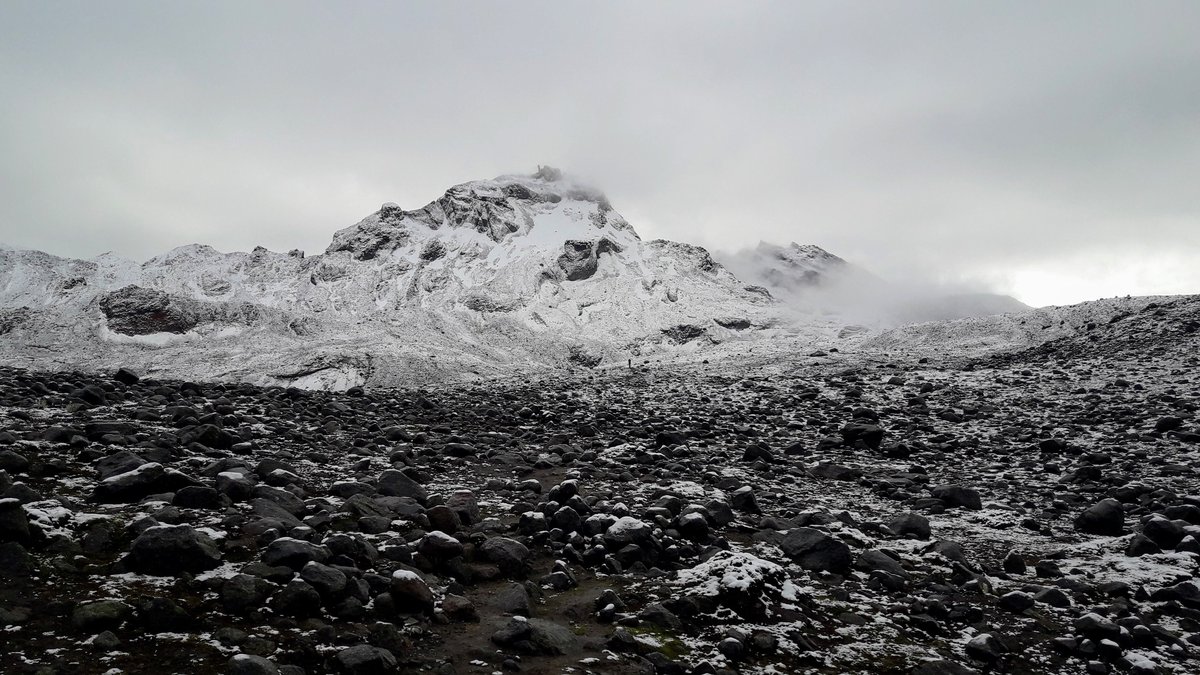
Ecuador’s Chimborazo is an inactive volcano in the Andes. Its summit sits close enough to the equator that Earth’s bulge does much of the work. The volcano rises from a natural platform that is already farther from the center of the planet.
That platform is the key. If Earth were a perfect sphere, Everest’s extra elevation would carry it farther from the center. Earth’s real shape gives mountains near the equator a built-in advantage. Chimborazo benefits more than any famous peak in the Himalayas.
NOAA’s explanation frames the issue through geodesy, the science of measuring Earth’s size, shape, gravity field and surface positions. Geodetic measurement asks where points are in three-dimensional space. In that system, the center of Earth can be used as a reference.
Once that reference is chosen, the rankings shift. Everest remains the highest point above the ocean-based surface. Chimborazo becomes the summit that reaches farthest from Earth’s center. Both statements can be accurate because they answer different measurement questions.
The volcano’s location also explains why the result feels surprising. A shorter mountain can win this particular contest because the planet beneath it supplies the missing distance. Chimborazo’s summit is riding on Earth’s widest belt.
The Numbers Put the Volcano Ahead
The difference between the two mountains is small compared with Earth’s size, but it is large enough to matter. Measured from the center of the planet, Chimborazo’s summit is about 3,967 miles away. Everest’s summit is about 3,966 miles from the center.
NOAA puts the comparison in direct terms, saying “the summit of Chimborazo is over 2,072 meters farther from the center of the Earth than Everest’s peak.” That is more than 6,800 feet, or about 1.3 miles, in favor of the Ecuadorian volcano.
Those numbers show why distance from Earth’s center tells a different story from altitude above sea level. Everest is more than 5.5 miles above the ocean’s average surface. Chimborazo is about 3.9 miles above that same reference. The equatorial bulge more than makes up the difference.
The comparison can feel counterintuitive because humans usually experience height locally. We stand on the ground, look upward and think in terms of how far a summit rises above nearby terrain or sea level. Planetary geometry uses a larger frame.
From that larger frame, the summit’s position depends on both mountain height and Earth’s radius at that latitude. Near the equator, that radius is larger. Chimborazo uses that extra radius to reach farther outward than Everest.
What “Closest to Space” Really Means
The phrase closest point to space is useful when it is tied to a specific measurement. Chimborazo is closest in the sense that its summit lies farthest from Earth’s center. It is the piece of solid ground that sticks farthest outward from the planet’s middle.
Space itself begins gradually rather than at a hard physical wall. The atmosphere thins with altitude and different organizations use different boundary conventions for spaceflight. For mountain comparisons, the phrase works best as shorthand for distance outward from the planet’s center.
By the sea-level ruler, Everest reaches higher into the atmosphere. Climbers on Everest stand at a greater elevation above mean sea level than climbers on Chimborazo. That familiar altitude measure remains essential for weather, oxygen levels, aviation, mapping and mountaineering.
By the center-of-Earth ruler, Chimborazo reaches farther away from the core. This ruler is especially useful for explaining the planet’s shape. It shows how latitude and rotation can influence a summit’s position in space.
Claims about being closest to the Sun require extra care. Earth’s orbit changes the planet’s distance from the Sun by millions of miles during the year. A summit-to-summit difference of about 1.3 miles is tiny in that solar-scale setting. The strongest scientific claim stays with Earth’s center.
A Mountain Fact With Deep Scientific Roots
The Chimborazo story reaches back to a major scientific problem from the 18th century. Researchers wanted to determine Earth’s true shape. The question mattered for navigation, mapping, astronomy and the basic physics of a rotating planet.
The French Geodesic Mission worked near Chimborazo in the 1730s and 1740s. Scientists measured a degree of latitude close to the equator and compared it with measurements made farther north. Those comparisons helped show that Earth is wider at the equator than from pole to pole.
That historical work gave later generations a clearer view of the planet’s geometry. It also made the Chimborazo region one of the symbolic places in the history of Earth measurement. The same broad region that helped reveal the equatorial bulge now provides the summit that benefits from it most clearly.
Chimborazo also held a special place in early mountain science. In the early 1800s, many people believed it was the world’s highest mountain. Alexander von Humboldt attempted to climb it in 1802, during an era when the Andes loomed large in European scientific imagination.
Modern surveys have refined the rankings. Everest leads in elevation above sea level. Mauna Kea in Hawaii is taller than Everest when measured from its underwater base to its summit. Chimborazo leads when the question is the summit farthest from Earth’s center.
Why the Ruler Matters
Mean sea level gives Earth science a practical reference for height. It lets surveyors compare mountains, cities, aircraft altitudes and coastlines using a shared surface. The system is familiar because it matches how people usually think about elevation.
Earth’s center gives scientists another reference. It helps describe the planet as a three-dimensional body moving through space. This approach is central to satellite navigation, gravity mapping and the precise positioning systems that support modern geodesy.
The Chimborazo and Everest comparison shows how a simple question can contain more than one scientific answer. “Highest” can mean highest above sea level. It can also mean farthest from the center. Each meaning points to a different physical relationship.
That distinction is more than trivia. It reveals how careful definitions shape scientific conclusions. A small change in the ruler can reorder familiar facts and expose hidden structure in the world beneath our feet.
Everest remains the great summit of altitude. Chimborazo holds the stranger planetary title. Thanks to a spinning Earth and a swollen equator, the Ecuadorian volcano reaches farther outward from our planet’s center than any other known summit on land.