On an island, two places separated by only a mountain ridge can have strikingly different weather. The windward side faces the prevailing wind and often receives more cloud and rain. The leeward side lies downwind, where descending air is commonly warmer and drier.
NOAA’s windward and leeward explanation uses the Hawaiian Islands as a clear example. Moist northeasterly trade winds reach one side first, climb volcanic terrain and leave many sheltered western and southern coasts sunnier.
The words also matter in sailing, aviation and ecology. Their meaning always depends on wind direction, so the same slope or vessel can change from windward to leeward when the wind shifts.
Windward means facing the wind
Wind is named for the direction it comes from. A northerly wind moves from north to south, making the northern side of an obstacle windward. Air encounters that side before crossing a mountain, building or ship.
Leeward means downwind and relatively sheltered. The protection is rarely complete because air curls around edges and becomes turbulent behind obstacles. On a small scale, the lee of a wall can feel calm while gusts swirl a short distance away.
Mariners use the terms to describe relative positions. A windward boat sits upwind of another, while a leeward boat is downwind. Sailing rules use these positions because windward and leeward vessels have different abilities to maneuver.
Mountains force moist air upward
When ocean air reaches an island, terrain blocks its horizontal path. The air rises along the windward slope. Atmospheric pressure decreases with height, so the rising parcel expands and cools.
Cooling raises relative humidity until water vapor begins condensing onto tiny particles. Clouds develop and enough growth produces rain or snow. Meteorologists call precipitation caused by terrain orographic precipitation.
The process depends on moisture, wind speed and mountain height. A low ridge may produce only cloud, while a tall range can wring out substantial precipitation. The National Weather Service describes how terrain alters airflow and creates hazards such as mountain waves.
Windward rainfall feeds streams and forests, influencing soil development and where people store water. Repeated exposure to salt-laden wind can also affect plants near the coast.
Descending air forms a rain shadow
After crossing a ridge, air descends the leeward slope. Higher pressure at lower elevation compresses and warms it. Relative humidity falls, which makes cloud droplets evaporate and reduces the chance of precipitation.
This dry zone is known as a rain shadow. Its strength depends on the mountain range and prevailing circulation. Some rain shadows extend hundreds of miles inland, while island contrasts can appear across a much shorter distance.
The NASA Earth Observatory uses satellite imagery to show how mountains leave dry regions downwind. Vegetation often makes the boundary visible, with greener slopes on the wet side and sparse cover in the lee.
Hawaii shows the contrast clearly
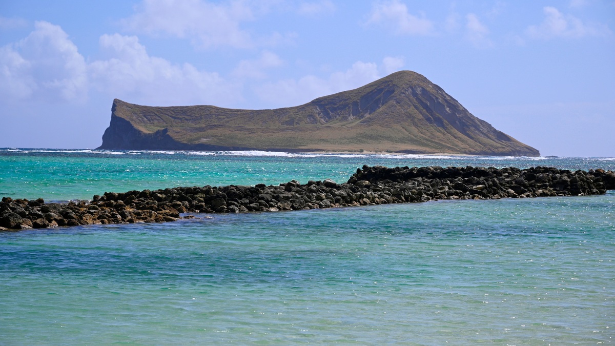
Northeasterly trade winds dominate much of Hawaii’s weather. Eastern and northeastern slopes are commonly windward, while many western and southwestern coasts are leeward. Local topography creates exceptions and winter storms can bring winds from other directions.
As moist air climbs the islands’ volcanic mountains, clouds frequently gather at predictable elevations. The resulting rainfall supports lush landscapes on many windward slopes. Resorts developed along several drier leeward coasts partly because sunshine is more common there.
Elevation complicates the simple wet-side, dry-side picture. High summits may rise above common cloud layers and deep valleys channel wind. The National Weather Service in Honolulu summarizes Hawaii’s climate as a product of trade winds, terrain and seasonal storm tracks.
Changes in wind direction can temporarily reverse local expectations. Kona storms, for example, may bring southerly or southwesterly flow and heavy rain to areas usually sheltered from the trades.
The terms extend beyond island weather
Aircraft approaching mountains face different conditions on each side. Windward air generally rises, while leeward flow may sink rapidly or form waves and turbulent rotors. Pilots rely on forecasts and observations because these motions can exceed an aircraft’s climbing ability.
Ecologists use exposure to explain differences in habitats. Windward coasts may receive stronger waves and salt spray. Sheltered leeward reefs can experience calmer water, different sediment movement and greater heating during still weather.
Weather forecasters combine the terms with a stated wind direction. Without that context, “the leeward side” can be misleading where prevailing winds reverse seasonally. The NOAA circulation lesson explains the global winds that make some regional directions persistent.
Windward and leeward are simple relational words with large consequences. They trace how moving air encounters terrain, loses moisture and descends into shelter. Reading a landscape through those directions helps explain neighboring climates that otherwise seem impossible to reconcile.
Wave exposure changes a coastline
Prevailing wind also decides how much wave energy reaches a shore. A windward coast may face locally generated waves over a long fetch, while a leeward bay sits behind land that blocks them. Distant swell can arrive from another direction and temporarily reverse the expected contrast.
Repeated wave exposure influences beach sediment and reef structure. Fine sand is more likely to remain in sheltered water, while energetic shores can move larger material. Coastal engineers therefore use wind exposure and wave climate when assessing erosion or selecting sites for harbors.
Human settlement often reflects the same geography. Ports favor protected leeward water where possible, though access, depth and storm direction also matter. Farms may cluster on wetter windward slopes, while tourism gravitates toward sunny sheltered coasts.
Ocean conditions can modify the airflow before it reaches land. Warm water supplies heat and moisture; cool water may stabilize the lower atmosphere. As climate patterns shift prevailing winds, the boundary between wet and dry parts of an island can shift as well.
A map labeled windward or leeward should therefore be read as a summary of typical exposure. Daily forecasts remain necessary because fronts and local circulations can replace the prevailing wind, bringing unusual rain or rough seas to the normally sheltered side.
Local winds can complicate the pattern
Daytime heating creates sea breezes that blow inland, while cooler nights can favor weaker land breezes toward the water. Valleys channel these local flows and may draw clouds into places that a simple windward map would label sheltered.
Mountain waves can extend far downwind of a ridge. Stable air oscillates after crossing the summit, producing bands of rising and sinking motion. Strong events create rotor turbulence near the ground, an important hazard for aircraft and sometimes for high-profile vehicles.
Weather stations on opposite sides of an island document the contrast, but elevation must be considered before comparing them. A cool upland gauge and a warm coastal gauge differ for several reasons. Long-term analysis separates altitude, exposure and shifting wind regimes to reveal a true change in local climate.
The most useful interpretation begins with a question: which way is the air moving now? Once that direction is known, windward and leeward provide a compact explanation for uplift, shelter and many of the weather differences across rugged terrain.
Planners also consider rare winds that approach from the opposite direction. Homes, roads and vegetation adapted to the usual sheltered setting may be exposed during an unusual storm. Hazard maps therefore combine prevailing wind with historical extremes, rather than assuming the leeward side is protected every day of the year. Building standards may account for gusts funneled through passes and evacuation plans must consider roads crossing exposed slopes. The everyday labels remain useful when paired with local measurements and knowledge of unusual storm tracks.
Related reading: the difference between wind waves and swell and how wind moves ocean water.