Between about 40 and 50 degrees south, prevailing winds can race around Earth with few continents to slow them. Sailors named this belt the Roaring Forties. Its powerful westerlies build large waves, hurry weather systems eastward and help connect the atmosphere with the Southern Ocean.
NOAA’s Roaring Forties account explains how the winds served ships during the Age of Sail while making westward passages, especially around Cape Horn, exceptionally dangerous. The same wind belt now interests oceanographers because it moves heat and gases through one of the planet’s most important ocean regions.
The latitude alone does not guarantee a gale. Individual storms and calm periods pass through. The name describes a persistent climatic pattern whose average strength stands out from winds at corresponding northern latitudes.
Why the winds blow from the west
Air descending within the subtropical high-pressure belt near 30 degrees spreads toward higher latitudes. Farther south, lower pressure and frequent storms draw that surface air poleward. Earth’s rotation deflects the flow, giving the midlatitude winds their west-to-east direction.
The Coriolis effect curves moving air to the left in the Southern Hemisphere. As air travels toward the pole, that deflection produces westerlies. The broader circulation also transports heat away from the subtropics and helps balance the uneven solar energy received by Earth.
The UK Met Office places these winds in the Ferrel cell, the middle component of a simplified three-cell circulation model. Real atmospheric motion is more complicated because eddies and cyclones carry much of the heat, yet the model gives a useful map of the prevailing flow.
An ocean with few land barriers
In the Northern Hemisphere, North America, Europe and Asia interrupt the midlatitude wind belt. South of 40 degrees, the ocean circles most of the globe with only the southern tips of South America, Africa, Australia and New Zealand in its path. Friction over the sea is also lower than over rough terrain.
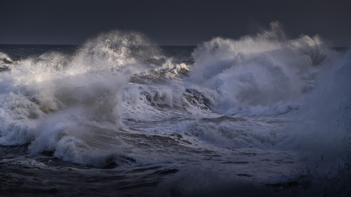
The broad, open fetch lets winds act on the water over immense distances. Waves grow as energy accumulates, especially when strong wind blows steadily in one direction. Swell generated far away can travel beyond the storm that created it.
Conditions often intensify farther south in belts sailors call the Furious Fifties and Screaming Sixties. Sea ice and Antarctica eventually alter the setting, but the shortage of land continues. The physical point is the uninterrupted path available to the winds.
Modern ships have engines, satellite forecasts and stronger hulls, yet the Southern Ocean still demands careful routing. Low-pressure systems can deepen rapidly and waves arriving from several directions create difficult seas. Distance from ports adds another layer of risk.
The winds drive a global current
Persistent westerlies push the ocean surface eastward. Their force helps drive the Antarctic Circumpolar Current, the only major current that flows completely around the planet without being blocked by a continent.
The current connects the Atlantic, Pacific and Indian oceans. It also forms a moving boundary between relatively warm waters to the north and cold water near Antarctica. The British Antarctic Survey describes this circulation as central to exchanges of heat and water among ocean basins.
Wind does more than push water east. Through Ekman transport, surface water is displaced partly across the wind direction. Divergence can draw deeper water toward the surface, carrying dissolved carbon and nutrients. The resulting exchange affects marine food webs and the amount of carbon dioxide the ocean releases or absorbs.
Why the Southern Ocean affects climate
Cold Southern Ocean water can absorb substantial heat and carbon dioxide. Wind controls how readily surface water mixes with deeper layers, so changes in the westerlies can alter where those properties travel. Scientists monitor both the average belt and short-lived storms.
Measurements are difficult because the sea is remote and rough. Research ships provide detailed samples along limited tracks. Autonomous floats now collect temperature and salinity through the year, including seasons when ship access is scarce. The international Argo program explains how profiling floats have expanded observation of the global ocean.
Satellite instruments add surface wind, wave height and sea-level information. Combining these data with floats and models helps researchers estimate the current’s transport and track shifts in ocean fronts. No single instrument captures the full depth and speed of the system.
Climate change may influence the position and strength of the Southern Hemisphere westerlies. Ozone loss and rising greenhouse gases have both affected atmospheric circulation, while ozone recovery could modify part of that response. Regional trends and seasonal changes remain active areas of research.
From clipper route to research corridor
Fast sailing ships once used the Roaring Forties to shorten eastbound voyages between continents. Captains sought strong following winds while trying to avoid the worst seas and the hazards around Cape Horn. A favorable route could save time, but an error carried severe consequences.
Today, oceanographic expeditions cross the same belt to study carbon uptake, currents and ecosystems. The NOAA World Ocean Database preserves measurements that allow scientists to compare modern conditions with historical observations.
The enduring name captures the sound and force experienced at sea. Its scientific meaning lies in a rare planetary arrangement: strong atmospheric westerlies meeting an almost continuous ocean. That arrangement powers waves, drives a current around Antarctica and links remote southern latitudes to climate around the world.
Storms carry heat across the wind belt
The average westerly flow is built from constantly changing weather. Extratropical cyclones develop along strong temperature contrasts, drawing warm air poleward on one side and cold air toward the equator on the other. This exchange reduces part of the temperature difference that supplied the storms with energy.
Individual lows often travel east or southeast around Antarctica. Their fronts produce abrupt wind shifts and large changes in pressure. A ship may encounter several systems during one crossing, with swell from an earlier storm arriving beneath winds generated by the next.
Meteorologists call the favored corridor a storm track. Its latitude follows the jet stream and shifts with the seasons. Variations in atmospheric patterns such as the Southern Annular Mode can move the westerlies closer to Antarctica or expand them toward lower latitudes.
The wind belt also affects sea ice by moving ice away from or toward the coast and by driving ocean mixing beneath it. Researchers compare satellite ice maps with atmospheric pressure fields to understand short-term changes, while long records help distinguish circulation effects from ocean warming.
For sailors, the rapid sequence of lows explains why a latitude famous for following winds can still be unpredictable. For climate scientists, those same storms are essential movers of energy between the subtropics and the polar atmosphere.
Wildlife uses a windy ocean
Albatrosses and other Southern Ocean seabirds exploit strong winds to travel with little flapping. Through dynamic soaring, a bird repeatedly crosses layers moving at different speeds and gains energy from the wind. This technique supports journeys over thousands of miles.
The animals still face risks when weather becomes extreme. Wind direction can affect access to feeding grounds, while changing ocean fronts influence where prey gathers. Researchers attach lightweight tracking devices to study how flight paths follow winds and productive water.
Surface mixing supplies nutrients that support plankton, yet deep mixing can also carry cells below the light they need. Seasonal light and sea ice further control productivity. The Roaring Forties support an ecosystem built around motion, with atmosphere, currents and animals responding to the same shifting wind field.
Fishing vessels and conservation teams use these movement records to identify heavily used areas. Their maps can guide measures that reduce seabird bycatch, especially where longline fisheries overlap with albatross feeding routes.
Related reading: the difference between wind waves and swell and how wind moves ocean water.