
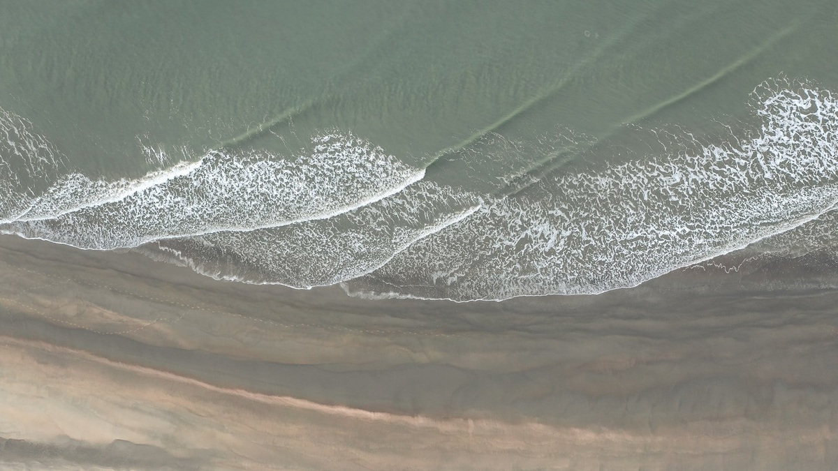
Deep-water and shallow-water waves are classified by comparing water depth with wavelength, not by judging whether the sea looks deep or shallow. A wave behaves as a deep-water wave when depth is greater than half its wavelength. It behaves as a shallow-water wave when depth is less than one-twentieth of its wavelength. Between those limits lies transitional water.
The categories tell scientists which physical relationship controls wave speed. In deep water, speed depends strongly on wavelength and period. In shallow water, speed depends mainly on depth. A long tsunami can therefore behave as a shallow-water wave in water several kilometers deep, while short wind ripples behave as deep-water waves close to shore.
These definitions help explain why swell changes as it approaches land. A coastal USGS flood study combines offshore waves with water depth and shoreline shape because the same wave follows different rules across its journey.
Wavelength determines what counts as deep
Wavelength is the horizontal distance between corresponding points on successive waves, usually crest to crest. Water depth is measured from the undisturbed surface to the bottom. Their ratio determines whether particle motion reaches the seabed strongly enough to change the wave.
For a wave 20 meters long, deep-water behavior applies at depths of at least 10 meters. Shallow-water behavior begins at one meter or less. A 200-meter swell reaches those thresholds at 100 meters and 10 meters. The boundary moves because longer waves extend their influence farther below the surface.
The NOAA wave lesson uses the same half-wavelength and one-twentieth-wavelength limits. These are useful physical regimes rather than names for fixed zones on a nautical chart.
Deep-water waves are dispersive
In deep water, water particles follow nearly circular paths that shrink rapidly with depth. The bottom lies below the part of the water column where most wave motion occurs. As a result, seabed friction has little direct influence on propagation.
Longer-period waves travel faster than shorter-period waves in this regime. A mixed group produced by a distant storm spreads out as it crosses the ocean. Long-period swell reaches a coast first, while shorter waves arrive later. This sorting is called dispersion.
Individual crests move through a wave group faster than the group itself. A crest can form at the rear and advance through the packet before fading at the front. The group carries most of the energy. This difference is important when estimating when storm swell will arrive.
Deep-water waves still break when they become too steep. Strong local wind can pile energy into a short wavelength and opposing currents can compress waves. The deep-water label does not guarantee a calm or stable surface.
Shallow-water waves feel the bottom
In the shallow-water regime orbital motion is flattened by the seabed. Water particles move back and forth along elongated paths rather than completing near-circular orbits. Friction becomes important, especially across rough bottoms and broad continental shelves.
Wave speed is approximately the square root of gravitational acceleration multiplied by depth. Every wavelength at the same shallow depth therefore moves at nearly the same speed. The regime is described as nondispersive, although friction and complex bathymetry can still alter a real wave train.
A decrease in depth slows the wave. Its period remains close to the value set offshore, so the wavelength must shorten. Energy packed into that shorter distance raises the crest and increases steepness. This sequence leads toward shoaling and breaking.
Transitional waves connect the regimes
Most coastal swell spends time in transitional water, where depth is between one-twentieth and one-half of wavelength. Neither the simple deep-water formula nor the shallow-water approximation captures the entire motion. Full wave equations account for both wavelength and depth.
The transition begins surprisingly far offshore for long swell. A 100-meter wavelength starts to feel the bottom around 50 meters depth and does not reach the shallow-water limit until about five meters. Its speed and particle paths change throughout that interval.
Bathymetric contours rarely run as perfect straight lines. One part of a crest may enter shallower water first and slow, causing the crest to bend. This wave refraction tends to align waves with the coast and can concentrate energy on headlands while spreading it inside bays.
Tsunamis reveal why the labels can surprise
A tsunami has an exceptionally long wavelength, often spanning tens or hundreds of kilometers. Even an ocean four kilometers deep is shallow relative to such a wavelength. The wave consequently travels according to shallow-water physics across the open ocean.
Greater depth lets a tsunami move faster. NOAA notes that open-ocean tsunami speeds can rival a jet aircraft, while the wave may rise only slightly at the surface. Near land, falling depth slows the front and compresses the wavelength. Water piles upward and can drive far inland without forming an ordinary curling surf wave.
The U.S. Tsunami Warning System uses seismic information with sea-level observations to assess this hazard. The example shows why visible height alone says little about a wave’s physical category or energy.
Why the distinction matters at the coast
Forecast models must know when offshore wave conditions begin interacting with bottom topography. Deep-water buoys report wave height and period together with direction. Local depth controls the transformation into nearshore surf. NOAA ocean buoys supply measurements used in marine forecasts and model checks.
Engineers apply the regimes when designing breakwaters and estimating wave loads. Ecologists use them to understand disturbance on reefs or seagrass beds. Mariners care because shallow-water steepening can make an entrance dangerous even when offshore swell appears moderate.
The most reliable classification requires two measurements: local depth and wavelength. Comparing them reveals the degree of bottom influence, from negligible through the transitional range to dominant. The ratio follows wave energy from an offshore storm through swell propagation to the breaker that finally releases it on shore.
Measurements identify the wave regime
A wave buoy estimates period from repeated surface motion. Directional buoys also describe the path of incoming energy. Wavelength can then be estimated with the appropriate dispersion relationship, while charts or sonar provide local depth.
Nearshore radar and video systems track crests as they slow and bend. Pressure sensors on the bottom detect changing water pressure, although the signal must be interpreted differently as frequency and depth change. These measurements help models reproduce transitional wave behavior.
For a quick field estimate, observe the period and consult a depth chart rather than guessing from visible height. Long-period swell reaches the transitional regime much farther offshore than short wind waves. The distinction explains why two equal-height seas can respond differently over the same reef.
The three labels describe a continuum from deep through transitional to shallow water. Crossing a numerical boundary does not cause an abrupt jump. It tells the analyst which approximation becomes reliable and whether wavelength or seabed depth deserves the greatest weight.
Common classification mistakes
A wave near shore is not automatically shallow-water. Short ripples above a deep harbor channel can remain in the deep regime. The correct test uses relative depth, calculated from depth divided by wavelength.
Likewise, deep water does not mean the abyssal ocean. A short wave can satisfy the deep-water condition in a few meters. A tsunami fails it even over the deepest trench because its exceptional wavelength dwarfs the water depth.
Wave height is absent from the classification thresholds, though it becomes vital for steepness and breaking. Keeping wavelength, height and period separate prevents a common mistake: treating every large wave as deep-water and every small coastal ripple as shallow-water.
Why the ratio is useful
The depth-to-wavelength ratio reduces a complicated setting to one physically meaningful comparison. It shows how strongly bottom influence should enter a detailed model.
It also scales across very different events. The calculation applies at every scale, from ripples and storm swell to a tsunami. Only the values change, which makes relative water depth a durable tool in wave science.
Related reading: Ocean floor topography explained and abiotic factors in the ocean.





