
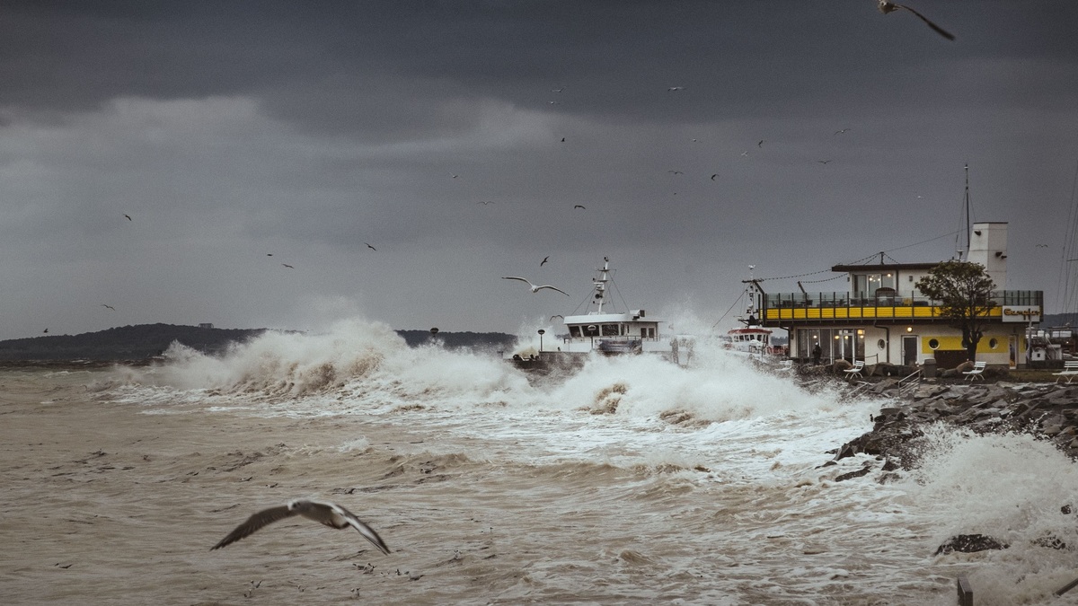
A meteotsunami is a tsunami-like wave generated by a fast-moving disturbance in air pressure and wind, usually connected to thunderstorms, squall lines, or other weather systems. The atmospheric disturbance transfers energy into the water and coastal depth or harbor shape can amplify the wave. Meteotsunamis occur on ocean coasts and in large lakes.
NOAA’s meteotsunami overview places these waves in the same period range as seismic tsunamis, roughly two minutes to two hours. Their weather origin separates them from waves generated by earthquakes, landslides, or volcanic activity. Because the water-level signal can look similar at a tide gauge, identifying the cause requires atmospheric and ocean observations together.
How weather creates the wave
A rapidly changing pressure boundary pushes down on the water on one side and releases pressure on the other. Strong changes in wind can add another shove. Most such disturbances produce only a small response, but energy builds when the moving weather system and the long wave in the water travel at nearly the same speed.
Scientists call that speed-matching process Proudman resonance. The pressure disturbance keeps feeding energy into the wave instead of passing over it once. Water depth controls the natural speed of a long, shallow-water wave, so the track and speed of a storm must line up with a favorable stretch of ocean or lake. NOAA technical work on U.S. meteotsunami risk also identifies atmospheric gravity waves, fronts and tropical or extratropical cyclones as possible sources.
Direction counts as much as speed. A disturbance moving across an unfavorable depth pattern may generate little at the coast. One traveling parallel to a shelf edge can couple with a coastal wave mode, while a system moving over the right depth can sustain resonance. The initial rise offshore may measure only centimeters and still become hazardous after several stages of amplification.
The disturbance does not have to sit directly over the threatened harbor. Once formed, the long wave can travel away from the weather system and reach another part of the coast. A beachgoer may therefore see rapid water motion even though the storm appears distant. Reconstructing an event requires matching its travel time with radar, pressure, wind and gauge records.
Why bays and shelves amplify it
As a long wave enters shallower water, it slows and its height can grow. A broad continental shelf may therefore strengthen a meteotsunami before landfall. Refraction bends the wave as different parts encounter different depths and reflection from shorelines can concentrate energy in particular locations.
Harbors, inlets and bays each have natural oscillation periods determined by their depth and shape. Incoming waves near one of those periods can excite harbor resonance, much as repeated pushes at the right rhythm increase a swing’s motion. Long, narrow inlets with limited energy loss can be especially responsive. NOAA’s account of a 2013 East Coast event illustrates how shelf effects and inlet geometry can amplify the arriving wave.
Coastal impacts can differ sharply over short distances. A wave that seems modest at an open beach may produce a rapid surge and powerful current inside a harbor. The reverse is also possible when local geometry does not favor amplification. Regional hazard maps therefore need bathymetry, shoreline form and observed water levels rather than weather data alone.
More than one wave usually arrives. Reflections inside a basin can keep water oscillating after the first crest and arriving energy may reinforce an existing motion. Boat owners can experience rapid tightening and slackening of mooring lines, while currents reverse near a channel. Maximum current may occur between the visible high and low stages, making the hazard easy to underestimate from water height alone.
Meteotsunami, seiche, or storm surge
A seiche is a standing oscillation in an enclosed or partly enclosed basin. Wind or pressure can set it in motion and water sloshes back and forth around nodes. Seiche periods are often longer than three hours. A meteotsunami is a progressive wave in the tsunami period band, although it can excite a seiche after entering a lake or harbor. Both motions may occur during the same event.
Storm surge is a broader, often slower rise in coastal water driven mainly by sustained winds pushing water toward shore, with low pressure contributing. Meteotsunamis tend to arrive as faster oscillations or a train of waves. Ordinary wind waves involve mainly the surface layer and have much shorter periods. A tsunami, including a weather-generated one, moves the whole water column as a long wave.
Tide-gauge analysts examine period, arrival pattern and the spatial sequence across stations. Weather radar can connect the signal to a moving squall, while earthquake catalogs help exclude a seismic source. A seiche can persist after the original forcing ends, so the final classification may include both a traveling atmospheric wave and a basin response.
Where meteotsunamis occur
Meteotsunamis have been recorded around the Great Lakes, the U.S. Atlantic and Gulf coasts, the Mediterranean and the Adriatic Sea. Similar phenomena have local names in several regions. Favorable weather patterns combine with shelf depth and harbor geometry, which is why some coasts experience damaging events more often.
NOAA notes that observed waves can reach six feet or more, though most are far smaller. Large events can flood shorelines, damage moored boats and create strong currents around docks or inlets. The wave train may last after the storm that generated it has moved away, leaving calm-looking skies near the affected harbor.
A regional meteotsunami can still be dangerous. It usually affects less area than a major earthquake tsunami, yet a sudden water-level change can knock people from piers or pull swimmers into fast water. The NOAA tsunami guide advises that large events can cause damage, injuries and deaths.
Documented incidents range from modest, measurable oscillations to destructive harbor waves. Comparing headline heights can mislead because a gauge reading differs from wave runup and from an eyewitness estimate. Scientists prefer instrument records tied to a known datum and time. Reports of boat damage or inundation provide useful confirmation but require careful location checks.
Forecasting and staying safe
Forecasting begins by detecting pressure jumps, wind shifts and storm motion with weather stations and radar. Scientists then assess whether the disturbance’s speed and path favor resonance over a particular depth. Tide gauges confirm unusual water-level oscillations, while numerical models estimate where shelves or harbors may enlarge them.
The difficulty is timing. Thunderstorm features are small and can evolve quickly and the dangerous outcome depends on a precise match among atmosphere, water depth and coastal geometry. A tide gauge sees the wave only after it reaches the station. Forecast systems must combine high-frequency observations with local modeling rapidly enough to issue a useful message.
Forecast confidence can be low even when the atmosphere looks favorable. Small errors in storm speed or direction change the overlap with the water wave, while harbor resonance can create a severe local response missed by a coarse regional model. Clear alerts should therefore describe the expected area, timing, uncertainty and actions to take near the water.
People near the water should treat an official tsunami or hazardous-water alert seriously, regardless of the trigger. A sudden rise or fall, an unusually strong current and repeated rapid surges are all reasons to leave the waterfront. Move away from beaches and docks as well as harbor entrances. Remaining clear until authorities give an all-clear accounts for the possibility that later waves may be larger than the first.
Related reading: how ocean waves form and spring tides and neap tides.





