
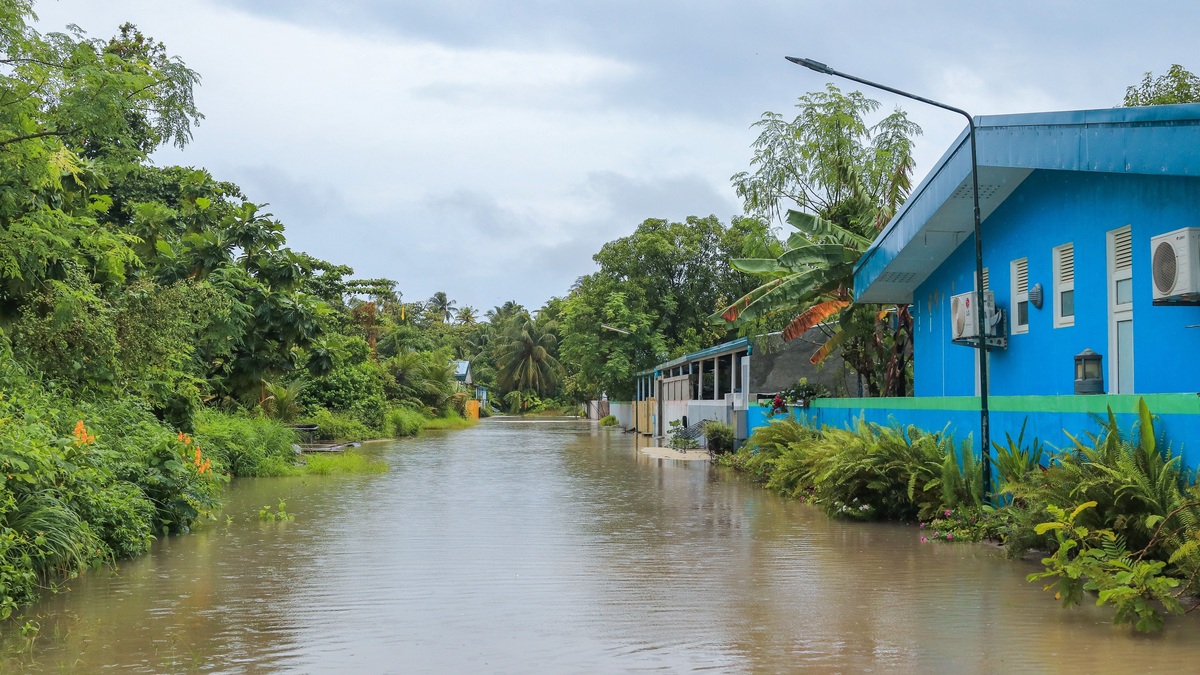
High-tide flooding occurs when seawater covers normally dry coastal land during high tide, often without a major storm. Rising relative sea level has brought routine tides closer to streets, storm drains and buildings in many communities. A strong astronomical tide, wind, ocean currents, waves, or rain can provide the smaller extra rise needed to cross a local flood threshold.
NOAA’s current definition connects the growing frequency of these events with sea level rise, sinking land and the loss of natural barriers. Terms such as sunny-day flooding and nuisance flooding describe similar events. The sky may be sunny or cloudy and repeated shallow floods can produce serious cumulative damage.
How a normal tide reaches dry land
Every coast has a normal range between low and high water. Buildings and drainage networks were often designed using the historical relationship between that range and land elevation. When the local mean sea level rises, the whole tidal cycle starts from a higher baseline. The gap between an ordinary high tide and the first flood-prone elevation becomes smaller.
Relative sea level includes both ocean change and land motion. Global warming raises ocean level through thermal expansion and melting land ice. Locally, land may sink because of groundwater withdrawal, sediment compaction, or geologic processes. Uplift can partly offset ocean rise in some areas. Tide gauges measure the combined change experienced at the shoreline.
Once the margin is narrow, common variations can cross it. A spring tide near a new or full moon may run higher than average. Persistent wind can push water toward shore and a change in a nearby current can alter coastal water level. NOAA’s high-tide flooding service combines station data and predictions to show when local thresholds are likely to be exceeded.
Threshold crossing is the operational signal. A gauge may rise only slightly above its usual highest daily tide, yet nearby pavement could sit at nearly the same elevation. Flat terrain allows shallow water to spread widely. Steeper coasts may experience little inland flooding at the same gauge height, showing why local topography controls the visible footprint.
What flooding looks like
Early impacts often appear at the lowest connections to the sea. Water backs up through storm drains, spreads across waterfront roads, enters parking lots, or surrounds buildings on low ground. Flooding can last around the peak of the tide and retreat afterward, then return with the next high tide.
NOAA classifies U.S. events as minor, moderate, or major using impact-based thresholds associated with each tide gauge. Minor flooding is disruptive, with road closures and stormwater backups. Moderate events can damage homes or businesses. Major events are destructive and may require evacuations. A single nationwide elevation would misrepresent local conditions, so operational thresholds are calibrated to impacts.
Rain can create compound flooding. A drainage system that normally releases runoff to a river or bay may have nowhere to send water when the outfall is submerged. Saltwater can also flow inland through the same pipes. The combined flood may extend beyond the area reached by direct overtopping.
Timing varies with the local tide pattern. Some places have one high tide per day, while many have two. The two daily highs may differ substantially. A vulnerable road can flood during the higher high water and remain open during the other peak, so generalized labels such as “afternoon high tide” are less useful than a station forecast.
How it differs from storm surge
Storm surge is an abnormal rise generated mainly by storm winds pushing water toward the coast. It can be deep, forceful and widespread, especially during a hurricane. High-tide flooding is tied to the tide crossing a local threshold and often occurs in relatively calm weather. The processes can overlap when a storm arrives near high tide.
A king tide is the popular name for an exceptionally high astronomical tide. It describes the water-level driver rather than the land impact. If a king tide stays below the community’s threshold, no high-tide flood occurs. If a more ordinary tide combines with wind or elevated seasonal water and crosses the threshold, high-tide flooding can occur without a king tide.
River flooding is driven by water moving through a watershed after rain or snowmelt. Near an estuary, river flow and coastal water can interact, especially when the tide slows drainage. Investigators identify the dominant source from gauge networks, rainfall, forecasts and the timing of the crest. Compound flooding may require both coastal and watershed responses.
Why repeated shallow floods cause damage
One brief event may seem manageable, yet repetition changes the cost. Salt water corrodes vehicles, electrical equipment and metal fittings. Pavement foundations can weaken, while buried utilities may be infiltrated and roadside trees stressed. Businesses lose access even when water never enters the building.
Stormwater systems suffer when outfalls are frequently submerged. Check valves and pumps require maintenance, while clogged drains can trap water after the tide recedes. Septic systems and low wastewater infrastructure may also lose function under saturated conditions. The NOAA coastal summary notes that long-term recurrent flooding can degrade wetlands and damage infrastructure below ground.
Wetlands need room to move inland as water levels rise. Roads, walls and development can block that migration, gradually narrowing a natural buffer. Lost marsh reduces habitat and can leave developed land more exposed to waves. Adaptation planning therefore considers the flood route and the health of the shoreline around it.
Households also absorb less visible costs: missed work, detours, cleanup, higher maintenance and repeated anxiety over access. Public agencies spend staff time placing barriers and repairing damaged surfaces. Measuring the number of flood days alongside depth and duration gives a fuller account of chronic disruption.
Frequency records reveal how the baseline is moving. The National Ocean Service’s explanation of high-tide flooding describes how tide-gauge observations track water crossing local flood thresholds. A rising count can expose mounting disruption even when most individual floods remain shallow, helping planners compare chronic access problems with rarer destructive storms.
Forecasts and practical responses
Tide predictions provide a starting point. Monthly and annual outlooks estimate when water may reach station-specific thresholds, while short-range weather forecasts capture wind, waves and rain. Residents should use the nearest representative tide gauge and pay attention to the datum used, since a predicted height has meaning only relative to its reference level.
Near-term measures include closing flood-prone roads, clearing drains, raising vulnerable equipment and warning customers before access is lost. Driving through saltwater is risky because depth and pavement condition are difficult to judge. Vehicles can stall, lose traction, or suffer corrosion later. Pedestrians should avoid moving water and uncovered drains.
Longer-term adaptation begins with local elevation data and a record of actual impacts. Communities may install backflow preventers, enlarge drainage capacity, elevate roads or utilities, restore wetlands and revise building standards. NOAA’s Sea Level Rise Viewer can support screening, though detailed design requires site surveys and engineering.
Each measure has limits. A pump needs power and a place to discharge water. A higher road can redirect flooding toward adjacent property. Barriers can block habitat migration or waterfront access. Scenario testing and community input help reveal those tradeoffs before construction, while monitoring shows whether a completed project performs as intended.
Sea level rise increases the number of tides capable of crossing a fixed threshold. Flood calendars that once centered on a few exceptional tides can expand into repeated disruptions. A community can respond earlier by tracking water levels and documenting impacts consistently. Planning for the next elevation band helps prevent occasional inconvenience from becoming chronic loss of access.
Related reading: how ocean waves form and spring tides and neap tides.





