
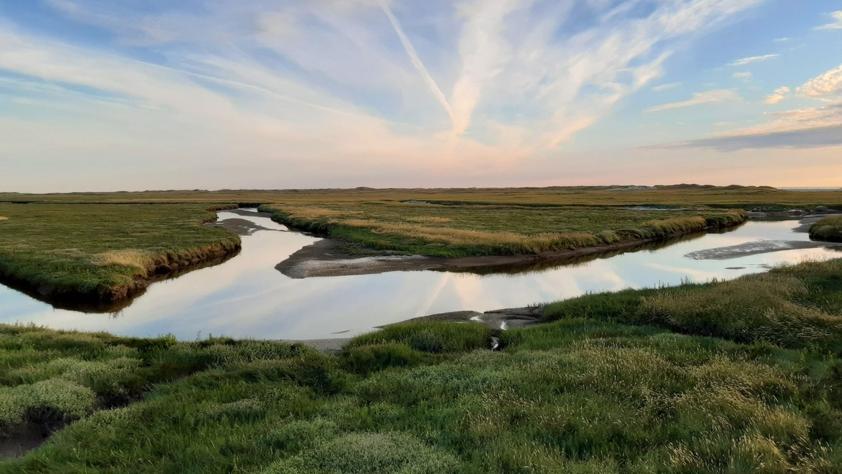
A living shoreline protects an eroding coast with native plants and other natural materials, sometimes supported by oyster reefs, rock sills, or anchored wood. It keeps a working connection between land and water while slowing waves and holding sediment. The approach is mainly designed for sheltered coasts such as bays, estuaries and tributaries, where wave energy and local conditions suit the design.
NOAA’s plain-language definition emphasizes both stabilization and natural materials. A successful project is therefore more than a planted strip beside the water. It requires the plants and elevations, together with structural elements and drainage, to fit the site closely enough to resist erosion while maintaining habitat.
What a living shoreline contains
At the softest end of the design range, a project may restore tidal marsh plants on a gently sloping bank. Their stems reduce the force of small waves, while roots bind soil near the surface. As tides carry suspended sediment through the vegetation, some particles settle and add material to the marsh. Native vegetation also gives small fish and invertebrates places to feed or shelter.
Sites with greater wave exposure may need a hybrid design. A low rock sill placed offshore can reduce incoming wave energy before it reaches newly planted marsh. In regions where oysters naturally occur, constructed oyster reefs can serve a similar protective role while creating hard habitat. Coir logs, made from coconut fiber, are sometimes used as temporary biodegradable support while plants become established.
The word “living” describes the project’s reliance on ecological components that can grow and respond over time. Living components can coexist with rock, wood and other structural material. NOAA’s broader design guidance includes natural soft elements combined with harder features when added stability is necessary.
Plant zones follow elevation because flooding tolerance changes over just a few inches. Species suited to the low marsh may endure daily saltwater immersion, while plants higher on the bank experience shorter flooding. Designers often survey a nearby natural reference marsh to identify useful elevations and species. A wrong elevation can drown plants or leave them too dry, so careful grading is as important as the planting list.
How it reduces erosion
Erosion occurs when waves, currents, runoff, or changing water levels remove sediment faster than it is replaced. A living shoreline addresses several parts of that process. Vegetation creates friction that slows water near the ground and roots strengthen the soil. A sill or reef can also make waves break farther from the bank. The remaining wave reaches shore with less energy available to carry sediment away.
Marsh width and plant density influence performance. NOAA reports that 15 feet of marsh can absorb about half of incoming wave energy, though real results depend on water depth, vegetation and wave conditions. During high water, a wide marsh also provides space for water to spread rather than striking a vertical wall directly.
A vertical bulkhead reflects wave energy and can increase scour near its base or along adjacent shores. It also fixes the boundary between land and water. A living shoreline uses a graded edge, so shallow-water habitat can remain connected to the upland. Research summarized by NOAA coastal scientists supports using the softest feasible technique for each setting.
Project performance is measured against a goal, such as reducing the annual rate of bank retreat. Repeated shoreline surveys, fixed photo points and elevation measurements reveal whether sediment is accumulating or disappearing. Habitat monitoring may count plants, oysters, fish, or invertebrates. A shoreline that remains visually green can still lose ground at one end, which is why measurements should cover the entire footprint.
Benefits beyond bank protection
A restored marsh creates intertidal habitat that rises and falls with the tide. Juvenile fish, crabs, shellfish and shorebirds can use different portions of this transition zone. Oyster structures add crevices and feeding surfaces. Compared with a bare wall, the result usually supports a more varied coastal community.
Vegetated shorelines can trap suspended sediment and take up nutrients carried by runoff. Marsh soils also store carbon in roots and accumulating organic matter. Benefits vary with project size, water circulation and long-term maintenance, so a small installation should not be credited with solving a whole bay’s pollution or flood risk. Its value lies in combining local protection with ecosystem services at the same site.
Public access can be incorporated through carefully placed paths, small beaches, or kayak landings where erosion controls allow it. The access design must avoid trampling new vegetation and concentrating runoff. In developed neighborhoods, a living edge may also make gradual water-level changes easier to see than a wall does, helping residents connect shoreline maintenance with the health of the adjoining estuary.
Where the approach works best
Living shorelines are most often used along sheltered waters, rather than exposed ocean beaches. Designers examine wave energy, fetch, boat wakes, currents, bank slope, sediment type, tidal range and expected water levels. A quiet creek may support vegetation alone. A busy estuary might need a sill, reef, or breakwater to give plants enough protection.
Open coasts with heavy surf may exceed what a typical living shoreline can withstand. Narrow lots, deep water close to shore, navigation channels, contaminated sediment and rapidly eroding bluffs can also limit the available options. The presence of healthy nearby marsh is useful evidence that suitable plants can survive locally, although it does not replace an engineering and habitat assessment.
Future sea level deserves special attention. A marsh can build elevation when it traps enough sediment and organic matter, yet it also needs room to migrate landward as water rises. A road or wall immediately behind it can create coastal squeeze. Designs that reserve transition space have a better chance of retaining habitat through changing conditions.
Planning, permits and maintenance
Planning starts with a survey of the erosion problem and the forces acting on the site. After comparing alternatives and setting measurable goals, practitioners select native species suited to the elevation and salinity. They also check property boundaries, public access, buried utilities and effects on neighboring shorelines. A plan may require drawings that show grading, plant zones and the location of any fill or structures.
Work below the ordinary high-water line often requires local, state, or federal authorization. In the United States, permits can involve state coastal agencies and the U.S. Army Corps of Engineers. Requirements differ by location, so early contact with regulators is practical. NOAA’s project examples also show why regional experience matters: marsh species and construction methods that suit North Carolina may be inappropriate in the Pacific Northwest.
Installation is followed by monitoring. Crews look for plant survival, bare patches, erosion around sill ends, movement of structural material, invasive species and trapped debris. Replanting or small repairs are common during establishment. After major storms, inspections reveal whether water cut a new channel or undermined part of the project. Adaptive maintenance lets managers correct a local weakness before it grows.
The best choice is site-specific. A living shoreline can provide durable erosion control and richer habitat when the coast offers suitable space and energy conditions. Where the exposure is too severe, a different method or carefully engineered hybrid may be safer. Design teams also need a maintenance budget and a clear responsibility for inspections, since plants, sills and access points can require different care as the site develops. The central decision is whether natural processes can be recruited to protect the shore without transferring unacceptable risk elsewhere.
Related reading: how ocean waves form and spring tides and neap tides.





