
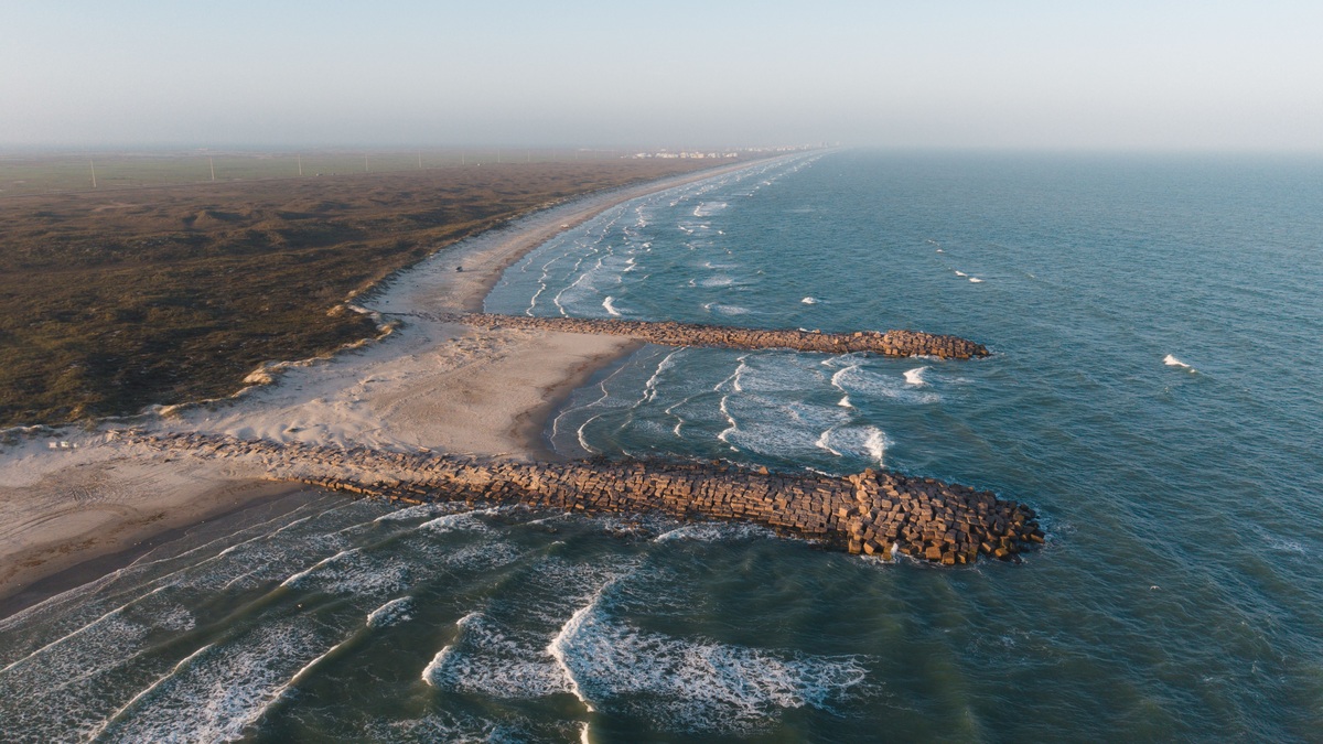
A barrier island is a long, narrow body of sand that runs roughly parallel to a mainland coast and is separated from it by a bay, lagoon, marsh, or tidal creek. Waves, tides, wind and storms continually rearrange its sediment. The island acts as a mobile buffer that absorbs ocean energy before it reaches sheltered water and the mainland.
NOAA’s barrier island explanation emphasizes movement: islands erode, grow, migrate, breach and sometimes disappear. Their changing form supports dunes, beaches, tidal flats, maritime forest and salt marsh. The same mobility that creates valuable habitat also makes permanent buildings and roads difficult to defend.
A barrier island is part of a wider barrier system, not an isolated pile of sand. Its ocean beach exchanges sediment with the nearshore seabed. Tidal inlets link the sea to back-barrier water and marshes collect fine material on the sheltered side. A change in one compartment can alter the others, so scientists follow sand across the whole profile instead of judging condition from the beach width on one day.
How sand builds an island offshore
Barrier islands need abundant sediment, a gently sloping coastal plain and waves capable of moving sand alongshore. Several formation models apply in different places. Offshore bars may grow upward, spits can lengthen and become separated from land, or rising sea level can flood low terrain while beach ridges remain exposed.
Waves approach the beach at an angle and generate longshore transport, moving grains along the coast. Tidal inlets interrupt the chain and exchange water between ocean and lagoon. Flood and ebb currents build shoals on either side. River deltas may supply new sediment, although dams and levees can reduce the amount that reaches the coast.
Barrier chains are common along the low-relief Atlantic and Gulf coasts of the United States. The steep, rocky Pacific coast has less of the broad sandy terrain needed for extensive chains. Local geology, wave direction, tidal range and sediment supply explain why islands flourish on one shoreline and remain absent from another.
Formation models describe plausible pathways, but one island may preserve evidence of several. Sediment cores reveal old marsh mud beneath beach sand, a sign that the barrier migrated over its back-barrier environment. Buried tidal channels mark former inlets. Shell ages and sand layers help establish timing. These records allow geologists to test whether a ridge grew from an offshore bar, detached from a spit, or remained as water flooded the surrounding terrain. Regional geology decides which explanation fits.
Storms move sediment across the island
During calm periods, waves return sand to beaches and wind carries dry grains inland, where grasses help build dunes. A storm raises water level and sends larger waves against that dune line. Sand eroded from the beach may settle offshore, travel along the coast, or wash across the island.
Overwash occurs when waves and surge carry sand over dunes into the island interior or back-barrier marsh. The deposit can raise land behind the beach and move the island landward. A severe storm may cut a new inlet. Later currents either keep the channel open or fill it, depending on the volume of tidal exchange and available sediment.
Migration is part of a barrier island’s natural response to rising water. Holding the oceanfront fixed with seawalls can prevent sand from moving landward and may narrow the beach. Beach nourishment adds sediment, while dune planting traps windblown sand. Each intervention changes transport and requires repeated assessment.
A USGS modeling study found that increased sea level and storminess can produce narrowing, flattening, breaching, or combinations of those responses. No single outcome fits every island. Elevation, storm sequence, recovery time and sediment pathways all influence the next shoreline position.
Post-storm recovery draws sand from several stores. Fair-weather waves may carry part of an offshore bar back toward the beach and wind moves dry grains into dunes where vegetation slows them. Recovery can take months or years. If another storm arrives first, the island begins from a lower profile and may overwash more readily. A sequence of moderate events can therefore produce a different result than one isolated severe storm.
Natural protection has clear limits
Beaches and dunes absorb wave energy through erosion and friction. Sheltered marshes can further slow water. Communities behind a wide island often experience lower waves than an exposed shoreline, yet a barrier does not eliminate storm surge. Low sections can flood while inlets funnel fast currents; surge may also enter a bay from several directions.
Ecological zones also share the load. Dune grasses hold loose surface sand and marsh plants reduce small waves; oyster reefs may limit edge erosion in suitable water. Protecting connected habitats preserves more functions than treating the island as a single ridge. NOAA supports natural infrastructure projects that restore islands and adjacent estuary habitat.
Development changes risk. Buildings add weight and hard surfaces while roads interrupt dunes; repeated rebuilding encourages attempts to immobilize the coast. Evacuation routes can be cut by overwash. Good planning uses elevation data and storm history, limits construction in active zones and leaves room for shoreline movement.
Protection is also directional. A barrier can reduce ocean waves reaching a lagoon while doing little to prevent water-level rise driven by regional surge, wind inside the bay, or river flooding. Inlets may carry surge into sheltered water and bridges or causeways can constrain flow locally. Hazard maps therefore model wave attenuation, flooding depth, current speed and evacuation access separately instead of treating the island as a solid wall.
Why barrier islands remain valuable habitat
The ocean-facing beach provides nesting space for sea turtles and shorebirds. Dunes support plants adapted to salt spray and burial. Protected flats and marshes behind the island serve as feeding or nursery areas for fish and shellfish. Small changes in height and flooding produce a surprising range of conditions across a narrow strip of land.
Human actions far inland can influence that habitat. Dredging changes channels while dams trap river sediment; boat wakes erode marsh edges. Sea-level rise increases the water depth storms begin with, while stronger rainfall can alter inlet flows. Managers therefore track whole sediment systems instead of focusing only on an eroding beachfront.
Restoration can place sand where natural supply has been lost, rebuild dunes, or reconnect tidal flow. Monitoring then checks island elevation, vegetation, nesting activity and movement after storms. The practical goal is resilience, meaning the barrier can change while continuing to support wildlife and reduce some coastal hazards. A healthy barrier island survives through motion, not by holding one permanent outline.
Remote sensing makes that motion measurable. Repeated aerial photographs and satellite images trace the shoreline, while lidar records dune and island elevation. Sonar maps the submerged shoreface where much of the sand is stored. Field crews verify sediment size and vegetation. Together, these observations produce a sediment budget, an accounting of gains, losses and transfers that helps managers determine whether nourishment or restoration is addressing the actual shortage.
Ecological timing affects construction choices. Sand placement during nesting can bury eggs or block access and sediment with the wrong grain size may change the beach used by turtles or invertebrates. New dunes can protect habitat but also alter overwash that some early-successional species need. Project monitoring therefore includes biological response alongside shoreline position, with adjustments when a physical gain creates an unintended habitat cost in the chosen coastal setting.
Related reading: ocean-floor topography and the difference between an ocean and a sea.





