
A map of New Mexico’s major rivers shows several continental drainage systems. The Rio Grande and Pecos River drain toward the Gulf of Mexico. The Canadian River belongs to the Arkansas-Mississippi system, while the San Juan and Gila rivers are part of the Colorado River Basin. Interior basins in the south and west have no outlet to an ocean.
The main named rivers are the Rio Grande, Pecos, Canadian, San Juan and Gila, with the Rio Chama, Animas, Cimarron and San Francisco serving as important tributaries. The New Mexico Office of the State Engineer basin map places those channels within the Upper Colorado, Lower Colorado, Rio Grande, Pecos, Arkansas-White-Red and Texas Gulf drainage regions.
The Continental Divide organizes western drainage
The Continental Divide crosses western New Mexico. Water on its western side generally enters the Colorado River system through the San Juan, Gila or their tributaries. East of the divide, local topography sends water toward one of several networks. It may join the Rio Grande or Pecos, while northeastern drainage enters the Canadian.
The divide is a ridge or line of high ground, not a river boundary marked by one channel. Smaller basin divides branch away from it. Closed basins can occur on either side where water ends in a playa, wetland or groundwater system instead of reaching the sea.
River lines on a state map also do not imply continuous visible water. New Mexico’s climate creates reaches that flow all year beside others that run only seasonally. Geology can produce ephemeral channels within the same broad drainage network.
Rio Grande crosses the center of the state
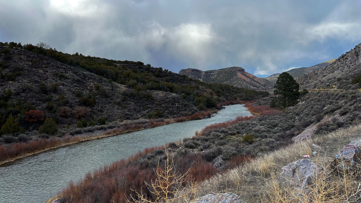
The Rio Grande enters northern New Mexico from Colorado and flows through the Rio Grande Gorge. Its southward route passes Española and Albuquerque before continuing through Socorro toward Las Cruces. It then forms the Texas-Mexico boundary before reaching the Gulf of Mexico.
The river’s central corridor links mountain headwaters with desert basins. Its floodplain has supported farming and settlement for centuries, while dams now divide the flow into managed reaches.
Mountain snowmelt supplies much of the northern flow. Reservoir operations, irrigation diversions, groundwater exchange and summer thunderstorms alter discharge farther south. A USGS regional description notes perennial flow through most of Colorado and New Mexico, while also identifying broad basins and narrow valleys along its route.
The Rio Chama joins the Rio Grande north of Española and supplies water from the southern San Juan Mountains. The Rio Puerco enters farther south after draining an erosion-prone basin west of Albuquerque.
Pecos River belongs to the Rio Grande system
The Pecos River rises in the Sangre de Cristo Mountains east of Santa Fe. It flows south through eastern New Mexico before passing Santa Rosa and Roswell. The river then enters Texas, where its eventual confluence with the Rio Grande lies near the international border.
Because the Pecos joins the Rio Grande, both belong to the same ultimate Gulf of Mexico drainage. State water planning often treats the Pecos as a major basin of its own because its tributaries, aquifers and management issues form a large distinct system.
Snowmelt supports headwater flow. Downstream timing responds strongly to reservoir releases and irrigation. In one dry reach, groundwater may sustain the channel; elsewhere the river loses water into the aquifer.
Canadian River flows east toward the Mississippi
The Canadian River begins in Colorado and enters northeastern New Mexico. It curves south before flowing east into Texas. Beyond New Mexico it crosses Oklahoma and joins the Arkansas River, which reaches the Mississippi.
Its canyon and reservoir landscape differs sharply from the broad Rio Grande valley. Tributaries drain the high plains as well as mountain country near the Colorado border.
The Cimarron River of northeastern New Mexico belongs to the Canadian system. Conchas Reservoir impounds the Canadian east of its confluence with the Mora River, while Ute Reservoir lies farther downstream near Logan.
A USGS hydrologic summary identifies the Canadian as New Mexico’s major east-flowing river and distinguishes it from the south-flowing Rio Grande and Pecos. Its ultimate outlet is the Gulf of Mexico through the Arkansas and Mississippi, not the Rio Grande.
San Juan River drains the northwest
The San Juan River enters northwestern New Mexico from Colorado and flows west through the Farmington area into Utah. It joins the Colorado River at Lake Powell. The basin therefore drains toward the Gulf of California, although dams and water use mean river water does not always reach the sea.
The Animas River flows south from Colorado and joins the San Juan at Farmington. The La Plata River is another cross-border tributary. Navajo Reservoir stores water on the San Juan upstream of the main New Mexico population corridor.
USGS sampling maps show San Juan and Animas watershed sites alongside stations in New Mexico’s other major basins. Their northwest direction contrasts with the Rio Grande even though the headwaters are separated by mountain divides only a few regions away.
Gila River carries southwestern drainage west
The Gila River forms in the mountains of southwestern New Mexico and flows west into Arizona. It joins the Colorado River near Yuma. Downstream diversion and arid conditions can leave parts of the lower system dry, but the mapped watershed still belongs to the Colorado Basin.
The San Francisco River begins in western New Mexico and joins the Gila in Arizona. Both systems support riparian habitat through rugged mountain and desert terrain. Flow can rise quickly during summer thunderstorms.
The Gila’s headwaters retain long free-flowing reaches. River status changes downstream, so “perennial river” should never be assumed to mean continuous surface flow along every mile.
Closed basins do not reach an ocean
Parts of New Mexico drain internally. The Mimbres River begins in mountains north of Silver City and flows toward the desert basin near Deming, where surface water commonly disappears into sediment or ends in closed depressions.
The Tularosa Basin between the Sacramento and San Andres mountains is also closed. Runoff moves toward low playas such as Lake Lucero rather than joining the Rio Grande. The Estancia Basin and Plains of San Agustin provide other interior drainage examples.
These basins show why the Continental Divide cannot be treated as the only hydrologic boundary. Local topography may enclose water before it reaches either side’s major river.
Perennial, intermittent and ephemeral describe flow
A perennial reach normally carries water throughout the year, although drought can still interrupt it. An intermittent reach flows during certain seasons or when groundwater is high. An ephemeral channel carries runoff directly after rain or snowmelt and usually lies above the water table.
A classic USGS statewide overview notes that most perennial streams drain high country and receive snowmelt, while many southern channels are ephemeral. It also warns that a large river described as perennial locally may have long dry sections.
Map symbology should therefore be read with gauge data and current conditions. The New Mexico Department of Game and Fish interactive waters map provides access and fishing information, but a recreation map serves a different purpose from a watershed boundary map.
Watersheds explain each river’s destination
A watershed includes every slope draining to a common outlet. The parts of a river describe tributaries and confluences, while major world drainage basins place New Mexico’s systems in continental context.
River erosion cuts canyons, while deposition builds floodplains and alluvial valleys explored in river landforms. Human diversions may move water between basins, but the natural watershed boundary remains a topographic concept.
The USGS New Mexico streamflow network provides current gauge observations. A gauge represents one cross-section, so it should be paired with basin maps before drawing conclusions about an entire river.
The New Mexico regional water-planning program organizes management around distinct regions whose boundaries may follow political needs as well as hydrology. A planning region should not automatically be mistaken for a natural watershed.
New Mexico’s map is therefore a junction of several destinations. Central and eastern water ultimately drains to the Gulf of Mexico through different networks, western rivers belong to the Colorado system and closed basins retain water within the state or neighboring interior valleys.





