
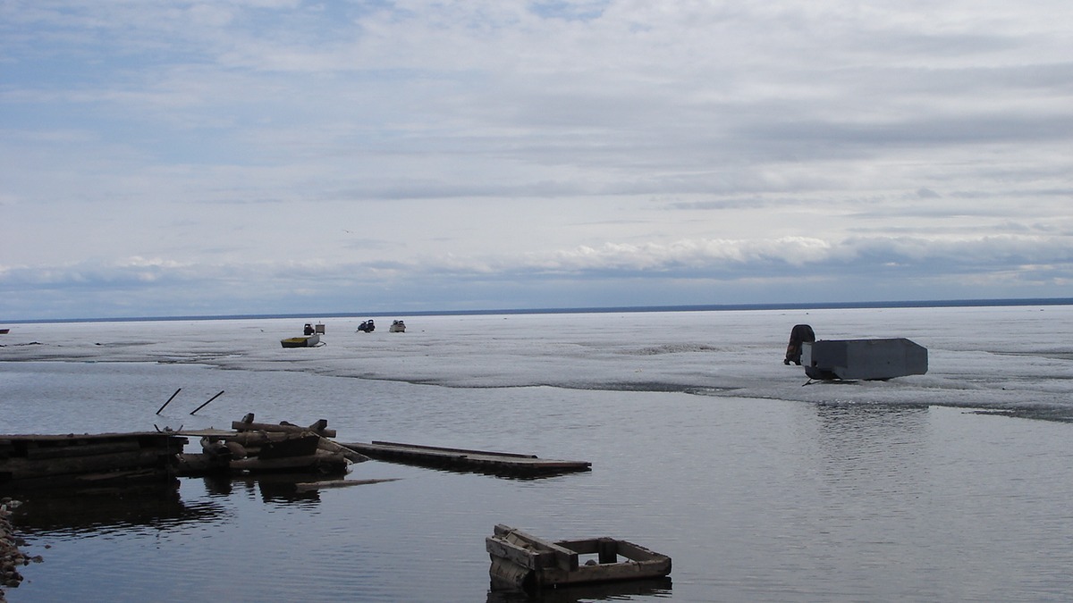
Great Bear Lake reaches a recorded maximum depth of 446 meters, or about 1,463 feet. That deepest known water lies in McTavish Arm near Port Radium, on the lake’s eastern side. The figure describes a measured maximum, not a typical depth across the enormous lake.
Canada’s official sailing directions say Great Bear Lake has not been surveyed throughout but is known to contain depths of 446 meters. A federal summary of major lakes gives a much wider published range of 137 to 445 meters, illustrating how older compilations and incomplete bathymetry can disagree. Modern limnological work consistently uses 446 meters as the best-supported recorded maximum.
Maximum depth compared with average depth
Great Bear Lake’s mean depth is about 72 meters, or 236 feet, according to a 2024 study of its seasonal circulation. The average is far shallower than the deepest point because much of the lake consists of broad shelves and basins outside the sharply descending McTavish Arm. A single maximum cannot describe the experience of the whole lake.
Mean depth is calculated from total volume and surface area, while maximum depth comes from the deepest reliable sounding. Great Bear Lake covers about 31,153 square kilometers and holds roughly 2,236 cubic kilometers of water. Those dimensions make it the largest lake entirely within Canada by surface area. Shared lakes such as Superior are larger, but their shorelines cross an international border.
For scale, 446 meters is more than four times the lake’s approximate mean depth. It is also deeper than the maximum depth of Lake Superior. Great Bear remains much shallower than Lake Baikal and Lake Tanganyika, which descend beyond 1,400 meters. The comparisons are most useful when all figures refer to maximum depth rather than mixing maximum and mean measurements.
Why official figures sometimes differ
The Government of Canada’s table of major lakes lists Great Bear Lake’s maximum depth as a range from 137 to 445 meters. The low end does not represent the accepted deepest point in current lake research. It reflects the table’s decision to present ranges gathered from differing references, just as the same table gives broad ranges for several other very large lakes.
An older 1967 paper reported 542 meters, another reminder that early sounding records require caution. Later bathymetric work and Canadian navigation guidance settled on a recorded depth near 446 meters. Because the lake remains incompletely surveyed, careful wording is appropriate: 446 meters is the deepest recorded depth, not a guarantee that every part of the bottom has been mapped closely enough to rule out a slightly deeper pocket.
Depth can also be presented relative to a changing water surface or a fixed chart datum. Great Bear Lake’s annual level varies by roughly 0.3 meter in the sailing directions, a small amount compared with its maximum depth but enough to change a sounding slightly. Rounding then produces 445 or 446 meters in different publications.
A lake with five long arms
Great Bear Lake does not form one simple oval basin. Five major arms radiate from a central body: Keith, Smith, Dease, McTavish and McVicar. The arms differ in depth, shoreline geology and exposure to river inflows. A Northwest Territories study of cisco diversity explains that each arm is large enough to function in some respects like a distinct water body.
McTavish Arm contains the deepest recorded point and meets the hard rocks of the Canadian Shield. Western parts of the lake border the softer sediments of the Interior Plains. Ice sheets widened and deepened preglacial valleys during the Pleistocene, while postglacial rebound continued to alter the surrounding land after the ice melted.
The complex outline also creates a very long shoreline. Published totals vary depending on whether island shorelines are included, but a figure near 2,700 kilometers is commonly used for the mainland shore. Surface area, shoreline length and catchment area answer different geographic questions and should not be substituted for one another.
Where Great Bear Lake is located
The lake lies in Canada’s Northwest Territories and straddles the Arctic Circle. Délı̨nę, on the western shore, is the only permanent community directly on the lake. Great Bear River drains from Keith Arm toward the Mackenzie River, placing the lake within the vast Mackenzie drainage network that ultimately reaches the Arctic Ocean.
Two peninsulas on the western side, Saoyú and ʔehdacho, total 5,550 square kilometers and hold deep cultural meaning for the Sahtúgot’ı̨nę. The Northwest Territories conservation profile describes them as teaching, healing and spiritual places that are cooperatively managed with Délı̨nę organizations and Parks Canada.
The wider watershed forms the Tsá Tué Biosphere Reserve, recognized by UNESCO in 2016. Indigenous governance is central to its protection. Great Bear Lake is therefore more than a remote physical feature: it is homeland, a source of food and a body of water with legal and cultural relationships that long predate modern depth surveys.
Cold water, ice and seasonal mixing
At such a high latitude, Great Bear Lake spends much of the year under ice. Its large heat capacity delays both freeze-up and breakup. Even in summer, much of the offshore water stays cold. Researchers describe it as a hybrid polar lake because different regions can follow different seasonal mixing patterns.
Wind transfers heat and momentum into the surface. In some areas, density differences keep layers partly separated; in others, cooling and wind mix water more deeply. The 2024 circulation study used temperature moorings across multiple arms to show that one label for the entire lake can conceal important regional behavior.
Depth influences how rapidly heat reaches the bottom and how long water remains in the basin. An estimated bulk residence time of roughly 130 years means that a water molecule may remain in Great Bear Lake for many decades before leaving through Great Bear River. Residence time is a lake-wide estimate, so circulation within a particular bay or arm can be much faster.
Life in a deep Arctic lake
Great Bear Lake is ultra-oligotrophic, meaning it contains very low concentrations of nutrients and supports relatively low biological production. Its water can be remarkably clear, yet clarity does not imply an empty ecosystem. Lake trout, Arctic grayling, cisco and other cold-water fish occupy habitats that vary among the five arms.
Scientists have documented unusual diversity within closely related cisco forms and lake trout body types. Differences in prey, depth and habitat allow fish using the same lake to follow distinct ecological strategies. The International Lake Environment Committee profile notes that Great Bear has fewer fish species than might be expected from its immense size, partly because latitude limits regional species richness.
The deepest water is dark throughout the year, but depth alone does not make it lifeless. Oxygen conditions, food supply and bottom substrate determine which organisms can persist. Great Bear’s cold, relatively unproductive character contrasts with the warmer and far more species-rich Lake Tanganyika. The Lake Tanganyika profile shows how two very deep lakes can support strikingly different ecosystems.
How Great Bear compares with other freshwater giants
Great Bear ranks among the world’s largest freshwater lakes by both surface area and volume. Its size is the main reason it appears alongside Superior, Victoria, Huron and Tanganyika in global tables. Ranking shifts when a table counts saline waters such as the Caspian Sea or uses area excluding islands.
Depth produces another order. Great Bear’s 446-meter recorded maximum is deeper than Superior’s roughly 406 meters but shallower than Great Slave Lake’s 614 meters. Readers can compare the measurement with Lake Superior’s depth and review the world’s largest freshwater lakes without confusing area with depth.
The clearest concise answer remains 446 meters, or about 1,463 feet, at the deepest recorded point. The accompanying qualifier is essential because Great Bear Lake’s floor has not been mapped everywhere at modern high resolution. Its average depth of about 72 meters and the sharply varied five-arm basin explain why a single number tells only one part of the lake’s geography.
Plan a Great Bear Lake fishing trip
Continue with Great Bear Lake fishing species, rules and season.





