
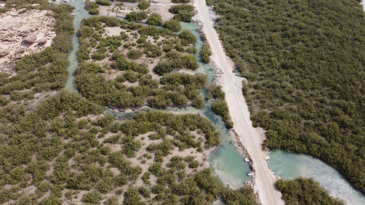
Coastal blue carbon is carbon captured and stored by tidal wetlands and shallow coastal ecosystems. Salt marshes, mangrove forests and seagrass meadows are the core habitats usually included. Plants remove carbon dioxide through photosynthesis and a large share of the carbon accumulates below ground in waterlogged soil and sediment.
The term focuses attention on climate benefits that can accompany coastal conservation and restoration. It does not mean every carbon atom in the ocean can be counted as a manageable blue-carbon credit. Reliable accounting requires a defined habitat, a defensible baseline and measurements of several greenhouse gases.
Where coastal blue carbon is stored
Mangroves and salt-marsh plants build leaves, stems and roots. Seagrasses grow below the water surface and trap suspended particles. When plant material dies, some is buried in sediment instead of decomposing immediately.
Waterlogged soils often contain little oxygen, slowing microbial breakdown. Fine sediment can keep accumulating around roots and rhizomes, burying organic matter more deeply. NOAA identifies salt marshes, mangroves and seagrass beds as coastal wetlands capable of storing large quantities of carbon through plant production and sediment trapping.
Most of the long-lived stock is commonly below ground. Aboveground vegetation is visible and important, yet storms, grazing and seasonal dieback can remove it quickly. Soil carbon may build for centuries where sediment continues to accumulate and erosion does not expose older layers.
How capture differs from storage
Carbon sequestration describes the rate at which carbon is added to a pool, while carbon stock describes the amount already present. A mature marsh can hold a large historical stock even if its current annual accumulation is modest. A young restoration site may be accumulating rapidly but still contain less total carbon.
Researchers measure vegetation, take soil cores and analyze carbon density at known depths. Dating methods estimate how quickly sediment accumulated. USGS blue-carbon mapping work combines field measurements with remote sensing to estimate aboveground tidal-marsh stocks across larger areas.
Carbon dioxide is only part of the balance. Fresh and brackish wetlands can emit methane, a strong greenhouse gas, because low-salinity flooded soils favor methane-producing microbes. Saltwater sulfate often suppresses methane production, though local emissions still need measurement.
A complete climate account uses carbon-dioxide equivalents over a stated time horizon. It includes gains in biomass and soil, losses through erosion or decomposition and emissions of methane or nitrous oxide. Leaving out an unfavorable term can exaggerate a project’s benefit.
Why habitat loss releases climate value
Draining a wetland brings oxygen into previously saturated soil. Microbes then break down stored organic matter more rapidly and release carbon dioxide. Excavation and erosion can export carbon-rich sediment, while clearing vegetation stops future capture.
The release does not necessarily occur all at once. It can continue for years after hydrology changes. Sea-level rise may drown a marsh that cannot build elevation or migrate inland, while coastal development can block that migration.
Protecting an intact site avoids the risk of disturbing a large existing stock. Restoration may resume sequestration and reduce continuing emissions from degraded soil. The two strategies are related but should not be treated as identical climate outcomes.
Disturbance can also move carbon sideways into adjacent water. Some exported organic carbon is decomposed and returned to the atmosphere, while some is buried elsewhere. Measuring only the project parcel may miss this lateral transport, so researchers use water sampling and sediment budgets alongside soil cores.
Benefits beyond carbon
Mangrove roots, marsh vegetation and seagrass blades create habitat for fish and invertebrates. Their physical structure slows water, stabilizes sediment and can reduce wave energy. These services help fisheries, wildlife and coastal communities regardless of the exact carbon price.
Mangroves protect coasts and sustain life through several connected mechanisms. Carbon storage is one, while nursery habitat and shoreline protection are separate benefits that should be measured in their own terms.
Multiple benefits can make restoration more resilient as policy. A project may remain worthwhile even if its carbon estimate changes after better sampling. Conversely, a high carbon estimate does not excuse damage to biodiversity or local access.
Water quality can improve where vegetation traps sediment and absorbs nutrients, but results depend on incoming loads and water exchange. No marsh can indefinitely absorb unlimited pollution. Restoration plans should address the watershed sources that created the stress.
What counts in a blue-carbon project
A credible project defines its boundary and asks what would happen without intervention. If a marsh was already protected and likely to remain intact, claiming all its future storage as newly caused by a project would overstate additionality. If a threatened site avoids drainage because of funded protection, the counterfactual may be different.
Projects also address permanence. A storm, fire, erosion or policy reversal can release stored carbon. Buffer areas, long-term monitoring and plans for landward wetland migration can reduce risk, though no natural system is guaranteed permanent.
Sea-level rise creates both opportunity and risk. More frequent flooding can slow decomposition and deliver sediment, yet excessive inundation can kill vegetation if elevation gain cannot keep pace. A wetland able to migrate inland may preserve habitat while one confined by a seawall loses area.
Leakage occurs when protection displaces damaging activity elsewhere. Standards use monitoring, verification and conservative deductions to manage these uncertainties. NOAA’s coastal blue-carbon report describes agency work connecting research, restoration and accounting.
Restoration technique changes the result. Reopening tidal flow can reduce carbon dioxide emissions from drained soil, while planting without restoring hydrology may fail. Managers monitor vegetation, elevation and greenhouse-gas exchange because a site can look green before its soil processes recover.
Freshwater, open ocean and the meaning of blue carbon
The phrase is sometimes used broadly for carbon across coastal and marine systems. USGS includes tidal freshwater systems and coastal-ocean processes in its blue-carbon research. International project methods, however, most often center on vegetated coastal habitats with measurable soil stocks.
Open-ocean phytoplankton absorb enormous amounts of carbon dioxide and deep-sea food webs receive part of that production. Yet attributing open-ocean storage to a local intervention is difficult. The carbon moves through currents, food webs and the biological pump over vast areas.
Definition follows the accounting purpose. A science discussion can examine all marine carbon pathways, while a restoration project needs boundaries and methods specific enough for verification. Readers should check which ecosystems a report includes before comparing its numbers.
How to evaluate a blue-carbon claim
Start with habitat and measurement. Does the claim concern salt marsh, mangrove, seagrass or another clearly named system? Does it report carbon stock, annual sequestration or avoided emissions? Are soil depth and greenhouse-gas terms stated?
Then examine time and comparison. A result based on one year cannot automatically describe a century. A restored site should be compared with a plausible no-project future, not only with a degraded plot chosen because it produces a dramatic contrast.
Uncertainty should be visible in the result. Soil depth, bulk density and carbon concentration vary across short distances, so a few cores cannot characterize a large estuary with equal confidence. Conservative estimates are a strength when decisions depend on verified tonnes. Repeated measurements reveal whether an apparent gain persists after seasonal vegetation changes and short-lived sediment deposition have passed.
Finally, look for ecological context. Argo’s guide to wetland landforms shows how water source and landscape position influence a wetland. Those physical differences affect sediment, salinity and carbon dynamics, so a rate from one coast should not be copied uncritically to another.
Coastal blue carbon remains a useful idea because it makes buried coastal carbon visible in conservation decisions. Its strongest applications combine careful greenhouse-gas accounting with the broader reasons these habitats deserve protection.





