
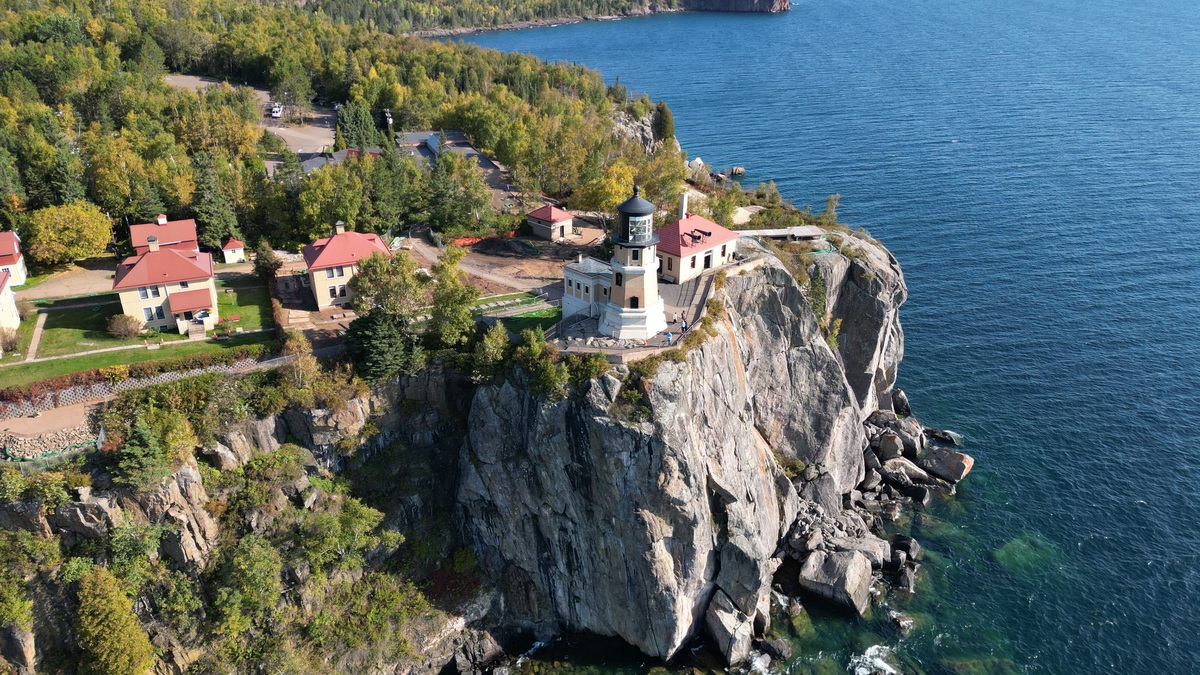
The Great Lakes span five enormous freshwater basins and thousands of miles of shoreline, so no single trip can cover their best-known places. The 15 attractions below represent all five lakes and include cliffs, islands, dunes, waterfalls, wildlife habitat and working maritime landmarks.
Seasonal access varies sharply. Ferries stop, trails close and Lake Superior weather can become dangerous with little warning. Use this list to choose a region, then confirm hours, permits and transport with the linked park or agency before leaving.
1. Pictured Rocks National Lakeshore
Pictured Rocks protects multicolored sandstone cliffs along Lake Superior in Michigan’s Upper Peninsula. The National Park Service says the park contains about 15 miles of cliffs across a 42-mile lakeshore, along with beaches, waterfalls and nearly 100 miles of trails.
Cliff views are strongest from the water, but Lake Superior is cold and conditions change quickly. Commercial boat tours offer a less exposed option than paddling. Hiking reaches formations such as Miners Castle and sections of the North Country National Scenic Trail.
2. Isle Royale National Park
Isle Royale is a remote Lake Superior archipelago reached by ferry, seaplane or private boat. Backpacking trails cross the main island, while protected harbors support paddling. The park’s official visitor information emphasizes the preparation required to reach this isolated archipelago.
The island is not a casual roadside stop. Transport reservations and overnight plans require preparation and the park closes to general visitation during winter. Argo’s look at islands in the Great Lakes places Isle Royale within the region’s wider island geography.
3. Apostle Islands National Lakeshore
Twenty-one islands and a section of Wisconsin mainland form Apostle Islands National Lakeshore. Visitors come for sandstone shorelines, lighthouses, camping and paddling. Mainland destinations provide alternatives when lake crossings are unsuitable.
The famous ice caves are a conditional winter phenomenon rather than a guaranteed annual attraction. Safe public access depends on lake ice and weather and the National Park Service announces the status. Summer sea-cave paddling also demands cold-water equipment and realistic judgment.
4. Sleeping Bear Dunes National Lakeshore
Sleeping Bear Dunes rises above Lake Michigan on the northwest coast of Michigan’s Lower Peninsula. The park combines beaches, forest, inland lakes and high bluffs, with the Pierce Stocking Scenic Drive providing several accessible viewpoints.
The Dune Climb is a managed recreation area, while steep bluff descents elsewhere can become exhausting and hazardous. Visitors should heed warning signs because climbing back up loose sand takes far more effort than descending.
5. Indiana Dunes National Park
Indiana Dunes protects 15 miles of Lake Michigan shoreline within reach of the Chicago region. Trails pass through beaches, dunes, oak savannas and wetlands. More than 350 bird species have been observed in the park, making migration seasons especially rewarding.
Lake Michigan conditions can resemble an ocean coast. Rip currents and cold water are serious risks even on a bright day. The park’s natural variety also connects directly with Argo’s overview of habitat loss in the Great Lakes.
6. Niagara Falls
Niagara Falls carries water from Lake Erie toward Lake Ontario through the Niagara River. Three principal falls form the spectacle: Horseshoe Falls, American Falls and Bridal Veil Falls. Viewpoints on both the Canadian and United States sides reveal different angles.
The falls belong to a regulated river system that also produces hydroelectric power. Walking paths, observation areas and boat excursions provide several ways to see the gorge, but border-crossing documents are necessary for visitors planning to experience both countries.
7. Mackinac Island
Mackinac Island sits in Lake Huron near the Straits of Mackinac, where Lakes Michigan and Huron meet. Ferries carry visitors to a community known for historic buildings, shoreline roads and the absence of ordinary private automobiles.
Mackinac Island State Park covers most of the island. Fort Mackinac interprets military and commercial history, while Arch Rock shows the island’s limestone geology. Bicycles and horse-drawn transport affect travel times during busy periods.
8. Soo Locks
The Soo Locks at Sault Ste. Marie raise and lower vessels between Lake Superior and the lower Great Lakes. The change in elevation is about 21 feet, which would otherwise interrupt navigation at the St. Marys Rapids.
A public viewing area on the Michigan side allows visitors to watch large freighters pass at close range. The U.S. Army Corps of Engineers operates the locks and vessel schedules remain approximate because weather and shipping operations control arrival times.
9. Bruce Peninsula National Park
Bruce Peninsula National Park occupies part of the limestone peninsula separating Georgian Bay from the main body of Lake Huron. Clear water, cliffs and sections of the Bruce Trail draw hikers to places such as the Grotto.
Parking reservations may be required at popular access points and cold water makes cliff jumping dangerous. The park also protects forest and alvar habitat, so its appeal extends well beyond one crowded shoreline formation.
10. Fathom Five National Marine Park
Fathom Five protects islands and waters off Tobermory at the entrance to Georgian Bay. Shipwrecks attract divers, while glass-bottom boat trips provide a view for visitors who remain above the surface. Flowerpot Island adds cliffs and sea stacks to the route.
Cold water can preserve wreck structures while increasing the consequences of diving problems. Qualified divers need the proper registration and equipment. Boat schedules depend on weather and island services are limited.
11. Thousand Islands
The Thousand Islands occupy the upper St. Lawrence River where water leaves Lake Ontario. The archipelago includes far more than a neat count of 1,000, with islands divided between Canada and the United States.
Boat tours emphasize channels, homes and landmarks such as Boldt Castle. Thousand Islands National Park protects several Canadian islands, but many sites require water transport. Border rules apply when an itinerary enters the other country.
12. Cuyahoga Valley National Park
Cuyahoga Valley National Park follows the Cuyahoga River south of Lake Erie between Cleveland and Akron. The Towpath Trail traces part of the historic Ohio & Erie Canal, while Brandywine Falls provides a short walk to a 60-foot waterfall.
The park demonstrates how a Great Lakes attraction can lie inland while remaining tied to the basin. Water from the Cuyahoga reaches Lake Erie at Cleveland. Rail excursions sometimes operate through the valley, but schedules should be checked separately.
13. Presque Isle State Park
Presque Isle curves into Lake Erie beside Erie, Pennsylvania. Beaches, lagoons and trails occupy a sandy peninsula continually reworked by waves and currents. Bird migration brings additional interest outside the main swimming season.
Beach openings depend on staffing and water conditions. Swimmers should use guarded areas and follow posted advisories. The peninsula’s dynamic sand also explains why shoreline management is an ongoing task.
14. Point Pelee National Park
Point Pelee projects into Lake Erie at the southern end of mainland Canada. Marsh boardwalks and forest trails cross a compact park renowned for spring and fall bird migration. The exact tip shifts as waves move sand.
Peak migration can bring large crowds, while storms or high water may restrict access to the point. The park’s wetlands support wildlife throughout the year. Visitors should remain on designated routes to protect sensitive habitat.
15. Great Lakes Shipwreck Museum
The Great Lakes Shipwreck Museum stands at Whitefish Point on eastern Lake Superior. Exhibits interpret regional navigation and losses including the 1975 sinking of the Edmund Fitzgerald. The light station location also overlooks a major shipping corridor.
Whitefish Point is important for migrating birds as well as maritime history. Its remote Upper Peninsula setting requires more driving than a city museum and seasonal hours apply. The surrounding water’s power becomes easier to understand after reading how the Great Lakes formed.
Together, these 15 places show why “things to do in the Great Lakes” is too broad for one quick circuit. Choosing one lake or shoreline region produces a better trip, with enough time for weather delays and the distance between attractions.
Planning and policy context appears in Argo’s Southeast Michigan lakes map, Ontario Great Lakes Protection Act explainer and Lake Superior rock-hunting beach guide.





