
Maine has thousands of lakes, yet clarity varies sharply from one basin to the next. A black-and-white Secchi disk may remain visible many yards below the surface in a deep, low-nutrient lake. In another lake, natural brown color or suspended sediment can hide the disk even when algae are scarce.
The ten waters below form an evidence-based selection rather than a permanent statewide ranking. High transparency measurements are supported by public monitoring records for each lake. Readers comparing regions can also explore the clearest U.S. lakes, along with separate lists for Minnesota and Michigan.
How these Maine lakes were selected
The starting point was the 2017 transparency survey published by Lakes of Maine, a Lake Stewards of Maine project that presents state monitoring data. Its graphic identifies 50 lakes with the greatest mean Secchi transparency measured that year. The list below favors well-documented examples from that set, including large public lakes and smaller ponds whose official records add important context.
A Secchi reading measures how deep an observer can follow a disk before it disappears. Maine DEP explains that its record covers more than 1,400 lakes, while annual late-summer sampling is often timed for the season when water quality is most stressed. Clarity alone is an incomplete measure of health because dissolved color and fine sediment also limit visibility. Sampling dates, stations and weather differ, so the numbering here organizes a curated selection rather than claiming a like-for-like scientific league table.
1. Pleasant Pond
Pleasant Pond in Caratunk and The Forks Plantation combines exceptional transparency with an unusually deep basin. The water-quality record reports 13.1 meters of mean Secchi transparency across its displayed monitoring summary. A Secchi depth of 13.1 meters is about 43 feet, well beyond the roughly 5.5-meter statewide average described in Maine lake-report guidance.
The official lake profile lists 1,037 acres of surface area and a maximum depth of 198 feet. Natural land covers 98 percent of the 500-meter shoreline buffer in the compiled landscape data, while impervious cover is only 0.2 percent. Such figures describe a watershed with limited hardened surface near the water, although they do not prove a single cause for every clarity reading.
2. Jordan Pond
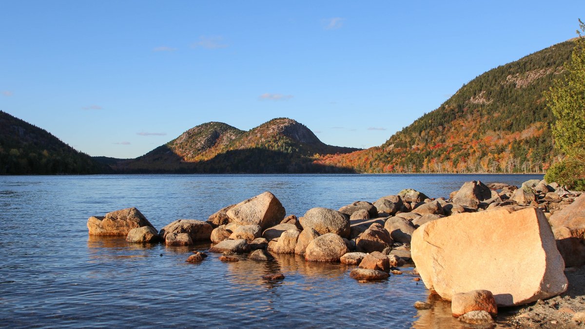
Jordan Pond supplies a striking Maine example of deep visibility. Lakes of Maine records a statewide high Secchi observation of 21.3 meters, about 70 feet, on May 27, 1999. A more recent Acadia National Park study reported mean transparency of 15.1 meters, with a 0.7-meter spread around that mean in the study summary.
The National Park Service assessment describes Jordan Pond as an oligotrophic drinking-water source with low nutrient concentrations. It covers about 76 hectares and reaches roughly 49 meters at its deepest point. Long-term transparency has become somewhat shallower since 1995, according to the same assessment, which shows why even exceptionally clear lakes need continuing observation.
3. Cold Stream Pond
Cold Stream Pond is a broad, deep water body near Enfield and Lincoln. A Maine DEP water-quality summary gives its main basin an average Secchi depth of 10.2 meters, or 33 feet, over the historical record covered by that report. Total phosphorus averaged 5 parts per billion, while chlorophyll-a averaged 1.6 parts per billion.
The lake overview lists 3,619 acres and a maximum depth of 104 feet. It also shows 94 percent natural land cover within 500 meters of shore and no known invasive aquatic plant infestation. DEP’s summary calls the water quality above average and rates the potential for nuisance algal blooms as low, based on the measurements available for the monitored basins.
4. Upper Cold Stream Pond
Upper Cold Stream Pond appears beside its larger namesake in Maine’s 2017 high-transparency group. The Burlington and Lincoln pond covers 648 acres and reaches 66 feet at its deepest measured point. Its two monitored basins make station choice especially important when comparing one year’s Secchi reading with another lake’s result.
Landscape data in the Upper Cold Stream profile show that natural cover occupies 96 percent of the 500-meter shoreline buffer. Developed land accounts for 4 percent, with 0.3 percent impervious surface. The profile also identifies a coldwater fishery and no known invasive aquatic plant infestation, giving readers useful context beyond the lake’s visual clarity.
5. Craig Pond
Craig Pond in Orland is much smaller than Cold Stream Pond, yet it ranked among the stronger 2017 Secchi performers. Two monitoring stations represent a basin of 229 acres. The depth map places the deepest soundings near 67 feet, enough depth for seasonal layering to influence temperature and oxygen conditions below the sunlit surface.
Lakes of Maine’s compiled fish record includes brook trout and lake trout, plus landlocked salmon. Fish presence does not measure clarity, though it helps describe the coldwater habitat associated with this clear pond. The 2017 statewide visualization remains the basis for Craig Pond’s inclusion because a single public summary value cannot represent every station and season.
6. Pleasant Lake
Pleasant Lake at Island Falls is the Aroostook County lake in this selection. Maine’s database contains several waters with the same name, so its MIDAS identifier, 1728, is essential for matching the record. The lake appeared high in the 2017 clarity visualization and its chemistry profile offers supporting clues about the character of the water.
The station-one chemistry summary reports average color of 6.3 standard platinum units and chlorophyll-a of 1.3 micrograms per liter. Epilimnetic total phosphorus averaged 6.1 micrograms per liter. Low dissolved color can allow a Secchi disk to remain visible deeper, while low chlorophyll indicates relatively little suspended algal pigment in the sampled water.
7. Basin Pond
Basin Pond in Fayette packs substantial depth into only 33 acres. Its official overview lists a 106-foot maximum depth and natural land occupies 97 percent of the shoreline buffer. A small surface area means a single monitoring station can describe much of the open-water basin, though year-to-year coverage remains uneven.
The Secchi history illustrates that uneven record clearly. One reading in 1984 reached 8.3 meters, while a 1999 reading reached 12.7 meters, or about 42 feet. Many intervening years show no value. Basin Pond therefore belongs in a curated clarity list, yet the gaps prevent a confident claim about its standing in every season.
8. West Grand Lake
West Grand Lake, also listed with Pug Lake and Junior Bay, shows that very large Maine lakes can retain high transparency. The lake spans 14,467 acres and reaches 128 feet. It also appeared near the top of the 2017 high-clarity set, even though different stations across such a large basin can produce different observations.
The current water-quality summary displays 6.9 meters of mean Secchi transparency across monitored sites, alongside total phosphorus of 4 parts per billion and chlorophyll-a of 1.9 parts per billion. The compiled record therefore contains low nutrient and algal measurements. Its multi-site summary values differ in scope from the annual values behind the 2017 visualization.
9. Clearwater Lake
Clearwater Lake lives up to its name in the monitoring record. Located in Farmington and Industry, it appears among the strongest waters in the 2017 Secchi visualization. Two stations cover a deep basin, allowing monitors to sample more than one part of a lake whose shape and depth can produce local differences.
The Clearwater profile lists 796 acres and a maximum depth of 129 feet. Natural land makes up 92 percent of the 500-meter shoreline buffer, while impervious surface occupies 0.6 percent. No invasive aquatic plant infestation is recorded in the profile. The watershed and basin data provide independent context beyond the lake’s unusually apt name.
10. Thompson Lake
Thompson Lake has a detailed monitoring record across several stations in southern Maine. The current Lakes of Maine summary reports 9.1 meters of mean Secchi transparency, equal to about 30 feet. Its displayed averages also include 5 parts per billion of total phosphorus and 2.4 parts per billion of chlorophyll-a.
The lake profile covers a 4,419-acre basin reaching 121 feet. Monitoring occurs at several stations, a useful safeguard for a lake with 32 miles of perimeter. Thompson’s presence near the lower end of the 2017 top-50 graphic also underscores the scale of Maine’s clear-water group: even the broader qualifying set contains lakes with transparency far above the state average.
Depth and clarity answer different questions. The Maine lake depth-map guide shows where official bathymetric charts can be found.





