
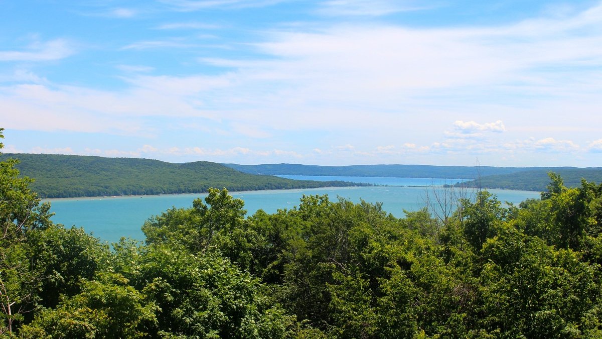
Michigan’s clearest inland lakes concentrate in the northern Lower Peninsula, where deep glacial basins and groundwater can produce striking blue water. Glen Lake, Torch Lake, Crystal Lake and several smaller northern lakes stand out in the state’s latest broad comparison. Their visibility still changes with weather, season and the material entering each basin.
This list uses the Michigan Lake Water Clarity Dashboard from the Michigan Department of Environment, Great Lakes and Energy. The order follows its satellite-derived July-through-September average for 2023, with a 100-acre minimum. Unnamed waters, reservoirs and mine ponds were excluded so the result answers a practical search for recognizable natural lakes.
Clearest has no permanent official statewide champion. The ten entries below are a transparent snapshot from one consistent dataset rather than a promise about what a swimmer will see on a particular afternoon. Readers comparing states can also consult the planned lists of the clearest lakes in the United States and clearest lakes in Minnesota.
How the lakes were selected
EGLE’s statewide dataset estimates clarity from Sentinel-2 satellite images for Michigan water bodies larger than 20 acres. The agency analyzed the ice-free months from May through October between 2018 and 2023, then displayed late-summer averages for July through September. Its 2023 measure is an estimated Secchi depth in meters. A larger value indicates that light penetrated farther into the water.
A field Secchi reading comes from lowering a white disk until it disappears. MiCorps volunteers normally take repeated readings over a lake’s deepest location because a single observation can be distorted by glare, waves or recent rain. Satellite estimates cover far more lakes, while field records remain valuable for trends. Dissolved color also darkens water even when algae and suspended sediment are scarce. Michigan’s Great Lakes monitoring uses other programs across vast, variable systems, so the four Great Lakes bordering the state were considered separately from this inland list.
1. Glen Lake
Glen Lake in Leelanau County had a 2023 late-summer satellite estimate of 7.68 meters, the highest result among the named natural lakes of at least 100 acres retained for this list. The same dataset places its surface area near 4,875 acres. Its six annual estimates from 2018 through 2023 ranged from 6.76 to 8.09 meters, showing both exceptional clarity and measurable year-to-year movement.
Local geology helps explain the blue appearance. The National Park Service describes Glen Lake as groundwater-fed and contrasts that supply with runoff carrying soil or dissolved organic matter. Clear water lets sunlight reflect from the pale sandy bottom. The lake was once connected to ancestral Lake Michigan before a sandbar enclosed it.
2. Torch Lake
Torch Lake in Antrim County registered an estimated 7.23 meters in the dashboard’s 2023 late-summer average. Its 2018-through-2023 annual values stayed between 6.42 and 7.33 meters. That consistency places a very large lake near the top of the statewide snapshot rather than limiting the leading positions to compact, sheltered basins.
EGLE’s dataset measures Torch Lake at roughly 18,736 acres, making it the largest water body in this selected group. Its depth and relatively low algal productivity help preserve long sight lines through the water column. Michigan DNR also identifies Torch among the state’s better-known cold, deep inland lake-trout waters. Clear water is an optical condition, however and does not by itself certify every aspect of water quality.
3. Crystal Lake
Benzie County’s Crystal Lake produced a 2023 late-summer clarity estimate of 7.18 meters. Its annual estimates were especially stable at the upper end of the dataset, ranging from 7.18 to 8.03 meters during the six covered years. EGLE maps the lake at about 9,876 acres, so its high visibility applies across another large northern basin.
The underlying EGLE dataset also provides estimates of chlorophyll and colored dissolved organic matter. Those measures help interpret the optical result because algae absorb light, while dissolved organic material can stain otherwise particle-poor water. Wind and suspended sediment add further variation, so the Secchi estimate remains the clearest basis for this particular comparison.
4. Blue Lake
The 108-acre Blue Lake identified in Kalkaska County reached an estimated 7.02 meters in the 2023 late-summer average. County and size are important because Michigan contains several waters with the same name. EGLE’s annual estimates for this particular basin rose from 5.76 meters in 2018 to the 2023 result, with lower values in some intervening years.
Blue Lake’s record illustrates why this is a dated ranking rather than a permanent label. Water transparency responds to the optical conditions captured during valid satellite passes and the annual average depends on observations that survive cloud and shoreline screening. Michigan DNR’s Kalkaska County lake maps distinguish Blue Lake from Big Blue Lake, North Blue Lake and Little Blue Lake.
5. Bear Lake
Kalkaska County’s 313-acre Bear Lake had a 2023 late-summer estimate of 6.96 meters. Its six-year series moved between 6.00 and 7.34 meters. The spread is large enough to change a lake’s place in any single-year table, yet every annual value remained high compared with most inland waters in the statewide display.
Bear Lake is another name that appears repeatedly across Michigan, so the county and approximate area identify the basin used here. The satellite value estimates how deeply a Secchi disk would remain visible. It does not mean the bottom can be seen at that depth everywhere. Bottom color, viewing angle and local water depth affect the scene observed from shore or a boat.
6. Twin Lake
The dashboard assigns Kalkaska County’s 209-acre Twin Lake a 2023 late-summer estimate of 6.75 meters. Annual estimates ranged from 5.82 to 6.85 meters over 2018 through 2023. A drop during one summer did not erase the longer pattern of high transparency, which is why several years of context are more informative than a single photograph.
Satellite methods treat the lake as a collection of valid water pixels rather than one point sampled from a boat. EGLE says its processing removes land, cloud shadows and other obstructed pixels before calculating monthly and seasonal summaries. Field monitoring can then test how well the broad estimate follows conditions at the deepest station through the summer.
7. Clear Lake
Clear Lake in Montmorency County recorded an estimated 6.74 meters for late summer 2023. Its six annual values stayed within a relatively narrow band from 6.40 to 7.33 meters. EGLE’s National Lakes Assessment record identifies the state-owned lake as 142 acres and 94.8 feet deep, while the separate satellite dataset uses a slightly different shoreline area.
EGLE’s live 2017 assessment records a 39.7-foot field Secchi depth from one visit conducted under approved quality-assurance procedures. It also measured chlorophyll a at 0.65 micrograms per liter and reported zero color on the APHA scale. The assessment classified Clear Lake as oligotrophic. One field visit cannot be compared directly with a three-month satellite average, but it independently documents unusually transparent water.
8. Higgins Lake
Roscommon County’s Higgins Lake had a 2023 late-summer satellite estimate of 6.61 meters. EGLE’s annual series varied from 6.47 to 7.22 meters. The state dataset gives an area near 10,193 acres, placing Higgins with Torch and Crystal among the unusually clear large basins in this selection.
Michigan DNR describes Higgins as a large spring-fed lake known for its clarity, while South Higgins Lake State Park provides public shoreline access. The agency says the lake stretches 7 miles and reaches 135 feet at its deepest point. Basin depth does not determine transparency by itself, although a deep lake can preserve cold-water habitat below the bright shallows seen from the park.
9. Avalon Lake
Montmorency County’s 386-acre Avalon Lake reached an estimated 6.25 meters in the 2023 late-summer average. Its annual results ranged from 5.86 to 6.91 meters across the dashboard period. The values keep Avalon among Michigan’s strongly documented clear inland lakes even though its position shifts when a different year is chosen.
Michigan DNR lists Avalon in its Montmorency County map collection and classifies it as a regulated trout lake in state fisheries orders. Cold-water fisheries often occur in deep, low-productivity basins, but fish rules are not a clarity measurement. Avalon’s placement here comes from EGLE’s optical estimate.
10. Smoky Lake
Smoky Lake, which straddles the Michigan-Wisconsin border in Iron County, closes this selected list with a 2023 estimate of 5.96 meters. The Michigan portion covers about 596 acres in EGLE’s data. Its annual late-season estimates rose from 5.04 meters in 2020 to the 2023 value, reinforcing the need to attach a year to any numerical comparison.
Michigan DNR includes Smoky Lake in its Iron County inland-lake maps and state fishery material identifies it as a border water. Its inclusion also shows that visible clarity extends beyond Michigan’s famous Lower Peninsula vacation lakes. For more Lake Michigan context, Argo’s related articles explain fish in Lake Michigan and how much water Lake Michigan holds.





