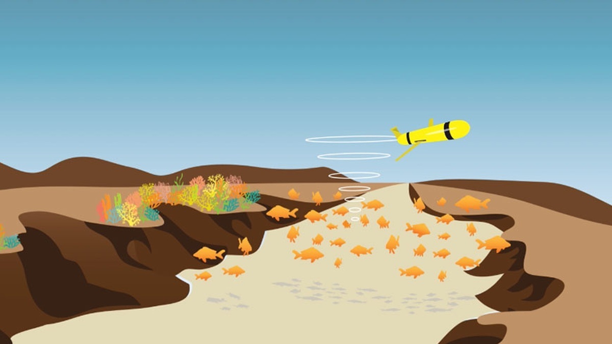
An ocean glider is a small autonomous underwater vehicle that changes its buoyancy to move up and down through the sea. Wings convert part of that vertical motion into slow forward travel, producing a repeated sawtooth path. The glider carries sensors, surfaces periodically for satellite communication, then continues a mission that can last days to months.
NOAA’s ocean glider explanation describes a pump-driven buoyancy change rather than a conventional propeller on the illustrated Slocum glider. Low energy use gives these robots long endurance, making them valuable where ships would be costly or dangerous to keep on station.
How buoyancy creates forward motion
A glider descends after changing its average density so it becomes slightly heavier than the surrounding water. Its wings create lift as it sinks, redirecting the path forward. At a programmed depth, the vehicle changes volume or shifts fluid so it becomes buoyant and rises. The wings again convert vertical motion into horizontal travel.
Inside the pressure hull, a pump may move oil into an external bladder, changing the vehicle’s displaced volume without greatly changing its mass. Some designs move an internal battery to adjust pitch and use a rotating mass or rudder for steering. The exact mechanism varies, but the repeated dive-and-climb cycle is the defining motion of a profiling glider.
Gliders are slow compared with propeller-driven AUVs and surface vessels. Speed is less important than efficiency for many observing missions. A vehicle can cross water masses while recording vertical profiles, revealing how conditions change with depth rather than measuring only at the surface.
The shallow glide angle spreads each profile over a horizontal distance, so a glider does not sample a perfectly vertical line. Mission planners account for that geometry when comparing profiles with a fixed buoy or ship cast. They also set upper and lower turning depths to avoid the seabed while collecting the part of the water column needed for the study.
What ocean gliders measure
Core instruments commonly measure temperature, conductivity for calculating salinity and pressure for depth. Together they describe the water column’s physical structure. Extra sensors can measure dissolved oxygen, chlorophyll fluorescence, optical backscatter, acidity-related variables, currents, or underwater sound, depending on space and energy limits.
A single dive creates a profile as the glider passes through layers. Repeated profiles along its route reveal fronts, eddies, coastal cold pools and changes below storms. Satellites provide broad surface coverage, while a glider samples beneath the skin of the ocean. Ships obtain richer measurements and samples, but cannot remain everywhere continuously.
The U.S. Integrated Ocean Observing System lists uses from fisheries monitoring to hurricane forecasts. Acoustic receivers can detect tagged animals or animal calls. Bio-optical sensors help track plankton and suspended particles. Instrument choice follows a mission’s scientific question and requires careful calibration.
Calibration connects the sensor voltage to a physical quantity. Temperature and conductivity instruments are checked before deployment and operators inspect their readings for drift or fouling afterward. Time stamps and position estimates also matter because a precise salinity value has limited use if assigned to the wrong depth or place. Quality control flags questionable samples without silently erasing them.
How gliders navigate and communicate
Radio and ordinary GPS signals do not penetrate seawater, so a submerged glider estimates its position from heading, speed, depth, time and motion sensors. Currents push it away from the planned track. When it surfaces, a GPS fix shows the actual location and lets mission software correct the next set of headings.
At the surface, an antenna connects through satellite networks. The vehicle can send position, health information and selected scientific data, then receive new waypoints or instructions. Bandwidth and energy are limited, so the full high-resolution record may stay onboard until recovery. If communications fail, predefined safety behavior can keep the glider at the surface or direct it toward a recovery point.
Operators remain involved even though the vehicle is autonomous. They watch battery use, leak alarms, sensor behavior, currents, shipping and weather. A glider follows onboard commands during each dive, while people revise the mission during surface calls. Autonomous describes operation without a tether or continuous piloting, rather than an absence of human supervision.
The offset between the underwater dead-reckoned position and the next GPS fix provides an estimate of depth-averaged current over the dive. Pilots can use that estimate to aim across a flow instead of directly at the waypoint. Rapidly changing currents remain difficult and repeated surfacings are needed to keep a long mission from drifting too far off course.
Why gliders help forecast hurricanes
Hurricanes draw energy from warm ocean water and their winds can mix cooler water upward. Forecast models need subsurface temperature and salinity to represent how much heat is available and how easily layers mix. Surface temperature alone can miss a deep warm layer or a shallow barrier of fresh water.
Gliders can occupy key regions for an entire hurricane season and continue profiling when conditions make ship operations unsafe. They do not chase fast-moving storms. NOAA’s hurricane glider program positions them to monitor features such as the Gulf Stream, Loop Current, eddies and coastal cold pools before, during and after storm passage.
Measurements reach data centers and can enter ocean circulation and forecast systems. Quality control is essential because a drifting sensor can bias a model. The glider network complements floats, buoys, satellites, radar and ship observations; no single platform captures the entire air-sea system.
Forecast centers use data assimilation to combine observations with a numerical model while respecting their timing and uncertainty. A glider profile can correct the modeled depth of a warm layer before a storm arrives. The resulting analysis then supplies the ocean state for coupled forecasts, in which the atmosphere and ocean exchange heat and momentum.
Limits and mission hazards
Low speed makes a glider vulnerable to strong currents. A mission planner may aim upstream, change depth to find a weaker flow, or accept a shifted route. Shallow water, fishing gear, heavy vessel traffic, sea ice and rough surf complicate deployment and recovery. Biofouling can degrade sensors during long missions.
Energy is a strict budget. Every pump cycle, sensor sample, computation and satellite call draws power. Adding an instrument may shorten endurance or reduce sampling frequency. Small size also limits payload and a glider cannot collect large water samples or perform complex manipulation like a work-class ROV.
Losses do happen. Flooding, collision, entanglement, battery failure, or navigation problems can leave a vehicle stranded or missing. Operators plan recovery carefully. Their preparations include published notices and identification labels. Mariners who find one should avoid damaging it and contact the organization shown on the vehicle.
Long endurance is the glider’s central advantage. The 2009 Scarlet Knight crossed the Atlantic from New Jersey to Spain and a Rutgers account of the trans-Atlantic mission records 221 days at sea along a 7,400-kilometer course. Most deployments cover shorter routes: repeated profiles fill gaps between ships and satellites, giving scientists a moving view through the ocean’s interior.
Recovery is part of the observing design rather than an afterthought. Teams choose a pickup area with room for the ship to maneuver and plan around daylight, sea state and battery reserve. The latest transmitted position narrows the search, but current can move a surfaced glider between satellite calls. A successful mission ends only after the vehicle and its full-resolution onboard data are safely recovered.
Related reading: how bathymetry maps ocean depth and how scientists measure ocean currents.