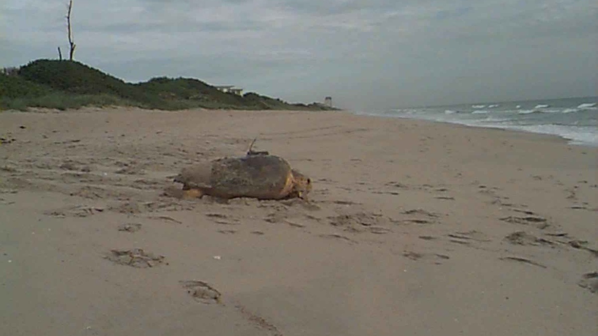
Marine telemetry is the remote measurement and transmission of information from animals, instruments or vehicles in the ocean. Researchers attach tags to wildlife, moor sensors or deploy robotic platforms, then receive data by radio, satellite, acoustic signals or later recovery. The method reveals movement and environmental conditions that cannot be followed continuously by a ship.
NOAA’s introduction to marine telemetry describes electronic tags used to track animals. Modern systems can record position, depth, temperature, acceleration, sound or physiology.
Telemetry connects a remote sensor with a researcher. The transmission pathway and battery budget determine how much information arrives and when.
Satellite tags follow surfacing animals
Platform transmitter terminals send signals to orbiting satellites when an antenna clears the water. They work well on seals, turtles and sharks that surface, although transmissions may be brief or irregular.
GPS can provide accurate positions but requires enough time above water to receive satellite signals. Fastloc GPS systems are designed to calculate locations during short surfacing events.
Pop-up archival tags record data underwater, detach on a programmed date, float up and transmit summaries. Recovery can provide the full high-resolution archive.
Acoustic telemetry works underwater
The Argos satellite system explains the global data service widely used for wildlife tracking and environmental instruments.
An acoustic tag emits a coded sound detected by underwater receivers. Fixed arrays record when a fish passes a gate, enters habitat or remains near a site.
Detection range is variable. Noise, depth, water structure, seabed and animal orientation affect whether a receiver hears a transmission. Range tests help interpret absence.
Collaborative networks allow one tagged animal to be detected across receivers maintained by many institutions. Shared standards and metadata are essential.
Archival tags trade speed for detail
The Ocean Tracking Network coordinates infrastructure and data used for aquatic animal research.
Archival loggers store depth, temperature, light or acceleration at frequent intervals. They can collect more detail than a low-bandwidth transmitter, but scientists may need to recover the tag.
Light-level data can estimate broad position from sunrise and sunset. Temperature and depth profiles help refine tracks, though uncertainty remains larger than GPS.
Data-storage tags are useful in fisheries where tagged animals may be recaptured. Reward programs encourage returns and recover both measurements and information about harvest.
Accelerometers record changes in motion along multiple axes. Combined with depth, they can indicate swimming effort, dives or rapid feeding events after validation.
Sensors measure behavior as well as position
Camera and audio tags add direct context but consume power and storage quickly. Suction cups allow temporary deployment on whales, while implanted or attached tags may last longer on other species.
Interpretation requires ground truth. A movement signature must be compared with observed behavior before it is labeled feeding, resting or escape.
The NOAA Fisheries tagging overview describes how movement data support conservation and stock research.
A tag adds drag, weight or a capture procedure. Researchers select attachment, shape and deployment duration according to species anatomy and study goals.
Tag design balances data and welfare
Ethical review is part of study design. Teams minimize handling, monitor attachment effects and use the smallest device that can answer the question. Permits regulate work on protected species.
Battery capacity competes with sampling frequency and transmission power. Engineers compress data or program sensors to activate only during informative events.
Receiver arrays have boundaries. A fish last detected at the edge may have emigrated, died or carried a failed transmitter. Survival models use detection histories and assumptions that must be stated.
Missing detections require cautious interpretation
Tag shedding creates another ambiguity. A stationary transmitter could represent mortality or a detached device. Depth patterns, accelerometers and recovery surveys help distinguish outcomes.
Data ownership needs planning. Collaborative networks define embargo periods, attribution and access while protecting sensitive locations for endangered species or culturally important resources.
Standard metadata include tag model, programming, attachment, animal measurements and receiver maintenance. Without them, a detection code has little biological meaning.
Tags can record temperature and depth along an animal’s route, sampling places ships rarely reach. Measurements need calibration and may be affected by attachment position.
Tracking data guide practical management
Conductivity, oxygen and light sensors add habitat information but increase power demand. Researchers choose variables that directly test the study question.
Animal-borne observations can supplement ocean models. Quality control separates useful profiles from sensor drift or behavior that prevents normal sampling.
Animals are not random platforms. Their habitat preferences bias where measurements occur, which is valuable biologically but important for physical interpretation.
Positioning arrays use synchronized arrival times at several receivers to estimate locations between stations. Geometry and sound-speed variation determine accuracy.
Mobile receivers mounted on gliders or boats search beyond fixed stations. Their changing path expands coverage but produces uneven detection effort that analysis must include.
Environmental sensors give movement context
Tag codes are coordinated to avoid duplication within a network. Registration prevents one animal’s detections from being assigned to another project.
Recovery planning includes contact labels and public outreach. A beachgoer or fisher who finds a detached tag can return data that were never transmitted.
Costs include receivers, vessel servicing and analysis as well as tags. A smaller, well-maintained array can answer more than broad infrastructure with gaps.
Clock drift can misalign detections among receivers. Synchronization tags and correction procedures maintain accurate timing for movement-speed or position estimates.
Engineering determines data return
Acoustic collisions occur when several tags transmit simultaneously, masking codes. Randomized intervals and array design reduce lost detections.
Maintenance is part of measurement. A receiver with a depleted battery creates a gap that must be distinguished from genuine animal absence.
Salt water blocks radio signals, so submerged communication commonly uses sound. Satellite or cellular transmission usually waits until the device reaches air.
Networks depend on metadata and maintenance
Biofouling can cover sensors and change drag. Coatings, wipers or shorter deployments reduce the problem without introducing harmful chemicals.
Pressure housings protect electronics at depth, while release mechanisms must operate after months in corrosive water. Redundant systems improve recovery odds.
Every byte has a cost. Sampling, storage and transmission consume energy, forcing a deliberate balance between detail and deployment length.
Migration routes identify where animals cross fisheries, shipping lanes or proposed development. Residency estimates show which habitats receive repeated use rather than a single passage.
Telemetry informs seasonal management
Evidence can guide timing. Seasonal speed restrictions or construction windows become more targeted when movement data show when vulnerable species are present.
Telemetry also evaluates conservation after implementation. Researchers can test whether fish pass a dam, use a restored wetland or remain inside a protected area.
Movement alone does not demonstrate benefit. Population data are needed to determine whether altered behavior improves survival or reproduction.
Technology changes the feasible questions. Smaller tags allow work on smaller animals, while better batteries lengthen studies. Every improvement still requires a design focused on biological inference.
Marine telemetry converts otherwise unseen journeys into measurements. Its value comes from matching the transmitter, receiving network and statistical analysis to a question that matters for ecology or management.
Tracks require population context
A track represents tagged individuals, not automatically the whole population. Capture location, age, sex and season affect whether a sample is representative.
Missing detections can mean the animal left, the tag failed or the receiver missed a signal. State-space models estimate plausible movement while accounting for location error.
Marine telemetry is most valuable when paired with habitat maps, surveys and fisheries information. It shows where animals travel and what they experience, while complementary evidence explains population consequences and guides practical management.
Clear end-of-study plans determine whether tags are removed, recovered or allowed to detach, reducing unnecessary long-term attachment and clarifying the fate of equipment.
Related reading: ocean gliders and marine biogeography.