
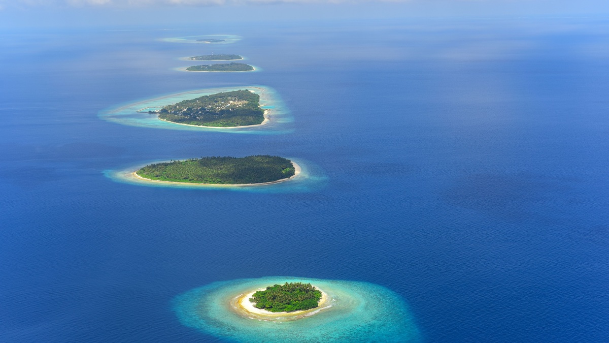
An archipelago is a chain, cluster, or broad group of islands. Its islands may rise from the ocean, sit in a lake, or divide a large river. Some archipelagos form one country, while others cross political borders. Geology explains why the islands occur together; maps and human history often determine which name people give the group.
NOAA’s archipelago definition covers volcanic chains, coral cays, continental fragments and nearshore island groups. The Hawaiian Islands show one famous route to island building, but there is no single archipelago blueprint. Moving plates, reefs, glaciers, sediment, erosion and rising seas can each assemble a recognizable island group.
The word combines medieval Italian and Greek roots associated with a principal sea. Modern usage shifted from a name for water dotted with islands to the islands themselves. An archipelago can therefore include dry land, reefs, shoals and the channels between them. The label describes a geographic grouping rather than a minimum island count, a particular rock type, or one legal form of government. Context supplies the intended boundary.
Volcanoes build many oceanic archipelagos
Underwater eruptions pile lava on the seafloor. If a volcanic mountain grows high enough, its summit breaks the surface as an island. Repeated eruptions may create several islands along a plate boundary, where one tectonic plate sinks beneath another, or above a mantle hot spot, where magma rises within a plate.
Hawaiʻi records plate motion especially clearly. The Pacific Plate moves over a relatively fixed source of magma, so active volcanoes occur near one end of the chain while older islands and seamounts stretch northwest. NOAA describes a Hawaiian archipelago of 132 islands, atolls, reefs, banks, shoals and seamounts extending roughly 1,500 miles.
Age changes the appearance of a volcanic chain. Waves and rain carve valleys while landslides remove flanks; the cooling oceanic crust also subsides. Coral reefs may continue growing near the surface as an old volcanic island sinks. The sequence can leave a low atoll ring above a buried volcanic foundation, a process described by the U.S. Geological Survey.
A hot-spot chain also preserves time in its rocks. Radiometric dates generally become older away from the active volcanic center, allowing geologists to estimate the direction and pace of plate motion. Island-building is rarely a neat conveyor belt, however. Volcanoes sometimes overlap and eruption rates vary; parts of a huge shield volcano can also collapse. The visible islands are only the high points of a much longer submarine mountain chain.
Other island groups come from continents, coral and sediment
A continental archipelago lies close to a mainland and shares its geologic foundation. Flooded valleys, glacial erosion and rising sea level can isolate higher ground, producing complicated coasts such as British Columbia’s Inside Passage. Continental fragments follow a different history: tectonic movement splits crust away from a larger landmass and carries it outward.
Coral cays begin with reef growth in warm, shallow water. Waves and currents sweep broken coral, shells and sand onto the reef platform. Material accumulates above high tide, then plants trap more sediment. The Florida Keys include a coral cay archipelago, although their geology also reflects older reef tracts and changing sea level.
River and coastal currents can build archipelagos from deposited sediment. Channels divide around bars and floods rearrange them; vegetation may stabilize their surfaces. Elsewhere, glaciers scour bedrock into countless knobs and troughs. When ice retreats and water fills the low areas, exposed rock becomes a dense island field.
Erosion can both reveal and erase islands. Resistant rock remains while softer material wears away, producing clustered stacks or remnants along a coast. Because several processes may act over millions of years, geologists use rock chemistry, fossils, seafloor maps and island ages to reconstruct a group’s origin.
Coral islands have their own balance between construction and breakdown. Reef organisms build calcium carbonate, while waves grind skeletons into sand that currents push onto cays. Plants can stabilize the dry surface, but cyclones may split or relocate it. In a continental fragment, by contrast, the island rock may preserve minerals and fossils inherited from a distant mainland. Those records let scientists distinguish reef-built cays from pieces of older crust even when both form low island clusters.
Where an archipelago begins and ends
Nature rarely draws a crisp border around an island group. Distance, shared geology, water depth, culture and political administration all influence the boundary. An island might belong to one chain geologically and another region politically. NOAA notes that Canada’s Gulf Islands and Washington’s San Juan Islands are geologically related but are usually named as separate archipelagos across an international border.
Scale varies just as much. An archipelago can contain a few closely spaced islands or extend thousands of kilometers across open ocean. Large named groups may contain smaller archipelagos. The Malay Archipelago, for example, is a vast regional term, while local island groups within it have their own names and histories.
Cartographers use bathymetry to see ridges and shelves hidden beneath the sea. Satellite images reveal reef outlines, sediment plumes and coastline form. Radiometric dating establishes when volcanic rocks cooled. Together, such evidence shows whether nearby islands share a foundation or merely look clustered on a flat map.
The mapped boundary can change with purpose. A geologist may include submerged seamounts belonging to the same volcanic chain, whereas a tourist map may show only inhabited islands. Ecologists may group islands connected by migrating animals or drifting larvae. Governments use administrative borders and maritime zones. Clear writing therefore names the criterion, such as the geologic archipelago or the political island group, when competing definitions could cause confusion.
Coastlines within an archipelago also move at different rates. Satellite records such as NASA’s coastal change series show how waves and currents redistribute sand over decades. The same approach can track new volcanic land alongside growing deltas and shrinking cays. A map is a dated measurement of a dynamic island system, especially where loose sediment lies only slightly above high tide.
Why island chains are biologically distinctive
Water separates populations, but the islands within a chain can act as stepping stones. Seeds arrive on wind or waves. Birds carry organisms while animals occasionally raft across channels. Once established, isolated populations may evolve independently. Differences in island age, elevation, rainfall and distance create a natural patchwork of habitats.
Young volcanic islands start with bare rock. Weathering produces soil before colonists arrive and ecological communities become more complex. Older islands may have deep valleys and broad reefs, while subsiding atolls offer little land above storm waves. The Hawaiian seamount chain lets scientists compare many stages of that long progression.
Archipelagos also concentrate environmental risks. Invasive species can spread between islands; endemic organisms may have tiny ranges, while sea-level rise threatens low cays. Conservation planning has to account for connections among islands as well as the uniqueness of each one. A chain is therefore more than dots on a map: it is a linked geological and ecological system with boundaries that depend on the question being asked.
Human travel changes those links. Boats and aircraft move people and supplies efficiently, but they can also carry insects, seeds, rodents, or pathogens past natural ocean barriers. Biosecurity checks focus on preventing arrival, while restoration may remove an invader from one island before it reaches its neighbors. Protecting several islands can preserve different stages of succession and provide backup populations after a storm or eruption affects one site.
Related reading: ocean-floor topography and the difference between an ocean and a sea.





