
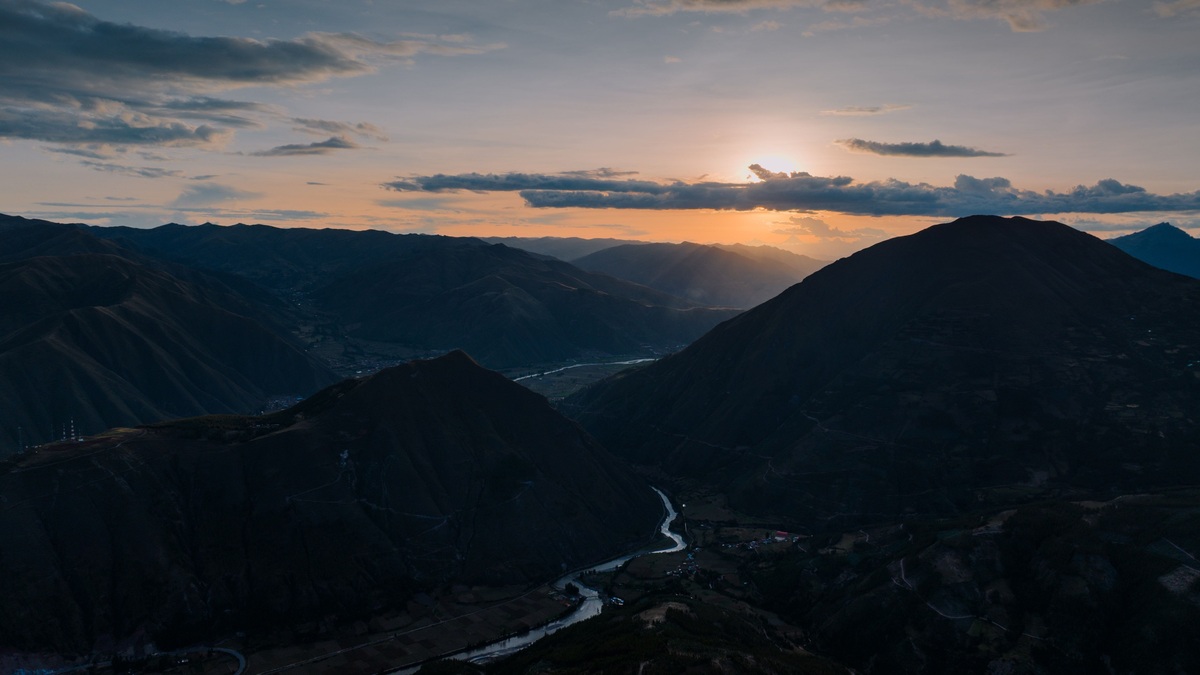
A drainage divide is the boundary between neighboring areas of surface drainage. Rain falling on one side flows toward one outlet, while water on the other side follows a different stream system. The divide usually follows ridges or local high ground, but it can be subtle across flat terrain.
Every watershed has a divide, from the catchment of a roadside ditch to a continental river basin. Its scale depends on the outlet being studied.
Gravity creates the basic boundary
Water on the land surface moves downhill along the steepest available route. High points separate those routes. Connecting the points where runoff could move in either direction traces the drainage divide.
The USGS drainage-area definition calls the divide the boundary separating one drainage area from its neighbors. A gage, confluence or lake outlet can serve as the point whose upstream area is delineated.
A divide is a line on a map rather than a wide zone, although uncertainty may make its exact position difficult to resolve. Better elevation data can shift a mapped line without changing the underlying concept.
Small divides surround every tributary
A small creek receives runoff from its own catchment. Ridges separate it from adjacent tributaries and their combined drainage joins a larger river basin downstream.
This nested pattern repeats through the river network. Argo’s map of New Mexico’s rivers and watersheds shows how state-scale basins contain many smaller contributing areas.
Moving a study outlet changes the divide. A boundary drawn for one stream gage differs from the boundary at a gage farther downstream because the latter includes additional tributaries.
Continental divides separate major destinations
A continental divide sends water toward different oceans or large terminal basins. North America’s best-known divide separates much drainage toward the Pacific from drainage toward the Atlantic system.
The continent contains more than one major divide because some water flows north to the Arctic, toward Hudson Bay or into closed interior basins. Labels depend on how outlets are grouped.
Continental status does not change the hydrology. It is a very large example of the same topographic rule operating between neighboring gullies.
Flat terrain makes divides hard to see
Mountain ridgelines often provide an obvious boundary. On plains, a few inches of relief may determine which ditch receives runoff. Wet ground can spread flow across a broad area before a channel forms.
Closed depressions complicate automated mapping because water may collect and evaporate or infiltrate rather than reach a surface outlet. Analysts decide whether a depression is real or an artifact in elevation data.
Wetlands can connect basins during high water. A divide mapped from ordinary topography may not capture temporary overflow, so flood studies incorporate observed channels and water-control structures.
Engineered routes can cross natural divides
Canals transfer water from one basin to another. Storm sewers, road culverts and drainage ditches redirect local runoff. A road embankment may create a new boundary unless a culvert preserves the former path.
Digital models must be hydro-enforced so water follows known crossings rather than stopping at bridges or flowing along a raised road surface. The USGS NHDPlus user guide describes how elevation grids and mapped hydrography are reconciled.
Legal and operational boundaries may follow the altered network. Water managers need to know whether a map represents natural topography, present-day infrastructure or a standardized hydrologic unit.
Groundwater divides can lie elsewhere
A surface divide is defined by land elevation. A groundwater divide is a ridge in hydraulic head. The two can align in simple terrain but diverge when permeable layers slope beneath the surface.
Pumping can move a groundwater divide by lowering head near a well. Water that naturally discharged to one stream may then cross underground toward the pumped area.
Fractured and karst rock produces especially complex routes. Groundwater tracing may show that recharge beneath one surface watershed emerges from a spring in another. Surface maps remain correct for runoff but incomplete for subsurface flow.
How divides are mapped
Traditional delineation follows contour lines on a topographic map, crossing contours at right angles along ridges. The analyst starts at the outlet and traces uphill around all contributing channels before returning to the other side.
Modern geographic information systems use digital elevation models to assign a flow direction to each grid cell. The upstream cells draining to a selected point form the watershed. Resolution affects small channels and subtle divides.
Field evidence corrects the model. Culvert direction, ditch connections and observations during rain can reveal paths missed by the terrain grid.
The USGS watershed overview places divides in context: a watershed contains surface waters and the land draining to a common outlet, while ridges and hills separate it from neighboring watersheds.
Why the line matters
Pollution released inside a divide can travel toward the same receiving water. Watershed restoration therefore targets land uses within the contributing area rather than relying only on political borders.
Flood models convert rainfall over a drainage area into expected flow. An incorrect divide changes the area and can bias the result. Reservoir planning and stream statistics use the same geometry.
Argo’s North America rivers and lakes map shows the channels that divides organize. The ridges may be absent from a simple hydrographic map, yet they determine which branches join each network.
A drainage divide is therefore both simple and powerful: it is the high boundary that assigns surface runoff to different outlets. Accurate mapping requires enough elevation detail, recognition of human alterations and a clear distinction between surface and groundwater flow.
Divides can move over geologic time
A drainage divide is stable on a human map but not necessarily permanent. Erosion can let a vigorously cutting stream extend its headwaters into a neighboring basin. If it intercepts the other stream, river capture redirects part of the drainage network.
Uplift, faulting and volcanic deposits can also reorganize slopes. Glaciers carve valleys and leave sediment that blocks old routes. The modern divide records the combined topography produced by these processes.
Scientists look for abandoned valleys, sharp channel bends and mismatches between river size and valley form as evidence of past rearrangement. Sediment and mineral signatures can connect deposits with a former upstream source.
Divide migration is usually slow, although a landslide or flood can alter a small boundary suddenly. Engineered diversions move water without moving the ridge itself, so maps may show both the topographic divide and the actual transfer route.
These changes help explain why neighboring basins can contain related fish, sediments or landforms. The divide controls present runoff, while geology preserves evidence of earlier connections.
Divides guide planning beyond hydrology
Divides influence human routes as well. Mountain passes are low points along a ridge where roads and railways can cross and historic transport corridors often follow them. The crossing does not change which way unconfined runoff flows on either side.
Political borders sometimes follow prominent divides because ridges are visible landmarks. The hydrologic boundary can still cut across cities, counties and nations elsewhere, requiring cooperation among downstream users.
Headwater protection near a divide can benefit separate basins. Development on one slope affects one receiving stream, while construction only a short distance away drains in another direction. Site plans need detailed contours to identify the appropriate controls.
During wildfire or land clearing, knowing the divide helps predict where sediment-laden runoff will travel. Emergency teams can place monitoring and erosion barriers in the channels connected to the disturbed slope instead of treating all nearby streams as equally exposed.
The same logic guides spill response. Teams identify the downslope channel and its receiving basin, then protect intakes and habitats along that route. A nearby stream across the divide may face little direct surface runoff from the incident.





