
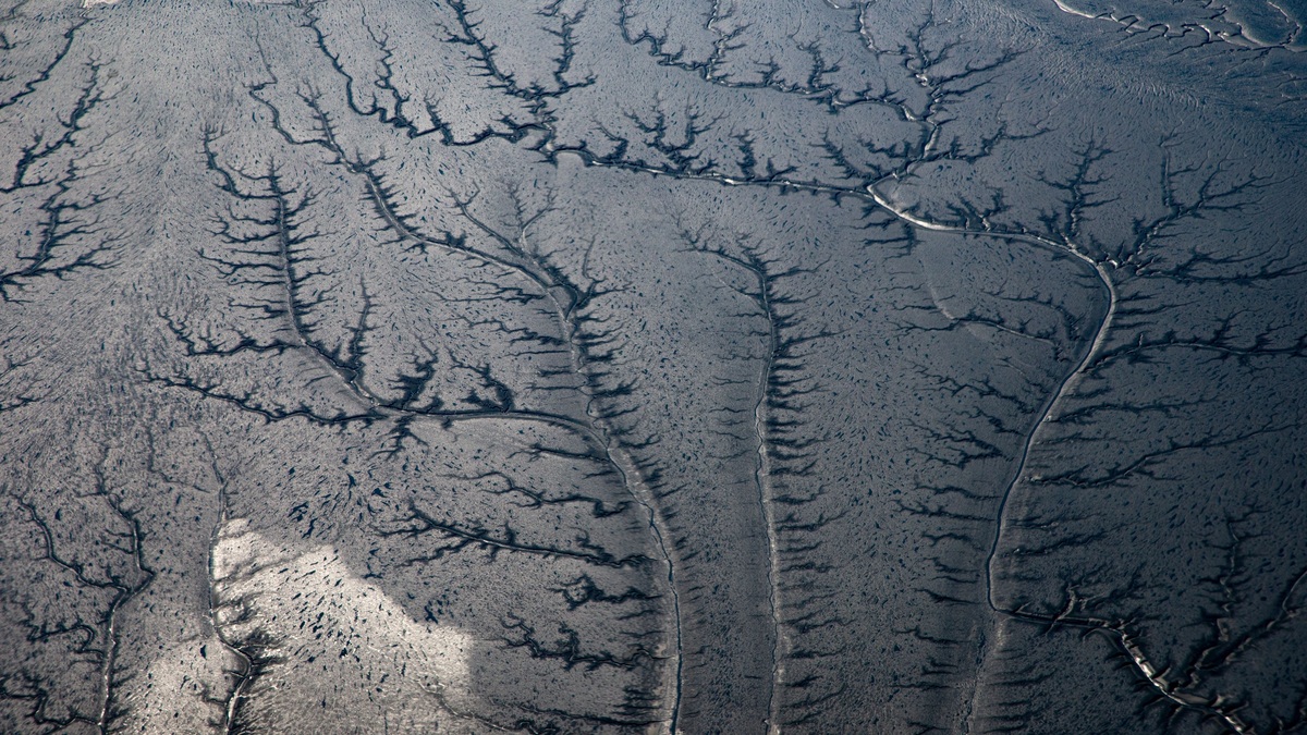
Stream order is a system for ranking channels within a river network. On a map, the smallest channels at the tips of the network receive the lowest number. Their ranks increase only when channels of the same order meet, so the number describes a stream’s position in the branching network rather than its width on a particular day.
The method gives hydrologists a consistent way to compare headwater creeks with larger rivers. It also reveals why a watershed contains many more tiny tributaries than major channels. A first-order stream may be narrow enough to step across, while the highest-order channel carries water collected across much of the basin.
How the Strahler system assigns stream order
The version used most often today is the Strahler system. Every channel that has no mapped tributary upstream begins as a first-order stream. When two first-order streams join, the channel below their confluence becomes second order. Two second-order streams produce a third-order stream and the same rule continues downstream.
A lower-order tributary does not raise the rank of a higher-order channel. If a first-order creek enters a second-order stream, the receiving stream remains second order. Its number rises to three only after it meets another second-order stream. The rule keeps a large number of minor side channels from inflating the rank.
The USGS water-quality glossary defines stream order as a ranking based on the nature of tributaries. Modern geographic information systems apply that logic across digital drainage networks, though the result still depends on which channels appear in the underlying map.
Why first-order streams dominate the map
River networks branch like trees viewed from the roots. Numerous small channels gather runoff from rain or snowmelt before combining into fewer large rivers. Groundwater also supplies many of them. Consequently, first-order streams usually account for most of the channel length in a watershed even though each one drains a small area.
Headwaters can be perennial, seasonal or active only after storms. The distinctions are explained in Argo’s guide to perennial, intermittent and ephemeral streams. A channel does not have to flow all year to occupy a place in a mapped drainage network, but mapping rules determine whether a short or faint channel is included.
Adding more detailed channel data creates more first-order tributaries and can change the calculated order farther downstream. Two studies may therefore report different maximum orders for the same river if one began with a finer drainage map. The system is reproducible only when analysts use comparable source data and channel thresholds.
Stream order describes position, not a fixed size
Higher orders generally correspond to wider channels and greater discharge. They also drain more land. Those are statistical tendencies rather than definitions. Climate and geology can give two streams of equal order very different dimensions, while human water use adds another source of difference. An arid-region channel may remain dry for long periods, while a humid-region stream with the same order carries steady flow.
The ranking also differs from stream stage and discharge. Stage is the height of the water surface at a location, while discharge is the volume passing that point over time. Argo’s explanation of river stage and discharge shows why both can change quickly during a flood even though the channel’s stream order stays the same.
What stream order can reveal about a watershed
Order provides a compact description of how drainage is organized. Researchers can group sampling sites by network position, compare headwater conditions with downstream reaches and estimate how disturbances may travel through connected channels. A pollutant released into one first-order tributary follows a narrow route at first, then enters progressively larger channels at confluences.
Ecologists also use network position when studying habitat. Small headwaters often have dense shade and cooler water. Their channels also remain in close contact with surrounding soils. Larger channels receive material from many upstream branches and usually have broader floodplains. The U.S. Environmental Protection Agency’s StreamCat dataset links watershed and landscape attributes to stream segments across the contiguous United States.
Flood response can change with network structure. Closely spaced tributaries may deliver runoff to a main channel within a similar time window, whereas storage in wetlands or floodplains can spread the response over longer periods. Stream order alone cannot predict a flood, but it helps organize the network variables used in hydrologic models.
How stream order is measured with digital maps
Analysts begin with a connected set of channel lines and identify their downstream direction. Software finds the channel tips and assigns first order. It then applies the confluence rule throughout the network. Digital elevation models can supply channels where field maps are incomplete by tracing the direction water would move across the land surface.
The USGS National Hydrography products provide mapped surface-water features and drainage relationships for the United States. Newer hydrographic frameworks connect streams to catchments, which makes it possible to associate each reach with the land that drains toward it.
Quality checks remain essential. Road ditches may be mistaken for natural channels, while culverts can hide connections. Flat terrain creates a separate uncertainty about flow direction. Reservoirs and engineered diversions may also interrupt the simple branching pattern assumed by the ranking rule.
Horton order and Shreve magnitude are different
Several numbering systems appear in hydrology. The Horton method is historically important and resembles Strahler ordering in many practical applications, but its original treatment followed the main stream through a network differently. A report should identify the method rather than presenting an unexplained order number.
Shreve magnitude answers another question. Each exterior link begins with a magnitude of one and magnitudes are added at every confluence. A channel formed by tributaries with magnitudes three and five receives magnitude eight. Unlike Strahler order, every upstream source contributes to the final number.
Shreve magnitude can be useful when the total number of upstream channel sources is relevant. Strahler order is easier to read as a hierarchy of comparable branches. Neither number replaces direct measurements of channel flow, sediment, water quality or habitat.
Reading stream order correctly
A stream-order map should be read as a model of network structure. The number identifies how similarly ranked branches combine and it remains tied to the mapped network used in the calculation. It supplies no evidence about navigation or flow permanence. Flood safety requires its own measurements and analysis.
The strongest comparisons state the ordering method and map resolution. They also define which channels were included. With those details in place, stream order becomes a practical way to move from thousands of headwater lines to a clear hierarchy of tributaries and main channels across an entire drainage basin.
Limits of stream order in environmental decisions
Order can guide a sampling design, but it does not prove that two reaches are ecologically equivalent. A second-order mountain creek flowing through forest differs from a second-order channelized ditch on a plain. Substrate, temperature, gradient and riparian cover need direct observation before habitat conclusions are drawn.
Administrative rules sometimes use stream order to define buffer widths or prioritize restoration. Such thresholds are easy to map, yet they inherit every omission in the channel dataset. An unmapped headwater could make the downstream rank too low. Field verification is especially important near the exact order at which a regulation changes.
Stream order works best as one organizing variable within a larger description. Drainage area indicates how much land contributes water and slope helps describe energy. Discharge measurements supply the actual flow. Together they explain more than the hierarchy alone while preserving the ordering system’s useful view of how tributaries connect.
Time also changes what a mapped channel represents. A debris flow can create a new branch, while a beaver wetland may spread flow through several paths that a line dataset simplifies into one. Updated hydrography and documented field methods keep the order useful without implying that a living river network is permanently fixed.





